Property Record
2120 Il Rte 25, Carpentersville, IL 60110


NEARBY LISTINGS FOR SALE OR LEASE
Property Detail
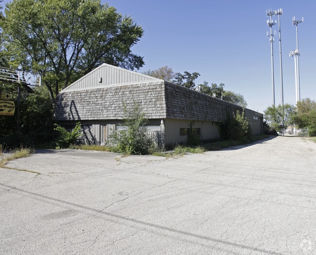
2120 Il Rte 25
03-02-200-024
Cell Tower
Commercialnec
SUBDIVISION: CELL TOWER RANGE CODE: 8 E TWSHP 42N
X
Kane
17089C0070H
Illinois
2024
0.97 AC
2024
Far Northwest
850302
Chicago
10,332 SF
Chicago-Naperville-Elgin, IL-IN
DEMOGRAPHICS near 2120 Il Rte 25
1 Mile
3 Mile
5 Mile
2024 Total Population
8,343
46,880
115,115
2029 Population
8,316
46,775
114,950
Pop Growth 2024-2029
(0.32%)
(0.22%)
(0.14%)
Average Age
38
37
39
2024 Total Households
2,855
15,155
40,319
HH Growth 2024-2029
(0.35%)
(0.24%)
(0.16%)
Median Household Inc
$90,017
$79,506
$92,436
Avg Household Size
2.80
3.00
2.80
2024 Avg HH Vehicles
2.00
2.00
2.00
Median Home Value
$206,168
$229,430
$254,664
Median Year Built
1998
1977
1985
Nearby Places
Map Layers
Map Styles
 Street
 Aerial
- Restaurants
- Banks
- Shops
- Fitness
- Groceries
PUBLIC TRANSPORTATION
COMMUTER RAIL
Fox River Grove Station (Union Pacific Northwest Line - Northeast Illinois Regional Commuter Railroad (Metra))
DRIVE
WALK
Distance
Fox River Grove Station (Union Pacific Northwest Line - Northeast Illinois Regional Commuter Railroad (Metra))
14 min
5.2 mi
Cary Station (Union Pacific Northwest Line - Northeast Illinois Regional Commuter Railroad (Metra))
DRIVE
WALK
Distance
Cary Station (Union Pacific Northwest Line - Northeast Illinois Regional Commuter Railroad (Metra))
14 min
6.6 mi
AIRPORT
Chicago O'Hare International
DRIVE
WALK
Distance
Chicago O'Hare International
38 min
27.7 mi
Freight Ports
Port Milwaukee
DRIVE
WALK
Distance
Port Milwaukee
103 min
76.3 mi
Nearby Properties
Address
Land Use
TOTAL SIZE
Lot Size
Zoning
Address
Land Use
TOTAL SIZE
Lot Size
Zoning
183,924 SF
0.80 AC
Address
Land Use
TOTAL SIZE
Lot Size
Zoning
211,680 SF
11.60 AC
Address
Land Use
TOTAL SIZE
Lot Size
Zoning
211,680 SF
11.34 AC
Address
Land Use
TOTAL SIZE
Lot Size
Zoning
23.38 AC
Address
Land Use
TOTAL SIZE
Lot Size
Zoning
9,614 SF
1.42 AC
Address
Land Use
TOTAL SIZE
Lot Size
Zoning
Address
Land Use
TOTAL SIZE
Lot Size
Zoning
56,900 SF
5.93 AC
Address
Land Use
TOTAL SIZE
Lot Size
Zoning
106,488 SF
5.60 AC
Address
Land Use
TOTAL SIZE
Lot Size
Zoning
35.28 AC
Address
Land Use
TOTAL SIZE
Lot Size
Zoning
Address
Land Use
TOTAL SIZE
Lot Size
Zoning
35,452 SF
105.76 AC
Address
Land Use
TOTAL SIZE
Lot Size
Zoning
106,488 SF
6.64 AC
Address
Land Use
TOTAL SIZE
Lot Size
Zoning
85,364 SF
5.57 AC
Address
Land Use
TOTAL SIZE
Lot Size
Zoning
229.01 AC
Address
Land Use
TOTAL SIZE
Lot Size
Zoning
61,955 SF
7.48 AC
Address
Land Use
TOTAL SIZE
Lot Size
Zoning
Address
Land Use
TOTAL SIZE
Lot Size
Zoning
103,155 SF
10.72 AC
Address
Land Use
TOTAL SIZE
Lot Size
Zoning
64,728 SF
5.16 AC
Address
Land Use
TOTAL SIZE
Lot Size
Zoning
50,460 SF
4.91 AC
Address
Land Use
TOTAL SIZE
Lot Size
Zoning
Address
Land Use
TOTAL SIZE
Lot Size
Zoning
75,399 SF
4.82 AC
Address
Land Use
TOTAL SIZE
Lot Size
Zoning
64,728 SF
2 AC
Address
Land Use
TOTAL SIZE
Lot Size
Zoning
Address
Land Use
TOTAL SIZE
Lot Size
Zoning
113,797 SF
0.60 AC
Address
Land Use
TOTAL SIZE
Lot Size
Zoning
Address
Land Use
TOTAL SIZE
Lot Size
Zoning
50,058 SF
2 AC
Address
Land Use
TOTAL SIZE
Lot Size
Zoning
12,540 SF
2 AC
Address
Land Use
TOTAL SIZE
Lot Size
Zoning
63,216 SF
2.98 AC
Address
Land Use
TOTAL SIZE
Lot Size
Zoning
40,090 SF
2.16 AC
Address
Land Use
TOTAL SIZE
Lot Size
Zoning
39,271 SF
4.07 AC
The World's #1 Commercial Real Estate Marketplace
Connect with us
© 2026 CoStar Group
The information above has been obtained from sources believed reliable. While we do not doubt its accuracy we have not verified it and make no guarantee, warranty or representation about it. It is your responsibility to independently confirm its accuracy and completeness. Any projections, opinions, assumptions, or estimates used are for example only and do not represent the current or future performance of the property. The value of this transaction to you depends on tax and other factors which should be evaluated by your tax, financial, and legal advisors. You and your advisors should conduct a careful, independent investigation of the property to determine to your satisfaction the suitability of the property for your needs.