Property Record
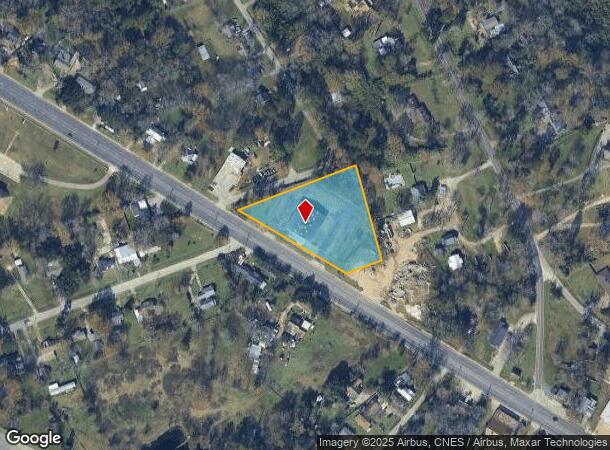
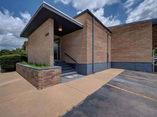
2120 N Raguet St, Lufkin, TX 75904

NEARBY LISTINGS FOR SALE OR LEASE
Property Detail
2120 N Raguet St
Lufkin, TX
Henry Kevin Addn
93090
4345 HENRY KEVIN ADDN BLK 1 LOT 1
Commercialnec
Angelina
X
Texas
48005C0255E
1
2025
2.18 AC
2025
Texas East Area
000400
Other Market Areas
6,900 SF
DEMOGRAPHICS near 2120 N Raguet St
1 Mile
3 Mile
5 Mile
2024 Total Population
3,361
28,635
47,799
2029 Population
3,457
28,981
48,285
Pop Growth 2024-2029
+ 2.86%
+ 1.21%
+ 1.02%
Average Age
41
38
39
2024 Total Households
1,363
10,594
17,895
HH Growth 2024-2029
+ 2.79%
+ 1.23%
+ 1.04%
Median Household Inc
$38,178
$46,696
$51,009
Avg Household Size
2.30
2.60
2.50
2024 Avg HH Vehicles
2.00
2.00
2.00
Median Home Value
$104,784
$120,601
$139,390
Median Year Built
1980
1977
1980
Nearby Places
Map Layers
Map Styles
 Street
 Aerial
- Restaurants
- Banks
- Shops
- Fitness
- Groceries
SALE & LEASE HISTORY
LISTING DATE
SALE/LEASE

Jun 26, 2024
For Lease
Jun 13, 2024
For Sale
Jul 25, 2019
For Sale
Nearby Properties
Address
Land Use
TOTAL SIZE
Lot Size
Zoning
Address
Land Use
TOTAL SIZE
Lot Size
Zoning
9,222 SF
10.69 AC
Address
Land Use
TOTAL SIZE
Lot Size
Zoning
34,528 SF
1.86 AC
CBD
Address
Land Use
TOTAL SIZE
Lot Size
Zoning
104,432 SF
10.06 AC
LM
Address
Land Use
TOTAL SIZE
Lot Size
Zoning
194,526 SF
14.99 AC
LBSU
Address
Land Use
TOTAL SIZE
Lot Size
Zoning
2,319 SF
19.10 AC
Address
Land Use
TOTAL SIZE
Lot Size
Zoning
31,467 SF
41.44 AC
RL
Address
Land Use
TOTAL SIZE
Lot Size
Zoning
14,514 SF
12.90 AC
RL
Address
Land Use
TOTAL SIZE
Lot Size
Zoning
50,378 SF
19.90 AC
RL
Address
Land Use
TOTAL SIZE
Lot Size
Zoning
46,368 SF
7 AC
Address
Land Use
TOTAL SIZE
Lot Size
Zoning
423,495 SF
87.05 AC
LM
Address
Land Use
TOTAL SIZE
Lot Size
Zoning
107,432 SF
11.25 AC
A
Address
Land Use
TOTAL SIZE
Lot Size
Zoning
54,239 SF
7.51 AC
Address
Land Use
TOTAL SIZE
Lot Size
Zoning
39,207 SF
1.92 AC
Address
Land Use
TOTAL SIZE
Lot Size
Zoning
70,046 SF
9 AC
LM
Address
Land Use
TOTAL SIZE
Lot Size
Zoning
34,536 SF
5.56 AC
Address
Land Use
TOTAL SIZE
Lot Size
Zoning
34,696 SF
2.76 AC
LBSU
Address
Land Use
TOTAL SIZE
Lot Size
Zoning
57,588 SF
5.07 AC
Address
Land Use
TOTAL SIZE
Lot Size
Zoning
32,834 SF
3.40 AC
LM
Address
Land Use
TOTAL SIZE
Lot Size
Zoning
Address
Land Use
TOTAL SIZE
Lot Size
Zoning
199,212 SF
36.43 AC
LMSU
Address
Land Use
TOTAL SIZE
Lot Size
Zoning
8,060 SF
6.53 AC
RS
Address
Land Use
TOTAL SIZE
Lot Size
Zoning
61,488 SF
0.90 AC
CBSU
Address
Land Use
TOTAL SIZE
Lot Size
Zoning
119,266 SF
10.36 AC
A
Address
Land Use
TOTAL SIZE
Lot Size
Zoning
57,883 SF
11.79 AC
C
Address
Land Use
TOTAL SIZE
Lot Size
Zoning
Address
Land Use
TOTAL SIZE
Lot Size
Zoning
4,056 SF
7.44 AC
Address
Land Use
TOTAL SIZE
Lot Size
Zoning
26,890 SF
1.31 AC
LM
Address
Land Use
TOTAL SIZE
Lot Size
Zoning
33,004 SF
2.74 AC
CSU
Address
Land Use
TOTAL SIZE
Lot Size
Zoning
12,615 SF
2.07 AC
LBD
Address
Land Use
TOTAL SIZE
Lot Size
Zoning
1,512 SF
6.31 AC
RL
The World's #1 Commercial Real Estate Marketplace
Connect with us
© 2026 CoStar Group
The information above has been obtained from sources believed reliable. While we do not doubt its accuracy we have not verified it and make no guarantee, warranty or representation about it. It is your responsibility to independently confirm its accuracy and completeness. Any projections, opinions, assumptions, or estimates used are for example only and do not represent the current or future performance of the property. The value of this transaction to you depends on tax and other factors which should be evaluated by your tax, financial, and legal advisors. You and your advisors should conduct a careful, independent investigation of the property to determine to your satisfaction the suitability of the property for your needs.