Property Record
2120 N Silverbell Rd, Tucson, AZ 85745
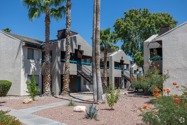


Property Detail
2120 N Silverbell Rd
115-20-016J
IRR PCL IN SW PTN LOT 4 7.75 AC SEC 3-14-13
Apartment
Pima
R3
Arizona
B and X Area of moderate flood hazard, usually the area between the limits of the 100-year and 500-year floods.
4
2025
7.75 AC
2026
Ward 1
001200
Tucson
117,640 SF
Tucson, AZ
NEARBY LISTINGS FOR SALE OR LEASE
DEMOGRAPHICS near 2120 N Silverbell Rd
1 mile
3 mile
5 mile
2025 Total Population
9,655
78,536
203,672
2030 Population
9,945
81,395
210,154
Pop Growth 2025-2030
+ 3.00%
+ 3.64%
+ 3.18%
Average Age
38
39
38
2025 Total Households
3,966
35,184
88,238
HH Growth 2025-2030
+ 3.08%
+ 3.78%
+ 3.33%
Median Household Inc
$71,604
$45,560
$49,202
Avg Household Size
2.40
2.20
2.10
2025 Avg HH Vehicles
2.00
2.00
2.00
Median Home Value
$296,223
$245,730
$287,647
Median Year Built
1990
1981
1979
Nearby Places
Map Layers
Map Styles
 Street
 Aerial
Layers
 Traffic
 Biking
Places
Listings with unknown addresses are not visible on the map
- Restaurants
- Banks
- Shops
- Fitness
- Groceries
PUBLIC TRANSPORTATION
COMMUTER RAIL
Tucson Amtrak Station (Sunset Limited - Amtrak, Texas Eagle - Amtrak)
Drive
Walk
Distance
Tucson Amtrak Station (Sunset Limited - Amtrak, Texas Eagle - Amtrak)
9 min
4.8 mi
AIRPORT
Tucson International
Drive
Walk
Distance
Tucson International
21 min
12.3 mi
Freight Ports
Port of San Diego
Drive
Walk
Distance
Port of San Diego
433 min
407.4 mi
Nearby Properties
Address
Land Use
TOTAL SIZE
Lot Size
Zoning
Address
Land Use
TOTAL SIZE
Lot Size
Zoning
134,710 SF
9.59 AC
I1
Address
Land Use
TOTAL SIZE
Lot Size
Zoning
106,852 SF
19.50 AC
I1
Address
Land Use
TOTAL SIZE
Lot Size
Zoning
813,186 SF
3.65 AC
OCR2
Address
Land Use
TOTAL SIZE
Lot Size
Zoning
89,497 SF
0.51 AC
Address
Land Use
TOTAL SIZE
Lot Size
Zoning
657,188 SF
24.97 AC
PAD5
Address
Land Use
TOTAL SIZE
Lot Size
Zoning
866,763 SF
17.17 AC
O3
Address
Land Use
TOTAL SIZE
Lot Size
Zoning
239,060 SF
7.85 AC
Address
Land Use
TOTAL SIZE
Lot Size
Zoning
495,871 SF
3.56 AC
Address
Land Use
TOTAL SIZE
Lot Size
Zoning
21,126 SF
1.10 AC
O3
Address
Land Use
TOTAL SIZE
Lot Size
Zoning
652,898 SF
233.08 AC
RX2
Address
Land Use
TOTAL SIZE
Lot Size
Zoning
300,034 SF
2.45 AC
C3
Address
Land Use
TOTAL SIZE
Lot Size
Zoning
418,519 SF
2.36 AC
OCR2
Address
Land Use
TOTAL SIZE
Lot Size
Zoning
298,003 SF
0.73 AC
Address
Land Use
TOTAL SIZE
Lot Size
Zoning
222,699 SF
2.22 AC
Address
Land Use
TOTAL SIZE
Lot Size
Zoning
213,066 SF
0.91 AC
OCR2
Address
Land Use
TOTAL SIZE
Lot Size
Zoning
251,043 SF
14.96 AC
Address
Land Use
TOTAL SIZE
Lot Size
Zoning
119,165 SF
21.85 AC
I1
Address
Land Use
TOTAL SIZE
Lot Size
Zoning
177,018 SF
16.78 AC
C2
Address
Land Use
TOTAL SIZE
Lot Size
Zoning
135,572 SF
0.36 AC
Address
Land Use
TOTAL SIZE
Lot Size
Zoning
36,100 SF
2.42 AC
I1
Address
Land Use
TOTAL SIZE
Lot Size
Zoning
246,038 SF
0.95 AC
Address
Land Use
TOTAL SIZE
Lot Size
Zoning
312,586 SF
28.73 AC
Address
Land Use
TOTAL SIZE
Lot Size
Zoning
261,229 SF
1.75 AC
Address
Land Use
TOTAL SIZE
Lot Size
Zoning
24,100 SF
4.96 AC
MU
Address
Land Use
TOTAL SIZE
Lot Size
Zoning
21,000 SF
9.34 AC
Address
Land Use
TOTAL SIZE
Lot Size
Zoning
248,388 SF
20.45 AC
O3
Address
Land Use
TOTAL SIZE
Lot Size
Zoning
119,759 SF
3.49 AC
C3
Address
Land Use
TOTAL SIZE
Lot Size
Zoning
291,038 SF
16.42 AC
C1
Address
Land Use
TOTAL SIZE
Lot Size
Zoning
214,907 SF
12.03 AC
C1
Address
Land Use
TOTAL SIZE
Lot Size
Zoning
227,880 SF
0.21 AC
OCR2
The World's #1 Commercial Real Estate Marketplace
Connect with us
© 2026 CoStar Group
The information above has been obtained from sources believed reliable. While we do not doubt its accuracy we have not verified it and make no guarantee, warranty or representation about it. It is your responsibility to independently confirm its accuracy and completeness. Any projections, opinions, assumptions, or estimates used are for example only and do not represent the current or future performance of the property. The value of this transaction to you depends on tax and other factors which should be evaluated by your tax, financial, and legal advisors. You and your advisors should conduct a careful, independent investigation of the property to determine to your satisfaction the suitability of the property for your needs.