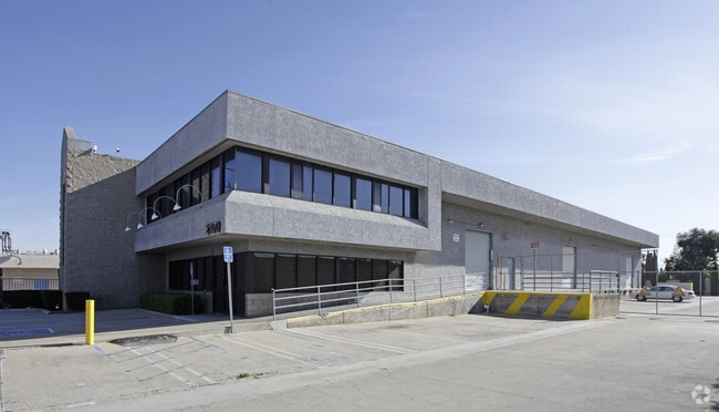
Property Record
2120 Placentia Ave, Costa Mesa, CA 92627


NEARBY LISTINGS FOR SALE OR LEASE
Property Detail
2120 Placentia Ave
Anaheim-Santa Ana-Irvine, CA
N TR 9 BLK LOT 36 TR 9 LOT 36 POR OF LOT - EX STR
422-461-22
Orange
Commercialnec
California
X
36
06059C0268J
1.31 AC
2024
Costa Mesa
2025
Orange County (California)
063701
DEMOGRAPHICS near 2120 Placentia Ave
1 mile
3 mile
5 mile
2024 Total Population
33,521
171,663
372,174
2029 Population
33,294
170,386
369,324
Pop Growth 2024-2029
(0.68%)
(0.74%)
(0.77%)
Average Age
37
41
41
2024 Total Households
11,177
65,797
144,024
HH Growth 2024-2029
(0.74%)
(0.69%)
(0.70%)
Median Household Inc
$84,637
$109,447
$107,916
Avg Household Size
2.80
2.50
2.50
2024 Avg HH Vehicles
2.00
2.00
2.00
Median Home Value
$753,711
$968,938
$966,161
Median Year Built
1970
1969
1973
Nearby Places
Map Layers
Map Styles
 Street
 Aerial
Transit
 Traffic
 Biking
Places
Listings with unknown addresses are not visible on the map
- Restaurants
- Banks
- Shops
- Fitness
- Groceries
PUBLIC TRANSPORTATION
COMMUTER RAIL
Tustin (Inland Empire-Orange County Line - Southern California Regional Rail Authority (Metrolink), Orange County Line - Southern California Regional Rail Authority (Metrolink))
Drive
Walk
Distance
Tustin (Inland Empire-Orange County Line - Southern California Regional Rail Authority (Metrolink), Orange County Line - Southern California Regional Rail Authority (Metrolink))
15 min
9.9 mi
AIRPORT
John Wayne/Orange County
Drive
Walk
Distance
John Wayne/Orange County
8 min
4.8 mi
Long Beach (Daugherty Field)
Drive
Walk
Distance
Long Beach (Daugherty Field)
29 min
22.0 mi
Freight Ports
Port of Long Beach
Drive
Walk
Distance
Port of Long Beach
33 min
21.5 mi
Nearby Properties
Address
Land Use
TOTAL SIZE
Lot Size
Zoning
Address
Land Use
TOTAL SIZE
Lot Size
Zoning
Address
Land Use
TOTAL SIZE
Lot Size
Zoning
Address
Land Use
TOTAL SIZE
Lot Size
Zoning
28,716 SF
14.90 AC
Address
Land Use
TOTAL SIZE
Lot Size
Zoning
21,258 SF
14.09 AC
Address
Land Use
TOTAL SIZE
Lot Size
Zoning
13.69 AC
Address
Land Use
TOTAL SIZE
Lot Size
Zoning
86,450 SF
3.33 AC
Address
Land Use
TOTAL SIZE
Lot Size
Zoning
415,284 SF
19.53 AC
Address
Land Use
TOTAL SIZE
Lot Size
Zoning
296,000 SF
12.77 AC
Address
Land Use
TOTAL SIZE
Lot Size
Zoning
19.69 AC
Address
Land Use
TOTAL SIZE
Lot Size
Zoning
164,000 SF
15 AC
MP
Address
Land Use
TOTAL SIZE
Lot Size
Zoning
Address
Land Use
TOTAL SIZE
Lot Size
Zoning
265,058 SF
11.87 AC
Address
Land Use
TOTAL SIZE
Lot Size
Zoning
29.62 AC
Address
Land Use
TOTAL SIZE
Lot Size
Zoning
402,000 SF
17.98 AC
R3
Address
Land Use
TOTAL SIZE
Lot Size
Zoning
18.48 AC
Address
Land Use
TOTAL SIZE
Lot Size
Zoning
4.33 AC
Address
Land Use
TOTAL SIZE
Lot Size
Zoning
78,000 SF
4.77 AC
R2
Address
Land Use
TOTAL SIZE
Lot Size
Zoning
349,995 SF
15.14 AC
Address
Land Use
TOTAL SIZE
Lot Size
Zoning
Address
Land Use
TOTAL SIZE
Lot Size
Zoning
130.43 AC
Address
Land Use
TOTAL SIZE
Lot Size
Zoning
Address
Land Use
TOTAL SIZE
Lot Size
Zoning
87.38 AC
Address
Land Use
TOTAL SIZE
Lot Size
Zoning
Address
Land Use
TOTAL SIZE
Lot Size
Zoning
2.64 AC
Address
Land Use
TOTAL SIZE
Lot Size
Zoning
105,215 SF
7.63 AC
Address
Land Use
TOTAL SIZE
Lot Size
Zoning
2.49 AC
Address
Land Use
TOTAL SIZE
Lot Size
Zoning
4,532 SF
0.59 AC
C
Address
Land Use
TOTAL SIZE
Lot Size
Zoning
Address
Land Use
TOTAL SIZE
Lot Size
Zoning
Address
Land Use
TOTAL SIZE
Lot Size
Zoning
214,959 SF
15.74 AC
The World's #1 Commercial Real Estate Marketplace
Connect with us
© 2026 CoStar Group
The information above has been obtained from sources believed reliable. While we do not doubt its accuracy we have not verified it and make no guarantee, warranty or representation about it. It is your responsibility to independently confirm its accuracy and completeness. Any projections, opinions, assumptions, or estimates used are for example only and do not represent the current or future performance of the property. The value of this transaction to you depends on tax and other factors which should be evaluated by your tax, financial, and legal advisors. You and your advisors should conduct a careful, independent investigation of the property to determine to your satisfaction the suitability of the property for your needs.