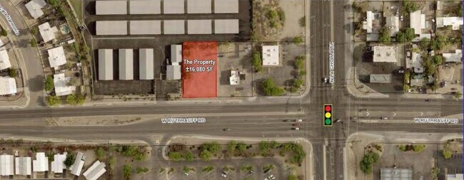
Property Record
2120 W Ruthrauff Rd, Tucson, AZ 85705

Current Lease Availabilities
Property Detail
2120 W Ruthrauff Rd
Tucson, AZ
LA CHOLLA W107.31 E357.31 S150 LOT 17 BLK 4
101-16-104G
Pima
Commercialacreage
Arizona
MU
17
C and X Area of minimal flood hazard, usually depicted on FIRMs as above the 500-year flood level.
0.37 AC
2025
West Tucson
2026
Tucson
004506
NEARBY LISTINGS FOR SALE OR LEASE
DEMOGRAPHICS near 2120 W Ruthrauff Rd
1 mile
3 mile
5 mile
2025 Total Population
11,529
71,861
190,274
2030 Population
11,892
73,830
196,033
Pop Growth 2025-2030
+ 3.15%
+ 2.74%
+ 3.03%
Average Age
39
41
40
2025 Total Households
4,645
31,155
84,731
HH Growth 2025-2030
+ 3.32%
+ 2.84%
+ 3.13%
Median Household Inc
$59,645
$58,332
$57,591
Avg Household Size
2.40
2.20
2.10
2025 Avg HH Vehicles
2.00
2.00
2.00
Median Home Value
$142,887
$257,643
$319,492
Median Year Built
1986
1983
1982
Nearby Places
Map Layers
Map Styles
 Street
 Aerial
Layers
 Traffic
 Biking
Places
Listings with unknown addresses are not visible on the map
- Restaurants
- Banks
- Shops
- Fitness
- Groceries
PUBLIC TRANSPORTATION
COMMUTER RAIL
Drive
Walk
Distance
12 min
8.1 mi
AIRPORT
Tucson International
Drive
Walk
Distance
Tucson International
25 min
15.6 mi
Nearby Properties
Address
Land Use
TOTAL SIZE
Lot Size
Zoning
Address
Land Use
TOTAL SIZE
Lot Size
Zoning
134,710 SF
9.59 AC
I1
Address
Land Use
TOTAL SIZE
Lot Size
Zoning
369,656 SF
12.62 AC
SP
Address
Land Use
TOTAL SIZE
Lot Size
Zoning
106,852 SF
19.50 AC
I1
Address
Land Use
TOTAL SIZE
Lot Size
Zoning
64,134 SF
9.58 AC
SR
Address
Land Use
TOTAL SIZE
Lot Size
Zoning
35,300 SF
5.20 AC
SR
Address
Land Use
TOTAL SIZE
Lot Size
Zoning
451,596 SF
18.92 AC
C3
Address
Land Use
TOTAL SIZE
Lot Size
Zoning
39,508 SF
7.29 AC
MU
Address
Land Use
TOTAL SIZE
Lot Size
Zoning
50,340 SF
14.37 AC
HI
Address
Land Use
TOTAL SIZE
Lot Size
Zoning
251,043 SF
14.96 AC
Address
Land Use
TOTAL SIZE
Lot Size
Zoning
119,165 SF
21.85 AC
I1
Address
Land Use
TOTAL SIZE
Lot Size
Zoning
139,733 SF
9.80 AC
C3
Address
Land Use
TOTAL SIZE
Lot Size
Zoning
290,039 SF
1.98 AC
C3
Address
Land Use
TOTAL SIZE
Lot Size
Zoning
177,018 SF
16.78 AC
C2
Address
Land Use
TOTAL SIZE
Lot Size
Zoning
373,887 SF
28.70 AC
CR4
Address
Land Use
TOTAL SIZE
Lot Size
Zoning
312,586 SF
28.73 AC
Address
Land Use
TOTAL SIZE
Lot Size
Zoning
310,258 SF
17.11 AC
TR
Address
Land Use
TOTAL SIZE
Lot Size
Zoning
24,100 SF
4.96 AC
MU
Address
Land Use
TOTAL SIZE
Lot Size
Zoning
21,000 SF
9.34 AC
Address
Land Use
TOTAL SIZE
Lot Size
Zoning
318,278 SF
18.26 AC
TR
Address
Land Use
TOTAL SIZE
Lot Size
Zoning
209,967 SF
14.19 AC
Address
Land Use
TOTAL SIZE
Lot Size
Zoning
19,892 SF
3.36 AC
CB1
Address
Land Use
TOTAL SIZE
Lot Size
Zoning
223,640 SF
18.06 AC
CB1
Address
Land Use
TOTAL SIZE
Lot Size
Zoning
16,244 SF
3.49 AC
TR
Address
Land Use
TOTAL SIZE
Lot Size
Zoning
309,905 SF
13.09 AC
SP
Address
Land Use
TOTAL SIZE
Lot Size
Zoning
275,370 SF
18.03 AC
CR4
Address
Land Use
TOTAL SIZE
Lot Size
Zoning
103,121 SF
12.39 AC
Address
Land Use
TOTAL SIZE
Lot Size
Zoning
60,421 SF
13.63 AC
SP
Address
Land Use
TOTAL SIZE
Lot Size
Zoning
324,571 SF
7.80 AC
C3
Address
Land Use
TOTAL SIZE
Lot Size
Zoning
4,712 SF
13.08 AC
Address
Land Use
TOTAL SIZE
Lot Size
Zoning
251,672 SF
13.88 AC
TR
The World's #1 Commercial Real Estate Marketplace
Connect with us
© 2026 CoStar Group
The information above has been obtained from sources believed reliable. While we do not doubt its accuracy we have not verified it and make no guarantee, warranty or representation about it. It is your responsibility to independently confirm its accuracy and completeness. Any projections, opinions, assumptions, or estimates used are for example only and do not represent the current or future performance of the property. The value of this transaction to you depends on tax and other factors which should be evaluated by your tax, financial, and legal advisors. You and your advisors should conduct a careful, independent investigation of the property to determine to your satisfaction the suitability of the property for your needs.