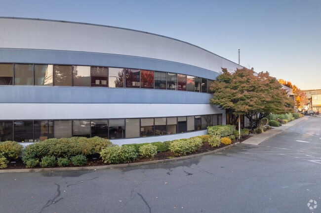
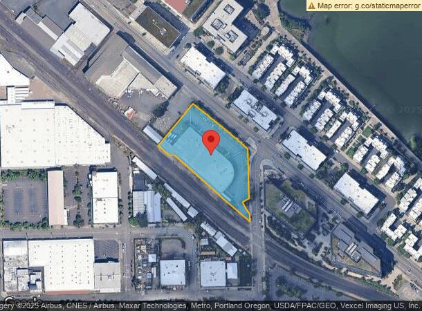
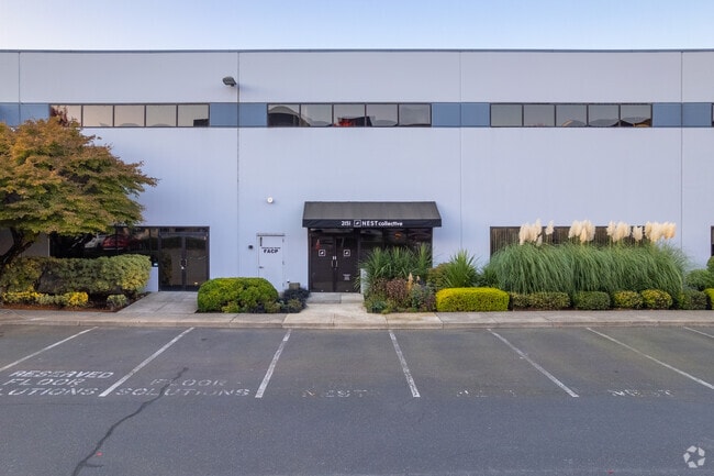
Property Record
2121 Nw Front Ave, Portland, OR 97209

Current Lease Availabilities
NEARBY LISTINGS FOR SALE OR LEASE
Property Detail
2121 Nw Front Ave
Portland-Vancouver-Hillsboro, OR-WA
Partition Plat
R237049
PARTITION PLAT 1991-34, LOT 1 TL 1400, LAND & IMPS
Industrialgeneral
Multnomah
ARE
Oregon
41067C0400E
1
2025
1.81 AC
2025
Guilds Lake
004500
Portland
38,884 SF
DEMOGRAPHICS near 2121 Nw Front Ave
1 Mile
3 Mile
5 Mile
2024 Total Population
30,612
180,244
391,686
2029 Population
30,511
179,419
386,693
Pop Growth 2024-2029
(0.33%)
(0.46%)
(1.27%)
Average Age
40
40
40
2024 Total Households
19,001
94,082
184,415
HH Growth 2024-2029
(0.52%)
(0.46%)
(1.30%)
Median Household Inc
$85,950
$80,778
$89,729
Avg Household Size
1.50
1.80
2.00
2024 Avg HH Vehicles
1.00
1.00
1.00
Median Home Value
$756,273
$697,573
$673,931
Median Year Built
2000
1970
1963
Nearby Places
Map Layers
Map Styles
 Street
 Aerial
- Restaurants
- Banks
- Shops
- Fitness
- Groceries
PUBLIC TRANSPORTATION
TRANSIT/SUBWAY
Nw 18Th & Northrup (Portland Streetcar - Tri-County Metropolitan Transportation District of Oregon Rail (TriMet Rail))
DRIVE
WALK
Distance
Nw 18Th & Northrup (Portland Streetcar - Tri-County Metropolitan Transportation District of Oregon Rail (TriMet Rail))
2 min
9 min
0.5 mi
Nw 14Th & Northrup (Portland Streetcar - Tri-County Metropolitan Transportation District of Oregon Rail (TriMet Rail))
DRIVE
WALK
Distance
Nw 14Th & Northrup (Portland Streetcar - Tri-County Metropolitan Transportation District of Oregon Rail (TriMet Rail))
2 min
11 min
0.6 mi
Nw 18Th & Lovejoy (Portland Streetcar - Tri-County Metropolitan Transportation District of Oregon Rail (TriMet Rail))
DRIVE
WALK
Distance
Nw 18Th & Lovejoy (Portland Streetcar - Tri-County Metropolitan Transportation District of Oregon Rail (TriMet Rail))
2 min
12 min
0.6 mi
Nw 12Th & Northrup (Portland Streetcar - Tri-County Metropolitan Transportation District of Oregon Rail (TriMet Rail))
DRIVE
WALK
Distance
Nw 12Th & Northrup (Portland Streetcar - Tri-County Metropolitan Transportation District of Oregon Rail (TriMet Rail))
3 min
13 min
0.7 mi
Nw 21St & Northrup (Portland Streetcar - Tri-County Metropolitan Transportation District of Oregon Rail (TriMet Rail))
DRIVE
WALK
Distance
Nw 21St & Northrup (Portland Streetcar - Tri-County Metropolitan Transportation District of Oregon Rail (TriMet Rail))
2 min
14 min
0.8 mi
COMMUTER RAIL
Portland (Amtrak Cascades - Amtrak, Coast Starlight - Amtrak, Empire Builder - Amtrak)
DRIVE
WALK
Distance
Portland (Amtrak Cascades - Amtrak, Coast Starlight - Amtrak, Empire Builder - Amtrak)
4 min
20 min
1.1 mi
Vancouver (Amtrak Cascades - Amtrak, Coast Starlight - Amtrak, Empire Builder - Amtrak)
DRIVE
WALK
Distance
Vancouver (Amtrak Cascades - Amtrak, Coast Starlight - Amtrak, Empire Builder - Amtrak)
17 min
9.5 mi
AIRPORT
Portland International
DRIVE
WALK
Distance
Portland International
23 min
11.8 mi
Freight Ports
Port of Portland
DRIVE
WALK
Distance
Port of Portland
2 min
1.1 mi
Nearby Properties
Address
Land Use
TOTAL SIZE
Lot Size
Zoning
Address
Land Use
TOTAL SIZE
Lot Size
Zoning
395,815 SF
2.66 AC
IRD
Address
Land Use
TOTAL SIZE
Lot Size
Zoning
27.58 AC
EX
Address
Land Use
TOTAL SIZE
Lot Size
Zoning
627,500 SF
16.60 AC
CX
Address
Land Use
TOTAL SIZE
Lot Size
Zoning
57,314 SF
60.69 AC
OS
Address
Land Use
TOTAL SIZE
Lot Size
Zoning
560,000 SF
0.15 AC
CX
Address
Land Use
TOTAL SIZE
Lot Size
Zoning
20.71 AC
OS
Address
Land Use
TOTAL SIZE
Lot Size
Zoning
409,260 SF
7.41 AC
EX
Address
Land Use
TOTAL SIZE
Lot Size
Zoning
1.09 AC
EX
Address
Land Use
TOTAL SIZE
Lot Size
Zoning
2.24 AC
CX
Address
Land Use
TOTAL SIZE
Lot Size
Zoning
326,547 SF
2.42 AC
RH
Address
Land Use
TOTAL SIZE
Lot Size
Zoning
304,836 SF
10.85 AC
CX
Address
Land Use
TOTAL SIZE
Lot Size
Zoning
417,324 SF
0.68 AC
CX
Address
Land Use
TOTAL SIZE
Lot Size
Zoning
598,328 SF
12.32 AC
CX
Address
Land Use
TOTAL SIZE
Lot Size
Zoning
257,700 SF
2.89 AC
EX
Address
Land Use
TOTAL SIZE
Lot Size
Zoning
128,500 SF
6.95 AC
OS
Address
Land Use
TOTAL SIZE
Lot Size
Zoning
460,000 SF
0.92 AC
CX
Address
Land Use
TOTAL SIZE
Lot Size
Zoning
689,840 SF
0.92 AC
CX
Address
Land Use
TOTAL SIZE
Lot Size
Zoning
125,217 SF
0.23 AC
CX
Address
Land Use
TOTAL SIZE
Lot Size
Zoning
97,465 SF
107.18 AC
OS
Address
Land Use
TOTAL SIZE
Lot Size
Zoning
7.78 AC
EX
Address
Land Use
TOTAL SIZE
Lot Size
Zoning
Address
Land Use
TOTAL SIZE
Lot Size
Zoning
426,742 SF
0.53 AC
RXD
Address
Land Use
TOTAL SIZE
Lot Size
Zoning
243,371 SF
0.67 AC
CI2
Address
Land Use
TOTAL SIZE
Lot Size
Zoning
584,483 SF
0.90 AC
CX
Address
Land Use
TOTAL SIZE
Lot Size
Zoning
645,294 SF
5.64 AC
CO2D
Address
Land Use
TOTAL SIZE
Lot Size
Zoning
247,520 SF
7.74 AC
CX
Address
Land Use
TOTAL SIZE
Lot Size
Zoning
306,000 SF
1.21 AC
NULL
Address
Land Use
TOTAL SIZE
Lot Size
Zoning
596,161 SF
0.92 AC
CX
Address
Land Use
TOTAL SIZE
Lot Size
Zoning
456,760 SF
0.53 AC
EX
Address
Land Use
TOTAL SIZE
Lot Size
Zoning
193,898 SF
2.50 AC
IRD
The World's #1 Commercial Real Estate Marketplace
Connect with us
© 2026 CoStar Group
The information above has been obtained from sources believed reliable. While we do not doubt its accuracy we have not verified it and make no guarantee, warranty or representation about it. It is your responsibility to independently confirm its accuracy and completeness. Any projections, opinions, assumptions, or estimates used are for example only and do not represent the current or future performance of the property. The value of this transaction to you depends on tax and other factors which should be evaluated by your tax, financial, and legal advisors. You and your advisors should conduct a careful, independent investigation of the property to determine to your satisfaction the suitability of the property for your needs.