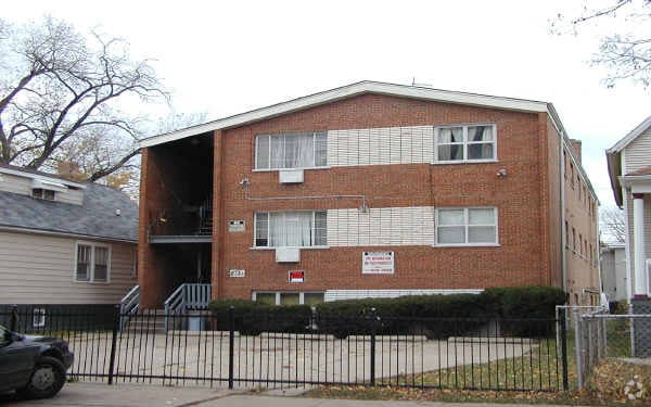
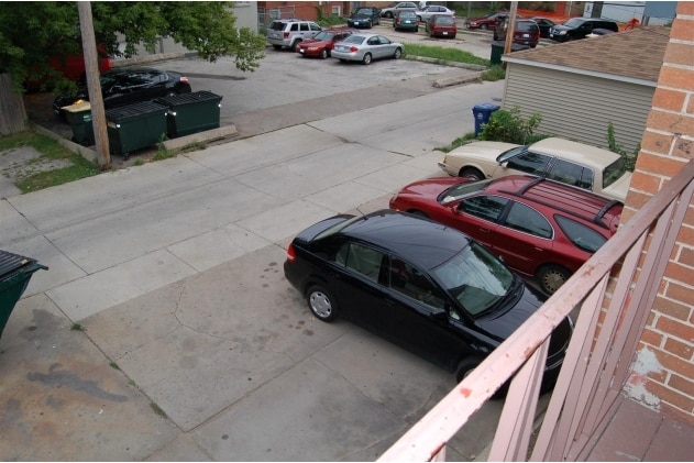
Property Record
2121 Darrow Ave, Evanston, IL 60201


Property Detail
2121 Darrow Ave
Chicago-Naperville-Elgin, IL-IN
(PAYNES) ADD TO (EVANSTON) SUB OF SW SE SEC 12-41-13
10-12-420-008-0000
Cook
Apartment
Illinois
B and X Area of moderate flood hazard, usually the area between the limits of the 100-year and 500-year floods.
13
2023
0.20 AC
2025
Evanston
809200
Chicago
6,404 SF
NEARBY LISTINGS FOR SALE OR LEASE
DEMOGRAPHICS near 2121 Darrow Ave
1 mile
3 mile
5 mile
2025 Total Population
33,800
169,817
402,147
2030 Population
34,157
171,491
405,220
Pop Growth 2025-2030
+ 1.06%
+ 0.99%
+ 0.76%
Average Age
37
41
41
2025 Total Households
12,445
63,804
153,940
HH Growth 2025-2030
+ 1.00%
+ 0.86%
+ 0.60%
Median Household Inc
$81,515
$99,946
$85,667
Avg Household Size
2.20
2.40
2.40
2025 Avg HH Vehicles
1.00
1.00
1.00
Median Home Value
$583,666
$477,691
$428,338
Median Year Built
1954
1953
1953
Nearby Places
Map Layers
Map Styles
 Street
 Aerial
Transit
 Traffic
 Biking
Places
Listings with unknown addresses are not visible on the map
- Restaurants
- Banks
- Shops
- Fitness
- Groceries
PUBLIC TRANSPORTATION
TRANSIT/SUBWAY
Evanston Central Street Station (Union Pacific North Line - Northeast Illinois Regional Commuter Railroad (Metra))
Drive
Walk
Distance
Evanston Central Street Station (Union Pacific North Line - Northeast Illinois Regional Commuter Railroad (Metra))
2 min
14 min
0.7 mi
Noyes Station (Purple Line - Chicago Transit Authority "L" Trains (The "L"))
Drive
Walk
Distance
Noyes Station (Purple Line - Chicago Transit Authority "L" Trains (The "L"))
3 min
15 min
0.8 mi
Foster Station (Purple Line - Chicago Transit Authority "L" Trains (The "L"))
Drive
Walk
Distance
Foster Station (Purple Line - Chicago Transit Authority "L" Trains (The "L"))
3 min
18 min
0.9 mi
Central Station (Purple Line) (Purple Line - Chicago Transit Authority "L" Trains (The "L"))
Drive
Walk
Distance
Central Station (Purple Line) (Purple Line - Chicago Transit Authority "L" Trains (The "L"))
3 min
20 min
1.0 mi
COMMUTER RAIL
Evanston Central Street Station (Union Pacific North Line - Northeast Illinois Regional Commuter Railroad (Metra))
Drive
Walk
Distance
Evanston Central Street Station (Union Pacific North Line - Northeast Illinois Regional Commuter Railroad (Metra))
2 min
14 min
0.7 mi
Evanston Davis Street Station (Union Pacific North Line - Northeast Illinois Regional Commuter Railroad (Metra))
Drive
Walk
Distance
Evanston Davis Street Station (Union Pacific North Line - Northeast Illinois Regional Commuter Railroad (Metra))
3 min
1.1 mi
AIRPORT
Chicago O'Hare International
Drive
Walk
Distance
Chicago O'Hare International
52 min
20.5 mi
Chicago Midway International
Drive
Walk
Distance
Chicago Midway International
44 min
22.7 mi
Nearby Properties
Address
Land Use
TOTAL SIZE
Lot Size
Zoning
Address
Land Use
TOTAL SIZE
Lot Size
Zoning
999,808 SF
50.13 AC
Address
Land Use
TOTAL SIZE
Lot Size
Zoning
180,397 SF
0.78 AC
Address
Land Use
TOTAL SIZE
Lot Size
Zoning
0.63 AC
Address
Land Use
TOTAL SIZE
Lot Size
Zoning
892,012 SF
37.29 AC
Address
Land Use
TOTAL SIZE
Lot Size
Zoning
341,698 SF
0.64 AC
Address
Land Use
TOTAL SIZE
Lot Size
Zoning
4,748 SF
0.40 AC
Address
Land Use
TOTAL SIZE
Lot Size
Zoning
303,960 SF
0.98 AC
Address
Land Use
TOTAL SIZE
Lot Size
Zoning
165,067 SF
10.88 AC
Address
Land Use
TOTAL SIZE
Lot Size
Zoning
0.84 AC
Address
Land Use
TOTAL SIZE
Lot Size
Zoning
251,409 SF
16.33 AC
Address
Land Use
TOTAL SIZE
Lot Size
Zoning
232,552 SF
5.78 AC
Address
Land Use
TOTAL SIZE
Lot Size
Zoning
176,115 SF
1.04 AC
Address
Land Use
TOTAL SIZE
Lot Size
Zoning
429,949 SF
16.06 AC
Address
Land Use
TOTAL SIZE
Lot Size
Zoning
218,982 SF
1.97 AC
Address
Land Use
TOTAL SIZE
Lot Size
Zoning
243,781 SF
0.84 AC
Address
Land Use
TOTAL SIZE
Lot Size
Zoning
110,528 SF
3.05 AC
Address
Land Use
TOTAL SIZE
Lot Size
Zoning
0.84 AC
Address
Land Use
TOTAL SIZE
Lot Size
Zoning
Address
Land Use
TOTAL SIZE
Lot Size
Zoning
163,981 SF
4 AC
Address
Land Use
TOTAL SIZE
Lot Size
Zoning
145,548 SF
0.80 AC
Address
Land Use
TOTAL SIZE
Lot Size
Zoning
8,550 SF
0.25 AC
Address
Land Use
TOTAL SIZE
Lot Size
Zoning
121,642 SF
1.65 AC
Address
Land Use
TOTAL SIZE
Lot Size
Zoning
372,244 SF
7.12 AC
Address
Land Use
TOTAL SIZE
Lot Size
Zoning
1.67 AC
Address
Land Use
TOTAL SIZE
Lot Size
Zoning
2.46 AC
Address
Land Use
TOTAL SIZE
Lot Size
Zoning
208,785 SF
0.61 AC
Address
Land Use
TOTAL SIZE
Lot Size
Zoning
5.65 AC
Address
Land Use
TOTAL SIZE
Lot Size
Zoning
206,139 SF
2.19 AC
Address
Land Use
TOTAL SIZE
Lot Size
Zoning
199,280 SF
3.10 AC
Address
Land Use
TOTAL SIZE
Lot Size
Zoning
190,350 SF
1.03 AC
The World's #1 Commercial Real Estate Marketplace
Connect with us
© 2026 CoStar Group
The information above has been obtained from sources believed reliable. While we do not doubt its accuracy we have not verified it and make no guarantee, warranty or representation about it. It is your responsibility to independently confirm its accuracy and completeness. Any projections, opinions, assumptions, or estimates used are for example only and do not represent the current or future performance of the property. The value of this transaction to you depends on tax and other factors which should be evaluated by your tax, financial, and legal advisors. You and your advisors should conduct a careful, independent investigation of the property to determine to your satisfaction the suitability of the property for your needs.