Property Record
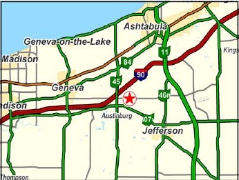
2121 State Route 45, Austinburg, OH 44010
NEARBY LISTINGS FOR SALE OR LEASE
-
-
View all Austinburg listings for sale on LoopNet.com
Property Detail
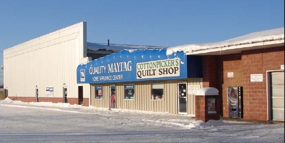
2121 State Route 45
070030003303
PART OF LOT 5
Storebuilding
Ashtabula
X
Ohio
39007C0165D
5
2024
2 AC
2024
Ashtabula County
001002
Cleveland
11,550 SF
Ashtabula, OH
DEMOGRAPHICS near 2121 State Route 45
1 Mile
3 Mile
5 Mile
2024 Total Population
322
2,772
12,840
2029 Population
314
2,715
12,629
Pop Growth 2024-2029
(2.48%)
(2.06%)
(1.64%)
Average Age
45
44
43
2024 Total Households
122
1,073
5,258
HH Growth 2024-2029
(3.28%)
(2.33%)
(1.79%)
Median Household Inc
$69,999
$68,561
$60,959
Avg Household Size
2.40
2.40
2.30
2024 Avg HH Vehicles
2.00
2.00
2.00
Median Home Value
$186,363
$203,934
$165,276
Median Year Built
1959
1969
1967
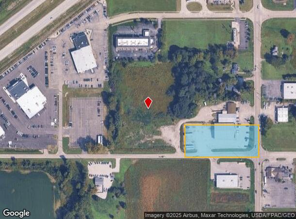
Nearby Places
Map Layers
Map Styles
 Street
 Aerial
- Restaurants
- Banks
- Shops
- Fitness
- Groceries
Nearby Properties
Address
Land Use
TOTAL SIZE
Lot Size
Zoning
Address
Land Use
TOTAL SIZE
Lot Size
Zoning
15,826 SF
320.34 AC
Address
Land Use
TOTAL SIZE
Lot Size
Zoning
400,734 SF
29.94 AC
Address
Land Use
TOTAL SIZE
Lot Size
Zoning
44,980 SF
13.44 AC
Address
Land Use
TOTAL SIZE
Lot Size
Zoning
72,961 SF
13 AC
Address
Land Use
TOTAL SIZE
Lot Size
Zoning
55,948 SF
12.28 AC
Address
Land Use
TOTAL SIZE
Lot Size
Zoning
53,096 SF
20.34 AC
Address
Land Use
TOTAL SIZE
Lot Size
Zoning
12,897 SF
3.58 AC
Address
Land Use
TOTAL SIZE
Lot Size
Zoning
30,826 SF
2.60 AC
Address
Land Use
TOTAL SIZE
Lot Size
Zoning
53,672 SF
7.25 AC
Address
Land Use
TOTAL SIZE
Lot Size
Zoning
16,803 SF
18.98 AC
Address
Land Use
TOTAL SIZE
Lot Size
Zoning
40,782 SF
1.75 AC
Address
Land Use
TOTAL SIZE
Lot Size
Zoning
46,362 SF
5.65 AC
Address
Land Use
TOTAL SIZE
Lot Size
Zoning
64,450 SF
14.95 AC
Address
Land Use
TOTAL SIZE
Lot Size
Zoning
66,370 SF
5.05 AC
Address
Land Use
TOTAL SIZE
Lot Size
Zoning
53,636 SF
5.05 AC
Address
Land Use
TOTAL SIZE
Lot Size
Zoning
12,670 SF
2.51 AC
Address
Land Use
TOTAL SIZE
Lot Size
Zoning
62,376 SF
5.93 AC
Address
Land Use
TOTAL SIZE
Lot Size
Zoning
3,344 SF
10.38 AC
Address
Land Use
TOTAL SIZE
Lot Size
Zoning
31,864 SF
5 AC
Address
Land Use
TOTAL SIZE
Lot Size
Zoning
10,982 SF
5.59 AC
Address
Land Use
TOTAL SIZE
Lot Size
Zoning
45,628 SF
4.41 AC
Address
Land Use
TOTAL SIZE
Lot Size
Zoning
298.19 AC
Address
Land Use
TOTAL SIZE
Lot Size
Zoning
7,592 SF
2.25 AC
Address
Land Use
TOTAL SIZE
Lot Size
Zoning
2,400 SF
249.94 AC
Address
Land Use
TOTAL SIZE
Lot Size
Zoning
6,868 SF
93.11 AC
Address
Land Use
TOTAL SIZE
Lot Size
Zoning
5,624 SF
54 AC
Address
Land Use
TOTAL SIZE
Lot Size
Zoning
3,748 SF
158.49 AC
Address
Land Use
TOTAL SIZE
Lot Size
Zoning
3,617 SF
2.07 AC
Address
Land Use
TOTAL SIZE
Lot Size
Zoning
15,480 SF
4.39 AC
Address
Land Use
TOTAL SIZE
Lot Size
Zoning
6,100 SF
20.77 AC
The World's #1 Commercial Real Estate Marketplace
Connect with us
© 2025 CoStar Group
The information above has been obtained from sources believed reliable. While we do not doubt its accuracy we have not verified it and make no guarantee, warranty or representation about it. It is your responsibility to independently confirm its accuracy and completeness. Any projections, opinions, assumptions, or estimates used are for example only and do not represent the current or future performance of the property. The value of this transaction to you depends on tax and other factors which should be evaluated by your tax, financial, and legal advisors. You and your advisors should conduct a careful, independent investigation of the property to determine to your satisfaction the suitability of the property for your needs.