Property Record
2121 W Danforth Rd, Edmond, OK 73003
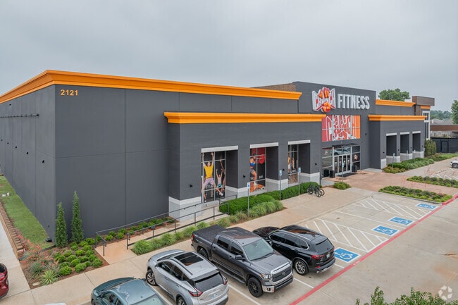

Property Detail
2121 W Danforth Rd
Oklahoma City, OK
DANFORTH VILLAGE EAST BLK 1 LOT 1
212691000
OKLAHOMA
Supermarket
Oklahoma
B and X Area of moderate flood hazard, usually the area between the limits of the 100-year and 500-year floods.
1
2024
6.33 AC
2025
North Outlying
108229
Oklahoma City
37,195 SF
NEARBY LISTINGS FOR SALE OR LEASE
DEMOGRAPHICS near 2121 W Danforth Rd
1 mile
3 mile
5 mile
2024 Total Population
9,759
74,956
151,187
2029 Population
9,835
76,116
153,915
Pop Growth 2024-2029
+ 0.78%
+ 1.55%
+ 1.80%
Average Age
38
37
38
2024 Total Households
3,634
28,214
58,028
HH Growth 2024-2029
+ 0.96%
+ 1.62%
+ 1.94%
Median Household Inc
$104,279
$97,399
$102,068
Avg Household Size
2.70
2.60
2.50
2024 Avg HH Vehicles
2.00
2.00
2.00
Median Home Value
$278,844
$298,589
$339,667
Median Year Built
1995
1997
1998
Nearby Places
Map Layers
Map Styles
 Street
 Aerial
Transit
 Traffic
 Biking
Places
Listings with unknown addresses are not visible on the map
- Restaurants
- Banks
- Shops
- Fitness
- Groceries
PUBLIC TRANSPORTATION
AIRPORT
Will Rogers World
Drive
Walk
Distance
Will Rogers World
40 min
25.0 mi
Freight Ports
Tulsa Port Of Catoosa
Drive
Walk
Distance
Tulsa Port Of Catoosa
136 min
122.1 mi
SALE & LEASE HISTORY
LISTING DATE
SALE/LEASE

Nov 01, 2021
For Lease
Jul 25, 2023
For Lease
Aug 10, 2022
For Lease
Apr 02, 2025
For Sale
Nearby Properties
Address
Land Use
TOTAL SIZE
Lot Size
Zoning
Address
Land Use
TOTAL SIZE
Lot Size
Zoning
304,750 SF
21.76 AC
Address
Land Use
TOTAL SIZE
Lot Size
Zoning
289,309 SF
26.01 AC
Address
Land Use
TOTAL SIZE
Lot Size
Zoning
164,940 SF
27.04 AC
Address
Land Use
TOTAL SIZE
Lot Size
Zoning
82,162 SF
6.13 AC
Address
Land Use
TOTAL SIZE
Lot Size
Zoning
173,384 SF
5.51 AC
Address
Land Use
TOTAL SIZE
Lot Size
Zoning
6,636 SF
0.18 AC
Address
Land Use
TOTAL SIZE
Lot Size
Zoning
151,156 SF
13.71 AC
PUD
Address
Land Use
TOTAL SIZE
Lot Size
Zoning
140,434 SF
18.14 AC
PUD
Address
Land Use
TOTAL SIZE
Lot Size
Zoning
210,018 SF
25.18 AC
Address
Land Use
TOTAL SIZE
Lot Size
Zoning
7,428 SF
1 AC
Address
Land Use
TOTAL SIZE
Lot Size
Zoning
176,307 SF
14.76 AC
Address
Land Use
TOTAL SIZE
Lot Size
Zoning
8,760 SF
1.05 AC
Address
Land Use
TOTAL SIZE
Lot Size
Zoning
154,244 SF
6.44 AC
PUD
Address
Land Use
TOTAL SIZE
Lot Size
Zoning
140,000 SF
11.94 AC
Address
Land Use
TOTAL SIZE
Lot Size
Zoning
8,920 SF
7.83 AC
Address
Land Use
TOTAL SIZE
Lot Size
Zoning
140,928 SF
9.60 AC
Address
Land Use
TOTAL SIZE
Lot Size
Zoning
71,902 SF
6.68 AC
Address
Land Use
TOTAL SIZE
Lot Size
Zoning
159,232 SF
14.06 AC
Address
Land Use
TOTAL SIZE
Lot Size
Zoning
75,308 SF
4.03 AC
SPUD
Address
Land Use
TOTAL SIZE
Lot Size
Zoning
110,250 SF
10 AC
Address
Land Use
TOTAL SIZE
Lot Size
Zoning
140,144 SF
15.74 AC
Address
Land Use
TOTAL SIZE
Lot Size
Zoning
1.89 AC
Address
Land Use
TOTAL SIZE
Lot Size
Zoning
20,810 SF
4.44 AC
Address
Land Use
TOTAL SIZE
Lot Size
Zoning
106,508 SF
2.65 AC
Address
Land Use
TOTAL SIZE
Lot Size
Zoning
81,518 SF
4.80 AC
Address
Land Use
TOTAL SIZE
Lot Size
Zoning
121,875 SF
17.45 AC
Address
Land Use
TOTAL SIZE
Lot Size
Zoning
181,989 SF
8.77 AC
Address
Land Use
TOTAL SIZE
Lot Size
Zoning
1,105 SF
1.06 AC
Address
Land Use
TOTAL SIZE
Lot Size
Zoning
17,670 SF
1.63 AC
PUD
The World's #1 Commercial Real Estate Marketplace
Connect with us
© 2026 CoStar Group
The information above has been obtained from sources believed reliable. While we do not doubt its accuracy we have not verified it and make no guarantee, warranty or representation about it. It is your responsibility to independently confirm its accuracy and completeness. Any projections, opinions, assumptions, or estimates used are for example only and do not represent the current or future performance of the property. The value of this transaction to you depends on tax and other factors which should be evaluated by your tax, financial, and legal advisors. You and your advisors should conduct a careful, independent investigation of the property to determine to your satisfaction the suitability of the property for your needs.