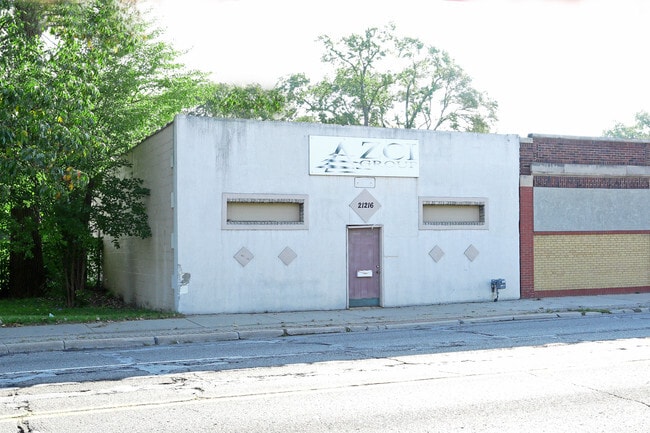
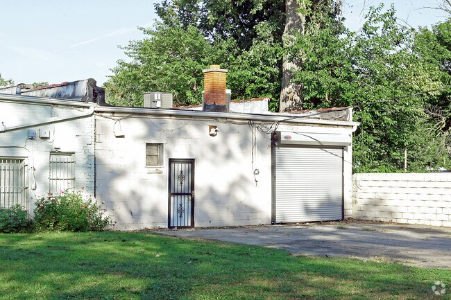
Property Record
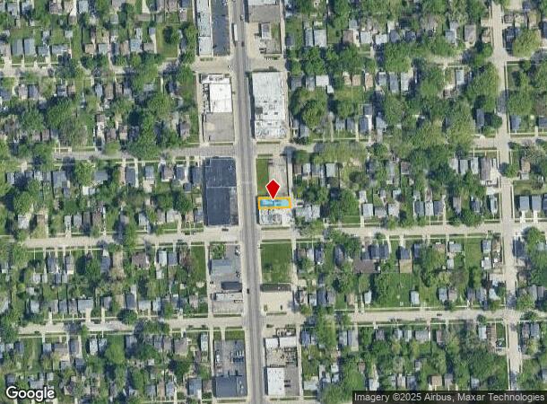
21216 John R Rd, Hazel Park, MI 48030
NEARBY LISTINGS FOR SALE OR LEASE
Property Detail
21216 John R Rd
Detroit-Warren-Dearborn, MI
Ford Park Sub
25-36-309-002
T1N, R11E, SEC 36 FORD PARK SUB LOT 325
Warehouse
Oakland
X
Michigan
26163C0125E
325
2024
0.07 AC
2024
Royal Oak
175300
Detroit
1,503 SF
DEMOGRAPHICS near 21216 John R Rd
1 Mile
3 Mile
5 Mile
2024 Total Population
14,736
135,640
397,902
2029 Population
14,826
135,139
394,344
Pop Growth 2024-2029
+ 0.61%
(0.37%)
(0.89%)
Average Age
39
39
39
2024 Total Households
6,425
58,843
163,092
HH Growth 2024-2029
+ 0.47%
(0.36%)
(0.78%)
Median Household Inc
$47,279
$54,460
$50,540
Avg Household Size
2.20
2.30
2.40
2024 Avg HH Vehicles
2.00
2.00
1.00
Median Home Value
$116,823
$142,340
$145,186
Median Year Built
1952
1951
1952
Nearby Places
Map Layers
Map Styles
 Street
 Aerial
- Restaurants
- Banks
- Shops
- Fitness
- Groceries
PUBLIC TRANSPORTATION
COMMUTER RAIL
DRIVE
WALK
Distance
10 min
4.6 mi
DRIVE
WALK
Distance
12 min
7.1 mi
AIRPORT
Windsor International
DRIVE
WALK
Distance
Windsor International
37 min
19.0 mi
Detroit Metro Wayne County
DRIVE
WALK
Distance
Detroit Metro Wayne County
41 min
28.5 mi
Nearby Properties
Address
Land Use
TOTAL SIZE
Lot Size
Zoning
Address
Land Use
TOTAL SIZE
Lot Size
Zoning
3,529,575 SF
84.46 AC
B4
Address
Land Use
TOTAL SIZE
Lot Size
Zoning
910,140 SF
47.78 AC
Address
Land Use
TOTAL SIZE
Lot Size
Zoning
649,140 SF
43.98 AC
Address
Land Use
TOTAL SIZE
Lot Size
Zoning
576,924 SF
31.35 AC
Address
Land Use
TOTAL SIZE
Lot Size
Zoning
306,345 SF
Address
Land Use
TOTAL SIZE
Lot Size
Zoning
576,924 SF
36.24 AC
Address
Land Use
TOTAL SIZE
Lot Size
Zoning
150,703 SF
Address
Land Use
TOTAL SIZE
Lot Size
Zoning
233,900 SF
15.56 AC
M-2
Address
Land Use
TOTAL SIZE
Lot Size
Zoning
259,959 SF
27.39 AC
MZ
Address
Land Use
TOTAL SIZE
Lot Size
Zoning
199,592 SF
17.02 AC
B3
Address
Land Use
TOTAL SIZE
Lot Size
Zoning
220,561 SF
10.62 AC
M-2
Address
Land Use
TOTAL SIZE
Lot Size
Zoning
303,615 SF
22.07 AC
MZ
Address
Land Use
TOTAL SIZE
Lot Size
Zoning
128,309 SF
1.74 AC
Address
Land Use
TOTAL SIZE
Lot Size
Zoning
43,437 SF
3.30 AC
REG BUS
Address
Land Use
TOTAL SIZE
Lot Size
Zoning
123,844 SF
1.81 AC
R2
Address
Land Use
TOTAL SIZE
Lot Size
Zoning
156,250 SF
8.79 AC
B4
Address
Land Use
TOTAL SIZE
Lot Size
Zoning
137,583 SF
2.96 AC
BI
Address
Land Use
TOTAL SIZE
Lot Size
Zoning
168,200 SF
12.08 AC
R-3
Address
Land Use
TOTAL SIZE
Lot Size
Zoning
119,418 SF
13.81 AC
B4
Address
Land Use
TOTAL SIZE
Lot Size
Zoning
292,032 SF
20.25 AC
B4
Address
Land Use
TOTAL SIZE
Lot Size
Zoning
180,056 SF
1.45 AC
II
Address
Land Use
TOTAL SIZE
Lot Size
Zoning
0.61 AC
PUD
Address
Land Use
TOTAL SIZE
Lot Size
Zoning
162,400 SF
M1LT
Address
Land Use
TOTAL SIZE
Lot Size
Zoning
125,055 SF
7.74 AC
MZ
Address
Land Use
TOTAL SIZE
Lot Size
Zoning
2.60 AC
MIX USE 1
Address
Land Use
TOTAL SIZE
Lot Size
Zoning
641,836 SF
20.69 AC
M4
Address
Land Use
TOTAL SIZE
Lot Size
Zoning
181,798 SF
10.48 AC
B4
Address
Land Use
TOTAL SIZE
Lot Size
Zoning
90,595 SF
8.20 AC
BI
Address
Land Use
TOTAL SIZE
Lot Size
Zoning
153,007 SF
7.74 AC
II
Address
Land Use
TOTAL SIZE
Lot Size
Zoning
160,754 SF
9.68 AC
M-2
The World's #1 Commercial Real Estate Marketplace
Connect with us
© 2025 CoStar Group
The information above has been obtained from sources believed reliable. While we do not doubt its accuracy we have not verified it and make no guarantee, warranty or representation about it. It is your responsibility to independently confirm its accuracy and completeness. Any projections, opinions, assumptions, or estimates used are for example only and do not represent the current or future performance of the property. The value of this transaction to you depends on tax and other factors which should be evaluated by your tax, financial, and legal advisors. You and your advisors should conduct a careful, independent investigation of the property to determine to your satisfaction the suitability of the property for your needs.