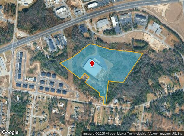
Property Record
2122 Noland Connector Rd, Augusta, GA 30909

NEARBY LISTINGS FOR SALE OR LEASE
Property Detail
2122 Noland Connector Rd
0680024070
Pinecrest Dev Co
Commercialacreage
Richmond
AE
Georgia
13245C0104G
22.18 AC
2025
South Richmond County
2025
Augusta/Richmond County
010515
Augusta-Richmond County, GA-SC
81,250 SF
DEMOGRAPHICS near 2122 Noland Connector Rd
1 mile
3 mile
5 mile
2024 Total Population
2,708
50,096
142,628
2029 Population
2,702
49,479
142,637
Pop Growth 2024-2029
(0.22%)
(1.23%)
+ 0.01%
Average Age
35
38
38
2024 Total Households
1,075
20,745
56,104
HH Growth 2024-2029
(0.28%)
(1.16%)
(0.07%)
Median Household Inc
$51,284
$46,288
$50,943
Avg Household Size
2.40
2.30
2.30
2024 Avg HH Vehicles
2.00
2.00
2.00
Median Home Value
$115,517
$126,714
$146,198
Median Year Built
1982
1980
1977
Nearby Places
Map Layers
Map Styles
 Street
 Aerial
Transit
 Traffic
 Biking
Places
Listings with unknown addresses are not visible on the map
- Restaurants
- Banks
- Shops
- Fitness
- Groceries
PUBLIC TRANSPORTATION
AIRPORT
Augusta Regional at Bush Field
Drive
Walk
Distance
Augusta Regional at Bush Field
18 min
9.9 mi
Freight Ports
Georgia Ports - Savannah
Drive
Walk
Distance
Georgia Ports - Savannah
152 min
119.0 mi
Nearby Properties
Address
Land Use
TOTAL SIZE
Lot Size
Zoning
Address
Land Use
TOTAL SIZE
Lot Size
Zoning
371,617 SF
13.26 AC
B-2
Address
Land Use
TOTAL SIZE
Lot Size
Zoning
4,357 SF
34 AC
R-3B
Address
Land Use
TOTAL SIZE
Lot Size
Zoning
292,232 SF
39.73 AC
B-2
Address
Land Use
TOTAL SIZE
Lot Size
Zoning
5,541 SF
14.81 AC
B-2
Address
Land Use
TOTAL SIZE
Lot Size
Zoning
5,480 SF
19.05 AC
R-3B
Address
Land Use
TOTAL SIZE
Lot Size
Zoning
984 SF
16.18 AC
R-3C
Address
Land Use
TOTAL SIZE
Lot Size
Zoning
1,428 SF
75.91 AC
R-1A
Address
Land Use
TOTAL SIZE
Lot Size
Zoning
2,665 SF
11.80 AC
B-2
Address
Land Use
TOTAL SIZE
Lot Size
Zoning
36,755 SF
12.09 AC
B-2
Address
Land Use
TOTAL SIZE
Lot Size
Zoning
1,620 SF
21.51 AC
R-3B
Address
Land Use
TOTAL SIZE
Lot Size
Zoning
61,236 SF
8.09 AC
R-3B
Address
Land Use
TOTAL SIZE
Lot Size
Zoning
952 SF
29 AC
A
Address
Land Use
TOTAL SIZE
Lot Size
Zoning
3,829 SF
35.30 AC
R-3B
Address
Land Use
TOTAL SIZE
Lot Size
Zoning
38,080 SF
19.19 AC
R-3B
Address
Land Use
TOTAL SIZE
Lot Size
Zoning
4,108 SF
14.12 AC
B-2
Address
Land Use
TOTAL SIZE
Lot Size
Zoning
1,782 SF
26.27 AC
R-3A
Address
Land Use
TOTAL SIZE
Lot Size
Zoning
640 SF
12.17 AC
B-1
Address
Land Use
TOTAL SIZE
Lot Size
Zoning
6,323 SF
25.49 AC
R-3C
Address
Land Use
TOTAL SIZE
Lot Size
Zoning
241,284 SF
20.61 AC
R-1A
Address
Land Use
TOTAL SIZE
Lot Size
Zoning
8,640 SF
13.15 AC
R-3B
Address
Land Use
TOTAL SIZE
Lot Size
Zoning
102,060 SF
45.63 AC
R-3B
Address
Land Use
TOTAL SIZE
Lot Size
Zoning
72,381 SF
0.95 AC
Address
Land Use
TOTAL SIZE
Lot Size
Zoning
42,617 SF
40.26 AC
R-1_B-1
Address
Land Use
TOTAL SIZE
Lot Size
Zoning
68,600 SF
20.94 AC
R-3A
Address
Land Use
TOTAL SIZE
Lot Size
Zoning
62,440 SF
5.70 AC
B-2
Address
Land Use
TOTAL SIZE
Lot Size
Zoning
11,584 SF
10.34 AC
R-3B
Address
Land Use
TOTAL SIZE
Lot Size
Zoning
56,631 SF
11.62 AC
R-1A, B-2
Address
Land Use
TOTAL SIZE
Lot Size
Zoning
106,072 SF
9.35 AC
007
Address
Land Use
TOTAL SIZE
Lot Size
Zoning
2,725 SF
12.42 AC
B-2
Address
Land Use
TOTAL SIZE
Lot Size
Zoning
89,307 SF
3.62 AC
B-2 COND
The World's #1 Commercial Real Estate Marketplace
Connect with us
© 2026 CoStar Group
The information above has been obtained from sources believed reliable. While we do not doubt its accuracy we have not verified it and make no guarantee, warranty or representation about it. It is your responsibility to independently confirm its accuracy and completeness. Any projections, opinions, assumptions, or estimates used are for example only and do not represent the current or future performance of the property. The value of this transaction to you depends on tax and other factors which should be evaluated by your tax, financial, and legal advisors. You and your advisors should conduct a careful, independent investigation of the property to determine to your satisfaction the suitability of the property for your needs.