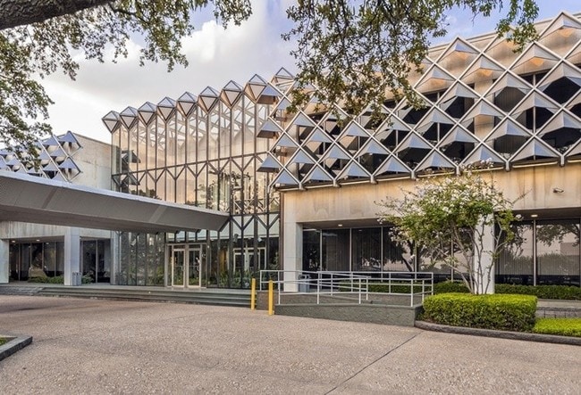
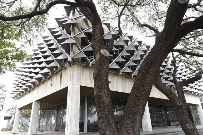
Property Record
2122 W Mockingbird Ln, Dallas, TX 75235

Property Detail
2122 W Mockingbird Ln
00000430633000000
FOREST PARK BLK A/5758 PT LT 5 ACS 5.309 INT202200056434 DD02282022 CO-DC 5758 00A 00500 2005758 00A
Commercialacreage
DALLAS
Z116
Texas
B and X Area of moderate flood hazard, usually the area between the limits of the 100-year and 500-year floods.
5
0
5.31 AC
2025
Stemmons Freeway
000409
Dallas/Ft Worth
10,014 SF
Dallas-Fort Worth-Arlington, TX
NEARBY LISTINGS FOR SALE OR LEASE
DEMOGRAPHICS near 2122 W Mockingbird Ln
1 mile
3 mile
5 mile
2025 Total Population
10,287
108,386
342,642
2030 Population
10,706
113,317
357,606
Pop Growth 2025-2030
+ 4.07%
+ 4.55%
+ 4.37%
Average Age
35
38
37
2025 Total Households
4,934
51,778
159,258
HH Growth 2025-2030
+ 4.38%
+ 4.65%
+ 4.73%
Median Household Inc
$64,597
$79,300
$91,543
Avg Household Size
2.00
2.00
2.00
2025 Avg HH Vehicles
2.00
1.00
2.00
Median Home Value
$277,870
$559,969
$634,677
Median Year Built
2005
1994
1994
Nearby Places
Map Layers
Map Styles
 Street
 Aerial
Layers
 Traffic
 Biking
Places
Listings with unknown addresses are not visible on the map
- Restaurants
- Banks
- Shops
- Fitness
- Groceries
PUBLIC TRANSPORTATION
COMMUTER RAIL
Medical/Market Ctr Station (TRINITY RAILWAY - Dallas Area Rapid Transit (DART))
Drive
Walk
Distance
Medical/Market Ctr Station (TRINITY RAILWAY - Dallas Area Rapid Transit (DART))
4 min
2.0 mi
Victory Station (DART LIGHT RAIL - GREEN LINE - Dallas Area Rapid Transit (DART), DART LIGHT RAIL - ORANGE LINE - Dallas Area Rapid Transit (DART), TRINITY RAILWAY - Dallas Area Rapid Transit (DART))
Drive
Walk
Distance
Victory Station (DART LIGHT RAIL - GREEN LINE - Dallas Area Rapid Transit (DART), DART LIGHT RAIL - ORANGE LINE - Dallas Area Rapid Transit (DART), TRINITY RAILWAY - Dallas Area Rapid Transit (DART))
9 min
4.6 mi
AIRPORT
Dallas Love Field
Drive
Walk
Distance
Dallas Love Field
4 min
2.0 mi
Dallas-Fort Worth International
Drive
Walk
Distance
Dallas-Fort Worth International
23 min
16.5 mi
Freight Ports
Port of Shreveport
Drive
Walk
Distance
Port of Shreveport
221 min
200.9 mi
SALE & LEASE HISTORY
LISTING DATE
SALE/LEASE

Sep 25, 2016
For Lease
Jul 25, 2018
For Sale
Nearby Properties
Address
Land Use
TOTAL SIZE
Lot Size
Zoning
Address
Land Use
TOTAL SIZE
Lot Size
Zoning
2,658,374 SF
37.70 AC
Z116
Address
Land Use
TOTAL SIZE
Lot Size
Zoning
2,476 SF
1,203.03 AC
Z116
Address
Land Use
TOTAL SIZE
Lot Size
Zoning
2,271,924 SF
Address
Land Use
TOTAL SIZE
Lot Size
Zoning
4,407,366 SF
1,300 AC
IR
Address
Land Use
TOTAL SIZE
Lot Size
Zoning
1,003,498 SF
22.15 AC
Z116
Address
Land Use
TOTAL SIZE
Lot Size
Zoning
1,896,570 SF
18.08 AC
Z151
Address
Land Use
TOTAL SIZE
Lot Size
Zoning
299,170 SF
9.71 AC
Z97
Address
Land Use
TOTAL SIZE
Lot Size
Zoning
504,533 SF
9.95 AC
Z151
Address
Land Use
TOTAL SIZE
Lot Size
Zoning
1,228,418 SF
24.51 AC
Z151
Address
Land Use
TOTAL SIZE
Lot Size
Zoning
602,716 SF
11.21 AC
Z239
Address
Land Use
TOTAL SIZE
Lot Size
Zoning
525,016 SF
6.51 AC
Z151
Address
Land Use
TOTAL SIZE
Lot Size
Zoning
512,667 SF
16.10 AC
Z151
Address
Land Use
TOTAL SIZE
Lot Size
Zoning
1,870,348 SF
12.70 AC
Z151
Address
Land Use
TOTAL SIZE
Lot Size
Zoning
806,107 SF
0.40 AC
Z239
Address
Land Use
TOTAL SIZE
Lot Size
Zoning
584,652 SF
22.90 AC
Z150
Address
Land Use
TOTAL SIZE
Lot Size
Zoning
446,593 SF
0.93 AC
Address
Land Use
TOTAL SIZE
Lot Size
Zoning
146,302 SF
5.66 AC
Z60
Address
Land Use
TOTAL SIZE
Lot Size
Zoning
615,910 SF
2.31 AC
Z239
Address
Land Use
TOTAL SIZE
Lot Size
Zoning
446,367 SF
3.35 AC
Z151
Address
Land Use
TOTAL SIZE
Lot Size
Zoning
352,834 SF
Address
Land Use
TOTAL SIZE
Lot Size
Zoning
1,898,977 SF
42.38 AC
Z239
Address
Land Use
TOTAL SIZE
Lot Size
Zoning
723,546 SF
16.98 AC
Z46
Address
Land Use
TOTAL SIZE
Lot Size
Zoning
226,948 SF
20.73 AC
Z239
Address
Land Use
TOTAL SIZE
Lot Size
Zoning
83,309 SF
13.37 AC
Z164
Address
Land Use
TOTAL SIZE
Lot Size
Zoning
485,166 SF
9.89 AC
Z236
Address
Land Use
TOTAL SIZE
Lot Size
Zoning
616,463 SF
4.74 AC
Z239
Address
Land Use
TOTAL SIZE
Lot Size
Zoning
538,312 SF
1.04 AC
Z239
Address
Land Use
TOTAL SIZE
Lot Size
Zoning
729,266 SF
10.20 AC
Z239
Address
Land Use
TOTAL SIZE
Lot Size
Zoning
1,259,199 SF
29.32 AC
Z116
Address
Land Use
TOTAL SIZE
Lot Size
Zoning
486,235 SF
1.32 AC
Z239
The World's #1 Commercial Real Estate Marketplace
Connect with us
© 2026 CoStar Group
The information above has been obtained from sources believed reliable. While we do not doubt its accuracy we have not verified it and make no guarantee, warranty or representation about it. It is your responsibility to independently confirm its accuracy and completeness. Any projections, opinions, assumptions, or estimates used are for example only and do not represent the current or future performance of the property. The value of this transaction to you depends on tax and other factors which should be evaluated by your tax, financial, and legal advisors. You and your advisors should conduct a careful, independent investigation of the property to determine to your satisfaction the suitability of the property for your needs.