Property Record
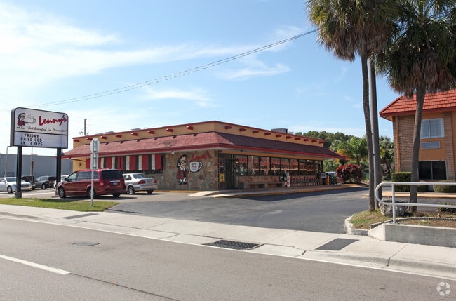
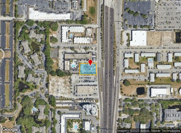
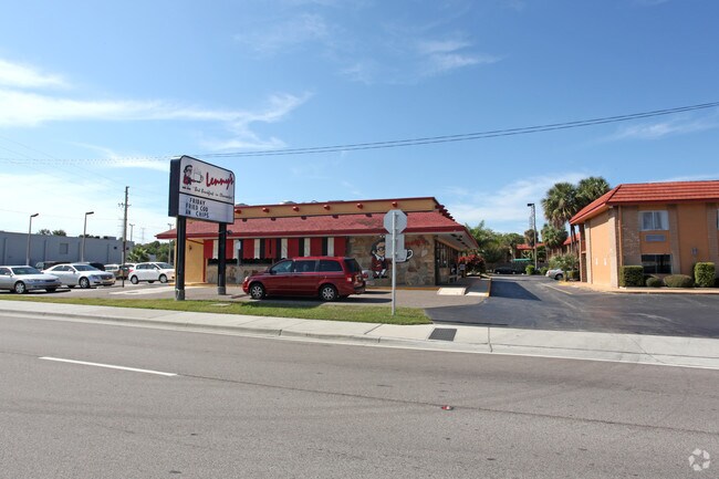
21220 Us Highway 19 N, Clearwater, FL 33765
NEARBY LISTINGS FOR SALE OR LEASE
Property Detail
21220 Us Highway 19 N
18-29-16-00000-110-0700
From Ne Sec Cor Th S01dw
Restaurantbuilding
FROM NE SEC COR TH S01DW 891.99FT TH N89DW 145FT FOR POB TH S01DW 130.01FT TH W 195FT(S) TH N 130FT TH E 195FT(S) TO POB
X
Pinellas
12103C0128H
Florida
2024
0.58 AC
2025
Bayside
026703
Tampa/St Petersburg
5,026 SF
Tampa-St. Petersburg-Clearwater, FL
DEMOGRAPHICS near 21220 Us Highway 19 N
1 Mile
3 Mile
5 Mile
2024 Total Population
15,199
93,832
240,602
2029 Population
15,364
94,693
242,066
Pop Growth 2024-2029
+ 1.09%
+ 0.92%
+ 0.61%
Average Age
42
46
46
2024 Total Households
7,101
42,100
110,433
HH Growth 2024-2029
+ 0.96%
+ 0.90%
+ 0.51%
Median Household Inc
$50,635
$57,100
$55,225
Avg Household Size
2.00
2.10
2.10
2024 Avg HH Vehicles
1.00
2.00
1.00
Median Home Value
$130,542
$242,677
$240,279
Median Year Built
1981
1976
1977
Nearby Places
Map Layers
Map Styles
 Street
 Aerial
- Restaurants
- Banks
- Shops
- Fitness
- Groceries
PUBLIC TRANSPORTATION
AIRPORT
St Pete-Clearwater International
DRIVE
WALK
Distance
St Pete-Clearwater International
21 min
9.9 mi
Tampa International
DRIVE
WALK
Distance
Tampa International
23 min
14.2 mi
Freight Ports
Port of Tampa Bay
DRIVE
WALK
Distance
Port of Tampa Bay
37 min
22.6 mi
Nearby Properties
Address
Land Use
TOTAL SIZE
Lot Size
Zoning
Address
Land Use
TOTAL SIZE
Lot Size
Zoning
524,588 SF
17.15 AC
Address
Land Use
TOTAL SIZE
Lot Size
Zoning
470,181 SF
29.93 AC
Address
Land Use
TOTAL SIZE
Lot Size
Zoning
563,328 SF
27.34 AC
Address
Land Use
TOTAL SIZE
Lot Size
Zoning
435,202 SF
9.80 AC
R3
Address
Land Use
TOTAL SIZE
Lot Size
Zoning
389,810 SF
16.93 AC
Address
Land Use
TOTAL SIZE
Lot Size
Zoning
498,319 SF
15.52 AC
Address
Land Use
TOTAL SIZE
Lot Size
Zoning
452,179 SF
5.75 AC
R4
Address
Land Use
TOTAL SIZE
Lot Size
Zoning
288,467 SF
43.51 AC
Address
Land Use
TOTAL SIZE
Lot Size
Zoning
305,970 SF
39.74 AC
Address
Land Use
TOTAL SIZE
Lot Size
Zoning
492,016 SF
19.86 AC
Address
Land Use
TOTAL SIZE
Lot Size
Zoning
313,486 SF
18.42 AC
Address
Land Use
TOTAL SIZE
Lot Size
Zoning
325,591 SF
31.97 AC
Address
Land Use
TOTAL SIZE
Lot Size
Zoning
352,647 SF
14.88 AC
Address
Land Use
TOTAL SIZE
Lot Size
Zoning
171,150 SF
17.58 AC
Address
Land Use
TOTAL SIZE
Lot Size
Zoning
284,609 SF
15.57 AC
Address
Land Use
TOTAL SIZE
Lot Size
Zoning
662,010 SF
33.76 AC
Address
Land Use
TOTAL SIZE
Lot Size
Zoning
492,747 SF
19.89 AC
Address
Land Use
TOTAL SIZE
Lot Size
Zoning
321,395 SF
25.22 AC
Address
Land Use
TOTAL SIZE
Lot Size
Zoning
160,014 SF
7.77 AC
Address
Land Use
TOTAL SIZE
Lot Size
Zoning
223,944 SF
12.13 AC
Address
Land Use
TOTAL SIZE
Lot Size
Zoning
239,340 SF
17.27 AC
Address
Land Use
TOTAL SIZE
Lot Size
Zoning
244,655 SF
16.84 AC
AE
Address
Land Use
TOTAL SIZE
Lot Size
Zoning
258,472 SF
18.23 AC
Address
Land Use
TOTAL SIZE
Lot Size
Zoning
251,016 SF
10.10 AC
AE
Address
Land Use
TOTAL SIZE
Lot Size
Zoning
284,000 SF
36.09 AC
Address
Land Use
TOTAL SIZE
Lot Size
Zoning
226,562 SF
11.08 AC
Address
Land Use
TOTAL SIZE
Lot Size
Zoning
208,637 SF
16.83 AC
M1
Address
Land Use
TOTAL SIZE
Lot Size
Zoning
367,503 SF
20.34 AC
M2
Address
Land Use
TOTAL SIZE
Lot Size
Zoning
277,450 SF
43.63 AC
Address
Land Use
TOTAL SIZE
Lot Size
Zoning
169,932 SF
19.83 AC
R3
The World's #1 Commercial Real Estate Marketplace
Connect with us
© 2025 CoStar Group
The information above has been obtained from sources believed reliable. While we do not doubt its accuracy we have not verified it and make no guarantee, warranty or representation about it. It is your responsibility to independently confirm its accuracy and completeness. Any projections, opinions, assumptions, or estimates used are for example only and do not represent the current or future performance of the property. The value of this transaction to you depends on tax and other factors which should be evaluated by your tax, financial, and legal advisors. You and your advisors should conduct a careful, independent investigation of the property to determine to your satisfaction the suitability of the property for your needs.