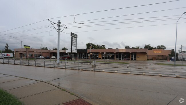
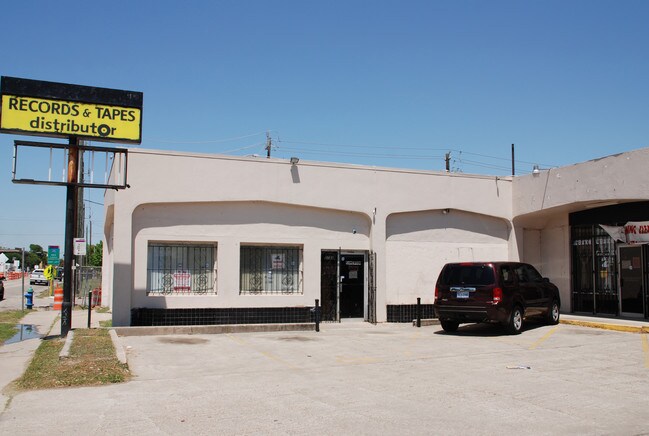
Property Record
2124 N Main St, Houston, TX 77009

Property Detail
2124 N Main St
Houston-Pasadena-The Woodlands, TX
LTS 17 18 19 20 & 21 BLK 56 ALLEN A C
0032200000017
HARRIS
Stripcommercialcenter
Texas
B and X Area of moderate flood hazard, usually the area between the limits of the 100-year and 500-year floods.
17
2024
0.58 AC
2025
Inner Loop/Heights
212300
Houston
11,044 SF
NEARBY LISTINGS FOR SALE OR LEASE
DEMOGRAPHICS near 2124 N Main St
1 mile
3 mile
5 mile
2025 Total Population
18,889
200,288
472,560
2030 Population
20,494
217,675
511,972
Pop Growth 2025-2030
+ 8.50%
+ 8.68%
+ 8.34%
Average Age
38
38
38
2025 Total Households
7,297
91,734
205,422
HH Growth 2025-2030
+ 9.35%
+ 9.37%
+ 8.97%
Median Household Inc
$73,753
$91,112
$84,335
Avg Household Size
2.40
2.00
2.10
2025 Avg HH Vehicles
2.00
2.00
2.00
Median Home Value
$457,515
$445,726
$445,356
Median Year Built
1969
2000
1992
Nearby Places
Map Layers
Map Styles
 Street
 Aerial
Transit
 Traffic
 Biking
Places
Listings with unknown addresses are not visible on the map
- Restaurants
- Banks
- Shops
- Fitness
- Groceries
PUBLIC TRANSPORTATION
TRANSIT/SUBWAY
Quitman / Near Northside (Redline - Harris County Metropolitan Transit Authority METRO Rail (METRORail))
Drive
Walk
Distance
Quitman / Near Northside (Redline - Harris County Metropolitan Transit Authority METRO Rail (METRORail))
0 min
2 min
0.1 mi
Fulton / North Central (Redline - Harris County Metropolitan Transit Authority METRO Rail (METRORail))
Drive
Walk
Distance
Fulton / North Central (Redline - Harris County Metropolitan Transit Authority METRO Rail (METRORail))
1 min
12 min
0.6 mi
Burnett Transit Center/Casa De Amigos (Redline - Harris County Metropolitan Transit Authority METRO Rail (METRORail))
Drive
Walk
Distance
Burnett Transit Center/Casa De Amigos (Redline - Harris County Metropolitan Transit Authority METRO Rail (METRORail))
2 min
12 min
0.6 mi
UH-Downtown (Redline - Harris County Metropolitan Transit Authority METRO Rail (METRORail))
Drive
Walk
Distance
UH-Downtown (Redline - Harris County Metropolitan Transit Authority METRO Rail (METRORail))
3 min
19 min
1.0 mi
COMMUTER RAIL
Drive
Walk
Distance
5 min
1.9 mi
AIRPORT
William P Hobby
Drive
Walk
Distance
William P Hobby
26 min
14.5 mi
George Bush Intcntl/Houston
Drive
Walk
Distance
George Bush Intcntl/Houston
24 min
18.4 mi
SALE & LEASE HISTORY
LISTING DATE
SALE/LEASE

Sep 19, 2017
For Sale
Oct 27, 2016
For Lease
Oct 18, 2016
For Lease
May 07, 2019
For Sale
Feb 20, 2018
For Lease
Nearby Properties
Address
Land Use
TOTAL SIZE
Lot Size
Zoning
Address
Land Use
TOTAL SIZE
Lot Size
Zoning
1,383,720 SF
1.47 AC
Address
Land Use
TOTAL SIZE
Lot Size
Zoning
1,101,686 SF
1.45 AC
Address
Land Use
TOTAL SIZE
Lot Size
Zoning
973,861 SF
1.18 AC
Address
Land Use
TOTAL SIZE
Lot Size
Zoning
899,279 SF
1.18 AC
Address
Land Use
TOTAL SIZE
Lot Size
Zoning
797,208 SF
1.46 AC
Address
Land Use
TOTAL SIZE
Lot Size
Zoning
1,916,394 SF
1.46 AC
Address
Land Use
TOTAL SIZE
Lot Size
Zoning
1,871,418 SF
1.44 AC
Address
Land Use
TOTAL SIZE
Lot Size
Zoning
1,091,726 SF
2.60 AC
Address
Land Use
TOTAL SIZE
Lot Size
Zoning
1,232,364 SF
1.49 AC
Address
Land Use
TOTAL SIZE
Lot Size
Zoning
1,436,400 SF
1.44 AC
Address
Land Use
TOTAL SIZE
Lot Size
Zoning
1,321,033 SF
1.46 AC
Address
Land Use
TOTAL SIZE
Lot Size
Zoning
4,169,721 SF
31.23 AC
Address
Land Use
TOTAL SIZE
Lot Size
Zoning
2,005,097 SF
1.44 AC
Address
Land Use
TOTAL SIZE
Lot Size
Zoning
1,374,271 SF
1.44 AC
Address
Land Use
TOTAL SIZE
Lot Size
Zoning
1,150,681 SF
1.17 AC
Address
Land Use
TOTAL SIZE
Lot Size
Zoning
515,025 SF
1.50 AC
Address
Land Use
TOTAL SIZE
Lot Size
Zoning
1,657,484 SF
1.44 AC
Address
Land Use
TOTAL SIZE
Lot Size
Zoning
1,282,908 SF
2.74 AC
Address
Land Use
TOTAL SIZE
Lot Size
Zoning
1,311,133 SF
1.44 AC
Address
Land Use
TOTAL SIZE
Lot Size
Zoning
555,351 SF
1.40 AC
Address
Land Use
TOTAL SIZE
Lot Size
Zoning
1,181,384 SF
1.47 AC
Address
Land Use
TOTAL SIZE
Lot Size
Zoning
1,162,204 SF
1.44 AC
Address
Land Use
TOTAL SIZE
Lot Size
Zoning
934,258 SF
1.45 AC
Address
Land Use
TOTAL SIZE
Lot Size
Zoning
1,103,424 SF
1.44 AC
Address
Land Use
TOTAL SIZE
Lot Size
Zoning
1,365,801 SF
1.44 AC
Address
Land Use
TOTAL SIZE
Lot Size
Zoning
644,352 SF
8.05 AC
Address
Land Use
TOTAL SIZE
Lot Size
Zoning
1,017,783 SF
1.44 AC
Address
Land Use
TOTAL SIZE
Lot Size
Zoning
1,182,525 SF
1.11 AC
Address
Land Use
TOTAL SIZE
Lot Size
Zoning
608,233 SF
2.23 AC
Address
Land Use
TOTAL SIZE
Lot Size
Zoning
930,730 SF
1.89 AC
The World's #1 Commercial Real Estate Marketplace
Connect with us
© 2026 CoStar Group
The information above has been obtained from sources believed reliable. While we do not doubt its accuracy we have not verified it and make no guarantee, warranty or representation about it. It is your responsibility to independently confirm its accuracy and completeness. Any projections, opinions, assumptions, or estimates used are for example only and do not represent the current or future performance of the property. The value of this transaction to you depends on tax and other factors which should be evaluated by your tax, financial, and legal advisors. You and your advisors should conduct a careful, independent investigation of the property to determine to your satisfaction the suitability of the property for your needs.