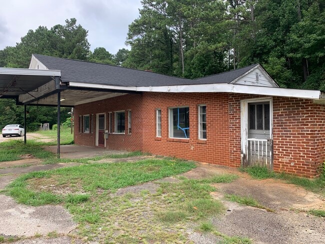
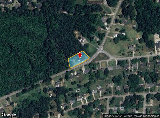
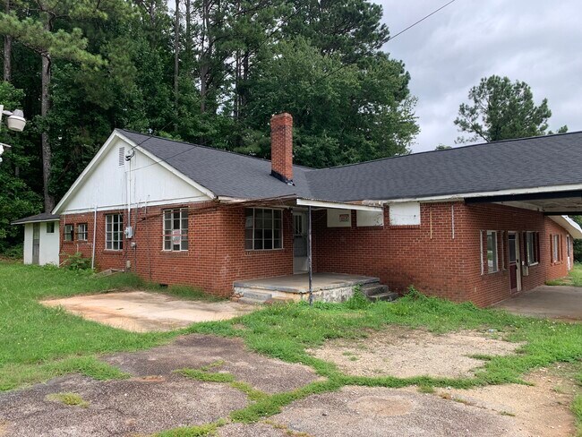
Property Record
2125 Brownsville Rd, Powder Springs, GA 30127

Current Lease Availabilities
NEARBY LISTINGS FOR SALE OR LEASE
Property Detail
2125 Brownsville Rd
Atlanta-Sandy Springs-Roswell, GA
Commercial Nh County
245.4.2.043.0000
REAL PROPERTY
Storebuilding
Paulding
X
Georgia
13067C0178H
4
2025
0.65 AC
2025
Paulding Cnty/Dallas
120601
Atlanta
2,690 SF
DEMOGRAPHICS near 2125 Brownsville Rd
1 Mile
3 Mile
5 Mile
2024 Total Population
3,709
25,252
90,508
2029 Population
3,953
26,879
96,463
Pop Growth 2024-2029
+ 6.58%
+ 6.44%
+ 6.58%
Average Age
39
39
39
2024 Total Households
1,247
8,519
31,407
HH Growth 2024-2029
+ 6.90%
+ 6.47%
+ 6.66%
Median Household Inc
$80,273
$87,577
$72,804
Avg Household Size
3.00
2.90
2.80
2024 Avg HH Vehicles
2.00
2.00
2.00
Median Home Value
$224,580
$232,871
$211,746
Median Year Built
1998
1996
1994
Nearby Places
Map Layers
Map Styles
 Street
 Aerial
- Restaurants
- Banks
- Shops
- Fitness
- Groceries
PUBLIC TRANSPORTATION
AIRPORT
Hartsfield - Jackson Atlanta International
DRIVE
WALK
Distance
Hartsfield - Jackson Atlanta International
48 min
32.4 mi
Freight Ports
Georgia Ports - Savannah
DRIVE
WALK
Distance
Georgia Ports - Savannah
311 min
271.7 mi
Nearby Properties
Address
Land Use
TOTAL SIZE
Lot Size
Zoning
Address
Land Use
TOTAL SIZE
Lot Size
Zoning
18.80 AC
MXU
Address
Land Use
TOTAL SIZE
Lot Size
Zoning
77.25 AC
A1
Address
Land Use
TOTAL SIZE
Lot Size
Zoning
Address
Land Use
TOTAL SIZE
Lot Size
Zoning
21.05 AC
Address
Land Use
TOTAL SIZE
Lot Size
Zoning
56,140 SF
8.24 AC
CRC
Address
Land Use
TOTAL SIZE
Lot Size
Zoning
73,314 SF
5.30 AC
CRC
Address
Land Use
TOTAL SIZE
Lot Size
Zoning
69,232 SF
7.35 AC
I1
Address
Land Use
TOTAL SIZE
Lot Size
Zoning
61,486 SF
12.88 AC
LI
Address
Land Use
TOTAL SIZE
Lot Size
Zoning
101,703 SF
8.95 AC
B2
Address
Land Use
TOTAL SIZE
Lot Size
Zoning
27,891 SF
5.08 AC
CRC
Address
Land Use
TOTAL SIZE
Lot Size
Zoning
67,700 SF
3.72 AC
LI
Address
Land Use
TOTAL SIZE
Lot Size
Zoning
221.39 AC
Address
Land Use
TOTAL SIZE
Lot Size
Zoning
47,804 SF
9.88 AC
B1
Address
Land Use
TOTAL SIZE
Lot Size
Zoning
14,946 SF
23.44 AC
Address
Land Use
TOTAL SIZE
Lot Size
Zoning
39.85 AC
PUD
Address
Land Use
TOTAL SIZE
Lot Size
Zoning
3,084 SF
284.96 AC
B1-1;PRD-9
Address
Land Use
TOTAL SIZE
Lot Size
Zoning
40,112 SF
2.46 AC
LI
Address
Land Use
TOTAL SIZE
Lot Size
Zoning
24,756 SF
9.04 AC
Address
Land Use
TOTAL SIZE
Lot Size
Zoning
10.53 AC
R-30
Address
Land Use
TOTAL SIZE
Lot Size
Zoning
35,000 SF
2.97 AC
PUD
Address
Land Use
TOTAL SIZE
Lot Size
Zoning
32,000 SF
6.43 AC
LI
Address
Land Use
TOTAL SIZE
Lot Size
Zoning
52,374 SF
5.98 AC
CRC
Address
Land Use
TOTAL SIZE
Lot Size
Zoning
25,000 SF
5.05 AC
LI
Address
Land Use
TOTAL SIZE
Lot Size
Zoning
34,580 SF
2.62 AC
I1-0
Address
Land Use
TOTAL SIZE
Lot Size
Zoning
9,042 SF
1.72 AC
CRC/WS
Address
Land Use
TOTAL SIZE
Lot Size
Zoning
13,881 SF
7.01 AC
Address
Land Use
TOTAL SIZE
Lot Size
Zoning
27,600 SF
2.73 AC
PUD
Address
Land Use
TOTAL SIZE
Lot Size
Zoning
21,600 SF
5 AC
Address
Land Use
TOTAL SIZE
Lot Size
Zoning
6,100 SF
3.26 AC
B1
The World's #1 Commercial Real Estate Marketplace
Connect with us
© 2026 CoStar Group
The information above has been obtained from sources believed reliable. While we do not doubt its accuracy we have not verified it and make no guarantee, warranty or representation about it. It is your responsibility to independently confirm its accuracy and completeness. Any projections, opinions, assumptions, or estimates used are for example only and do not represent the current or future performance of the property. The value of this transaction to you depends on tax and other factors which should be evaluated by your tax, financial, and legal advisors. You and your advisors should conduct a careful, independent investigation of the property to determine to your satisfaction the suitability of the property for your needs.