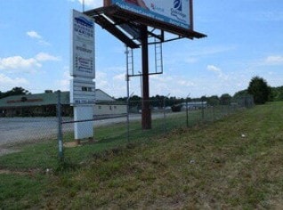
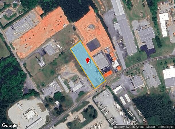
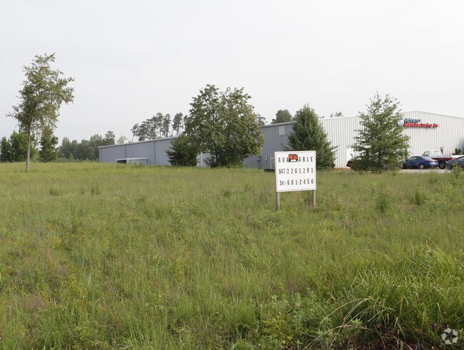
Property Record
2125 Highway 292, Inman, SC 29349

NEARBY LISTINGS FOR SALE OR LEASE
Property Detail
2125 Highway 292
Spartanburg, SC
Upcountry Park Phase 2
2-28-00-125.00
LOT 41 UPCOUNTRY PARK PHASE 2 PB 111-868
Commercialacreage
Spartanburg
X
South Carolina
45083C0135D
41
2024
1.93 AC
2025
Upper Spartanburg County
022803
Greenville/Spartanburg
DEMOGRAPHICS near 2125 Highway 292
1 Mile
3 Mile
5 Mile
2024 Total Population
308
13,658
39,963
2029 Population
349
15,609
45,574
Pop Growth 2024-2029
+ 13.31%
+ 14.28%
+ 14.04%
Average Age
42
41
40
2024 Total Households
113
5,135
14,965
HH Growth 2024-2029
+ 13.27%
+ 14.53%
+ 14.32%
Median Household Inc
$106,034
$79,045
$68,763
Avg Household Size
2.70
2.60
2.60
2024 Avg HH Vehicles
3.00
2.00
2.00
Median Home Value
$270,512
$246,193
$215,868
Median Year Built
1994
1996
1995
Nearby Places
Map Layers
Map Styles
 Street
 Aerial
- Restaurants
- Banks
- Shops
- Fitness
- Groceries
PUBLIC TRANSPORTATION
AIRPORT
Greenville Spartanburg International
DRIVE
WALK
Distance
Greenville Spartanburg International
31 min
23.2 mi
Freight Ports
North Charleston Terminal
DRIVE
WALK
Distance
North Charleston Terminal
227 min
204.0 mi
SALE & LEASE HISTORY
LISTING DATE
SALE/LEASE

Jun 27, 2017
For Sale
Nearby Properties
Address
Land Use
TOTAL SIZE
Lot Size
Zoning
Address
Land Use
TOTAL SIZE
Lot Size
Zoning
6,524 SF
0.98 AC
Address
Land Use
TOTAL SIZE
Lot Size
Zoning
4,956 SF
0.80 AC
Address
Land Use
TOTAL SIZE
Lot Size
Zoning
3,340 SF
36.01 AC
Address
Land Use
TOTAL SIZE
Lot Size
Zoning
3,960 SF
0.36 AC
Address
Land Use
TOTAL SIZE
Lot Size
Zoning
4,129 SF
0.34 AC
Address
Land Use
TOTAL SIZE
Lot Size
Zoning
6,945 SF
0.65 AC
Address
Land Use
TOTAL SIZE
Lot Size
Zoning
4,283 SF
0.50 AC
Address
Land Use
TOTAL SIZE
Lot Size
Zoning
15,130 SF
7.17 AC
Address
Land Use
TOTAL SIZE
Lot Size
Zoning
3,620 SF
0.67 AC
Address
Land Use
TOTAL SIZE
Lot Size
Zoning
4,751 SF
0.79 AC
Address
Land Use
TOTAL SIZE
Lot Size
Zoning
4,260 SF
0.66 AC
Address
Land Use
TOTAL SIZE
Lot Size
Zoning
3,166 SF
Address
Land Use
TOTAL SIZE
Lot Size
Zoning
4,294 SF
0.81 AC
Address
Land Use
TOTAL SIZE
Lot Size
Zoning
3,717 SF
0.55 AC
Address
Land Use
TOTAL SIZE
Lot Size
Zoning
3,495 SF
0.74 AC
Address
Land Use
TOTAL SIZE
Lot Size
Zoning
2,977 SF
0.52 AC
Address
Land Use
TOTAL SIZE
Lot Size
Zoning
5,733 SF
0.29 AC
Address
Land Use
TOTAL SIZE
Lot Size
Zoning
2,616 SF
0.69 AC
Address
Land Use
TOTAL SIZE
Lot Size
Zoning
3,480 SF
0.30 AC
Address
Land Use
TOTAL SIZE
Lot Size
Zoning
3,585 SF
0.53 AC
Address
Land Use
TOTAL SIZE
Lot Size
Zoning
1,651 SF
0.15 AC
Address
Land Use
TOTAL SIZE
Lot Size
Zoning
3,401 SF
0.80 AC
Address
Land Use
TOTAL SIZE
Lot Size
Zoning
41.18 AC
Address
Land Use
TOTAL SIZE
Lot Size
Zoning
2,549 SF
0.14 AC
Address
Land Use
TOTAL SIZE
Lot Size
Zoning
3,164 SF
0.28 AC
Address
Land Use
TOTAL SIZE
Lot Size
Zoning
3,611 SF
0.57 AC
Address
Land Use
TOTAL SIZE
Lot Size
Zoning
2,168 SF
0.12 AC
Address
Land Use
TOTAL SIZE
Lot Size
Zoning
2,565 SF
0.59 AC
Address
Land Use
TOTAL SIZE
Lot Size
Zoning
2,578 SF
1.60 AC
Address
Land Use
TOTAL SIZE
Lot Size
Zoning
1,877 SF
0.98 AC
The World's #1 Commercial Real Estate Marketplace
Connect with us
© 2025 CoStar Group
The information above has been obtained from sources believed reliable. While we do not doubt its accuracy we have not verified it and make no guarantee, warranty or representation about it. It is your responsibility to independently confirm its accuracy and completeness. Any projections, opinions, assumptions, or estimates used are for example only and do not represent the current or future performance of the property. The value of this transaction to you depends on tax and other factors which should be evaluated by your tax, financial, and legal advisors. You and your advisors should conduct a careful, independent investigation of the property to determine to your satisfaction the suitability of the property for your needs.