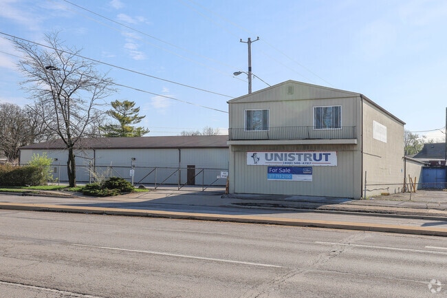
Property Record
2125 S Keystone Ave, Indianapolis, IN 46203
Current Lease Availabilities
NEARBY LISTINGS FOR SALE OR LEASE
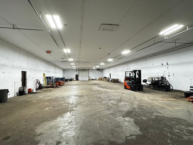
Property Detail
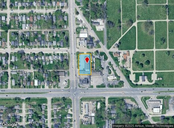
2125 S Keystone Ave
Indianapolis
Avenue Park Add
Indianapolis-Carmel-Anderson, IN
AVENUE PARK ADD L12 L13 PT L15 PT L16 PT L17 & 15 VAC ALLEY ADJ ALL LOTS BEG NE COR L12 W125 SW 17.72 S204.97 E126.61 N219.4 TO BEG 0.643 AC.
49-10-17-108-010.000-101
Marion
Commercialnec
Indiana
2023
15
2024
0.64 AC
357300
Garfield Park
12,319 SF
DEMOGRAPHICS near 2125 S Keystone Ave
1 Mile
3 Mile
5 Mile
2024 Total Population
13,001
110,374
245,590
2029 Population
13,003
110,986
246,690
Pop Growth 2024-2029
+ 0.02%
+ 0.55%
+ 0.45%
Average Age
36
36
36
2024 Total Households
4,967
45,938
104,043
HH Growth 2024-2029
(0.08%)
+ 0.56%
+ 0.49%
Median Household Inc
$39,999
$51,849
$55,033
Avg Household Size
2.50
2.20
2.20
2024 Avg HH Vehicles
2.00
2.00
2.00
Median Home Value
$87,143
$155,654
$167,616
Median Year Built
1954
1954
1957
Nearby Places
- Restaurants
- Banks
- Shops
- Fitness
- Groceries
PUBLIC TRANSPORTATION
COMMUTER RAIL
Indianapolis (Cardinal - Amtrak)
DRIVE
WALK
Distance
Indianapolis (Cardinal - Amtrak)
6 min
3.5 mi
AIRPORT
Indianapolis International
DRIVE
WALK
Distance
Indianapolis International
26 min
14.2 mi
Freight Ports
Port of Toledo
DRIVE
WALK
Distance
Port of Toledo
271 min
226.4 mi
Nearby Properties
Address
Land Use
TOTAL SIZE
Lot Size
Zoning
Address
Land Use
TOTAL SIZE
Lot Size
Zoning
33.61 AC
ZO01
Address
Land Use
TOTAL SIZE
Lot Size
Zoning
1,381,492 SF
15.08 AC
ZO01
Address
Land Use
TOTAL SIZE
Lot Size
Zoning
5.59 AC
ZO01
Address
Land Use
TOTAL SIZE
Lot Size
Zoning
23,200 SF
1.71 AC
Address
Land Use
TOTAL SIZE
Lot Size
Zoning
41.83 AC
ZO01
Address
Land Use
TOTAL SIZE
Lot Size
Zoning
302,187 SF
1.97 AC
ZO01
Address
Land Use
TOTAL SIZE
Lot Size
Zoning
1,202,700 SF
77.25 AC
ZO01
Address
Land Use
TOTAL SIZE
Lot Size
Zoning
2,273 SF
1.52 AC
ZO01
Address
Land Use
TOTAL SIZE
Lot Size
Zoning
12,392 SF
0.99 AC
ZO01
Address
Land Use
TOTAL SIZE
Lot Size
Zoning
500,908 SF
10.36 AC
ZO01
Address
Land Use
TOTAL SIZE
Lot Size
Zoning
19,896 SF
32.59 AC
ZO01
Address
Land Use
TOTAL SIZE
Lot Size
Zoning
20,422 SF
0.42 AC
ZO01
Address
Land Use
TOTAL SIZE
Lot Size
Zoning
12.63 AC
ZO01
Address
Land Use
TOTAL SIZE
Lot Size
Zoning
384,520 SF
1.93 AC
ZO01
Address
Land Use
TOTAL SIZE
Lot Size
Zoning
123,373 SF
2.14 AC
ZO01
Address
Land Use
TOTAL SIZE
Lot Size
Zoning
6,000 SF
0.47 AC
ZO01
Address
Land Use
TOTAL SIZE
Lot Size
Zoning
21,809 SF
1.57 AC
ZO01
Address
Land Use
TOTAL SIZE
Lot Size
Zoning
40,205 SF
1.58 AC
Address
Land Use
TOTAL SIZE
Lot Size
Zoning
309,006 SF
1.48 AC
ZO01
Address
Land Use
TOTAL SIZE
Lot Size
Zoning
217,895 SF
3.43 AC
ZO01
Address
Land Use
TOTAL SIZE
Lot Size
Zoning
245,608 SF
0.90 AC
Address
Land Use
TOTAL SIZE
Lot Size
Zoning
45,971 SF
0.78 AC
Address
Land Use
TOTAL SIZE
Lot Size
Zoning
73,803 SF
0.93 AC
Address
Land Use
TOTAL SIZE
Lot Size
Zoning
179,381 SF
2.11 AC
ZO01
Address
Land Use
TOTAL SIZE
Lot Size
Zoning
17,250 SF
0.29 AC
ZO01
Address
Land Use
TOTAL SIZE
Lot Size
Zoning
12,900 SF
2 AC
ZO01
Address
Land Use
TOTAL SIZE
Lot Size
Zoning
414,000 SF
1.64 AC
ZO01
Address
Land Use
TOTAL SIZE
Lot Size
Zoning
31,413 SF
3.91 AC
ZO01
Address
Land Use
TOTAL SIZE
Lot Size
Zoning
31,920 SF
0.80 AC
Address
Land Use
TOTAL SIZE
Lot Size
Zoning
3.32 AC
ZO01
The World's #1 Commercial Real Estate Marketplace
Connect with us
© 2025 CoStar Group
The information above has been obtained from sources believed reliable. While we do not doubt its accuracy we have not verified it and make no guarantee, warranty or representation about it. It is your responsibility to independently confirm its accuracy and completeness. Any projections, opinions, assumptions, or estimates used are for example only and do not represent the current or future performance of the property. The value of this transaction to you depends on tax and other factors which should be evaluated by your tax, financial, and legal advisors. You and your advisors should conduct a careful, independent investigation of the property to determine to your satisfaction the suitability of the property for your needs.