Property Record
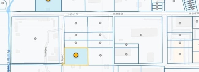
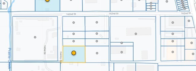
2125 W 162Nd St, Markham, IL 60428
Property Detail
2125 W 162Nd St
Chicago-Naperville-Elgin, IL-IN
(ANDERSONS)(DIXIE) HWY SUB OF S 60 65/100ACS LYING W OF OLD VINCENNES RD SEC 19-36-14
29-19-130-003-0000
COOK
Industrialgeneral
Illinois
C and X Area of minimal flood hazard, usually depicted on FIRMs as above the 500-year flood level.
6
2023
1.36 AC
2025
Near South Cook
827600
Chicago
17,145 SF
NEARBY LISTINGS FOR SALE OR LEASE
DEMOGRAPHICS near 2125 W 162Nd St
1 mile
3 mile
5 mile
2025 Total Population
10,739
88,925
251,958
2030 Population
11,173
91,311
257,104
Pop Growth 2025-2030
+ 4.04%
+ 2.68%
+ 2.04%
Average Age
39
40
40
2025 Total Households
3,676
31,170
90,742
HH Growth 2025-2030
+ 3.86%
+ 2.48%
+ 1.87%
Median Household Inc
$46,581
$59,850
$67,280
Avg Household Size
2.80
2.70
2.70
2025 Avg HH Vehicles
1.00
2.00
2.00
Median Home Value
$117,691
$160,895
$181,301
Median Year Built
1961
1964
1965
Nearby Places
Map Layers
Map Styles
 Street
 Aerial
Layers
 Traffic
 Biking
Places
Listings with unknown addresses are not visible on the map
- Restaurants
- Banks
- Shops
- Fitness
- Groceries
PUBLIC TRANSPORTATION
COMMUTER RAIL
Hazel Crest Station (Metra Electric Line - Northeast Illinois Regional Commuter Railroad (Metra))
Drive
Walk
Distance
Hazel Crest Station (Metra Electric Line - Northeast Illinois Regional Commuter Railroad (Metra))
4 min
1.4 mi
Calumet Station (Metra Electric Line - Northeast Illinois Regional Commuter Railroad (Metra))
Drive
Walk
Distance
Calumet Station (Metra Electric Line - Northeast Illinois Regional Commuter Railroad (Metra))
4 min
1.8 mi
AIRPORT
Chicago Midway International
Drive
Walk
Distance
Chicago Midway International
27 min
16.7 mi
Chicago O'Hare International
Drive
Walk
Distance
Chicago O'Hare International
52 min
38.5 mi
Freight Ports
Port Milwaukee
Drive
Walk
Distance
Port Milwaukee
134 min
110.2 mi
Nearby Properties
Address
Land Use
TOTAL SIZE
Lot Size
Zoning
Address
Land Use
TOTAL SIZE
Lot Size
Zoning
Address
Land Use
TOTAL SIZE
Lot Size
Zoning
1.45 AC
Address
Land Use
TOTAL SIZE
Lot Size
Zoning
6.19 AC
Address
Land Use
TOTAL SIZE
Lot Size
Zoning
244,665 SF
9.05 AC
Address
Land Use
TOTAL SIZE
Lot Size
Zoning
4.85 AC
Address
Land Use
TOTAL SIZE
Lot Size
Zoning
44,184 SF
5 AC
Address
Land Use
TOTAL SIZE
Lot Size
Zoning
203,995 SF
20.27 AC
Address
Land Use
TOTAL SIZE
Lot Size
Zoning
231,296 SF
10.91 AC
Address
Land Use
TOTAL SIZE
Lot Size
Zoning
196,125 SF
18.55 AC
Address
Land Use
TOTAL SIZE
Lot Size
Zoning
2.86 AC
Address
Land Use
TOTAL SIZE
Lot Size
Zoning
52,220 SF
6 AC
Address
Land Use
TOTAL SIZE
Lot Size
Zoning
62,380 SF
4.65 AC
Address
Land Use
TOTAL SIZE
Lot Size
Zoning
Address
Land Use
TOTAL SIZE
Lot Size
Zoning
Address
Land Use
TOTAL SIZE
Lot Size
Zoning
27,082 SF
0.69 AC
Address
Land Use
TOTAL SIZE
Lot Size
Zoning
67,314 SF
1.19 AC
Address
Land Use
TOTAL SIZE
Lot Size
Zoning
44,189 SF
3.09 AC
Address
Land Use
TOTAL SIZE
Lot Size
Zoning
125,535 SF
9.44 AC
Address
Land Use
TOTAL SIZE
Lot Size
Zoning
49,229 SF
1.31 AC
Address
Land Use
TOTAL SIZE
Lot Size
Zoning
Address
Land Use
TOTAL SIZE
Lot Size
Zoning
115,250 SF
10.75 AC
Address
Land Use
TOTAL SIZE
Lot Size
Zoning
111,902 SF
8.60 AC
Address
Land Use
TOTAL SIZE
Lot Size
Zoning
233,490 SF
10.19 AC
Address
Land Use
TOTAL SIZE
Lot Size
Zoning
6.34 AC
Address
Land Use
TOTAL SIZE
Lot Size
Zoning
Address
Land Use
TOTAL SIZE
Lot Size
Zoning
6.21 AC
Address
Land Use
TOTAL SIZE
Lot Size
Zoning
0.34 AC
Address
Land Use
TOTAL SIZE
Lot Size
Zoning
180,139 SF
18.78 AC
Address
Land Use
TOTAL SIZE
Lot Size
Zoning
20,579 SF
1.14 AC
The World's #1 Commercial Real Estate Marketplace
Connect with us
© 2026 CoStar Group
The information above has been obtained from sources believed reliable. While we do not doubt its accuracy we have not verified it and make no guarantee, warranty or representation about it. It is your responsibility to independently confirm its accuracy and completeness. Any projections, opinions, assumptions, or estimates used are for example only and do not represent the current or future performance of the property. The value of this transaction to you depends on tax and other factors which should be evaluated by your tax, financial, and legal advisors. You and your advisors should conduct a careful, independent investigation of the property to determine to your satisfaction the suitability of the property for your needs.