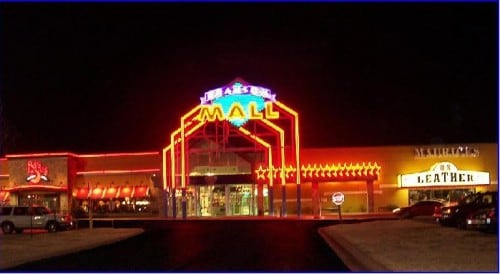
Property Record
2126 E State Highway 76, Branson, MO 65616
Property Detail
2126 E State Highway 76
Branson, MO
PT E2 LTS 1 & 2 NE4; CITY OF BRANSON
17-2.0-03-001-001-002.000
TANEY
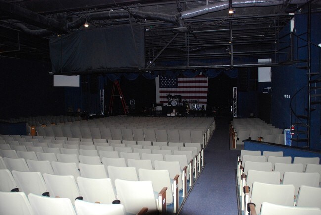
Commercialnec
Missouri
B and X Area of moderate flood hazard, usually the area between the limits of the 100-year and 500-year floods.
1,2
2024
1.37 AC
2025
Branson
480109
Other Market Areas
14,950 SF
NEARBY LISTINGS FOR SALE OR LEASE
DEMOGRAPHICS near 2126 E State Highway 76
1 mile
3 mile
5 mile
2025 Total Population
2,735
19,039
31,905
2030 Population
2,856
19,191
32,229
Pop Growth 2025-2030
+ 4.42%
+ 0.80%
+ 1.02%
Average Age
42
41
42
2025 Total Households
1,203
7,654
13,132
HH Growth 2025-2030
+ 4.57%
+ 0.91%
+ 1.23%
Median Household Inc
$54,119
$53,346
$60,237
Avg Household Size
2.20
2.20
2.20
2025 Avg HH Vehicles
2.00
2.00
2.00
Median Home Value
$235,837
$232,286
$242,119
Median Year Built
1996
1994
1995
Nearby Places
Map Layers
Map Styles
 Street
 Aerial
Transit
 Traffic
 Biking
Places
Listings with unknown addresses are not visible on the map
- Restaurants
- Banks
- Shops
- Fitness
- Groceries
SALE & LEASE HISTORY
LISTING DATE
SALE/LEASE

Oct 11, 2019
For Sale
Jan 04, 2018
For Sale
Nearby Properties
Address
Land Use
TOTAL SIZE
Lot Size
Zoning
Address
Land Use
TOTAL SIZE
Lot Size
Zoning
50,417 SF
17.43 AC
Address
Land Use
TOTAL SIZE
Lot Size
Zoning
66,272 SF
7.83 AC
Address
Land Use
TOTAL SIZE
Lot Size
Zoning
59,939 SF
15.76 AC
Address
Land Use
TOTAL SIZE
Lot Size
Zoning
Address
Land Use
TOTAL SIZE
Lot Size
Zoning
135,214 SF
13.91 AC
Address
Land Use
TOTAL SIZE
Lot Size
Zoning
63,890 SF
14.45 AC
Address
Land Use
TOTAL SIZE
Lot Size
Zoning
104,868 SF
13.61 AC
Address
Land Use
TOTAL SIZE
Lot Size
Zoning
19,872 SF
2.97 AC
Address
Land Use
TOTAL SIZE
Lot Size
Zoning
63,169 SF
22.17 AC
Address
Land Use
TOTAL SIZE
Lot Size
Zoning
24,176 SF
10.28 AC
Address
Land Use
TOTAL SIZE
Lot Size
Zoning
18,308 SF
2.59 AC
Address
Land Use
TOTAL SIZE
Lot Size
Zoning
34,856 SF
15.68 AC
Address
Land Use
TOTAL SIZE
Lot Size
Zoning
47,021 SF
5.20 AC
Address
Land Use
TOTAL SIZE
Lot Size
Zoning
68,610 SF
5.04 AC
Address
Land Use
TOTAL SIZE
Lot Size
Zoning
24,578 SF
16.15 AC
Address
Land Use
TOTAL SIZE
Lot Size
Zoning
46,797 SF
1.67 AC
Address
Land Use
TOTAL SIZE
Lot Size
Zoning
Address
Land Use
TOTAL SIZE
Lot Size
Zoning
11.46 AC
Address
Land Use
TOTAL SIZE
Lot Size
Zoning
Address
Land Use
TOTAL SIZE
Lot Size
Zoning
81.50 AC
Address
Land Use
TOTAL SIZE
Lot Size
Zoning
17,228 SF
2.24 AC
Address
Land Use
TOTAL SIZE
Lot Size
Zoning
41.50 AC
Address
Land Use
TOTAL SIZE
Lot Size
Zoning
31,513 SF
2.93 AC
Address
Land Use
TOTAL SIZE
Lot Size
Zoning
9,844 SF
11.51 AC
Address
Land Use
TOTAL SIZE
Lot Size
Zoning
27,951 SF
0.91 AC
Address
Land Use
TOTAL SIZE
Lot Size
Zoning
43,418 SF
3.56 AC
Address
Land Use
TOTAL SIZE
Lot Size
Zoning
32,312 SF
1.03 AC
Address
Land Use
TOTAL SIZE
Lot Size
Zoning
19,984 SF
2.59 AC
Address
Land Use
TOTAL SIZE
Lot Size
Zoning
8,058 SF
1.48 AC
The World's #1 Commercial Real Estate Marketplace
Connect with us
© 2026 CoStar Group
The information above has been obtained from sources believed reliable. While we do not doubt its accuracy we have not verified it and make no guarantee, warranty or representation about it. It is your responsibility to independently confirm its accuracy and completeness. Any projections, opinions, assumptions, or estimates used are for example only and do not represent the current or future performance of the property. The value of this transaction to you depends on tax and other factors which should be evaluated by your tax, financial, and legal advisors. You and your advisors should conduct a careful, independent investigation of the property to determine to your satisfaction the suitability of the property for your needs.