Property Record
2126 Resource Dr, Hazen, NV 89408
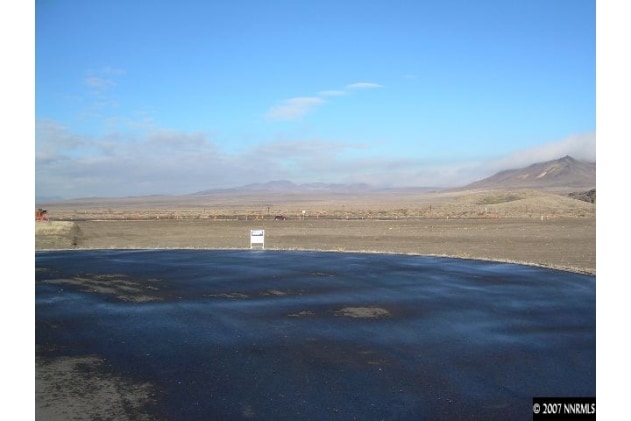
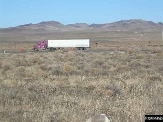

Property Detail
2126 Resource Dr
Fallon, NV
2006-07, CREATED FROM SPLIT OF PARCEL 009-251-37, PRIMARY NEW PARCEL IS PARCEL 009-251-42, PARCEL IN E1/2, GEOTHERMAL RAIL INDUSTRIAL DEVELOPMENT LLC PARCEL MAP, PARCEL 4, FILE 374774, RECORDED: SEPTEMBER 20, 2005, PARCEL 009-251-40
009-251-49
CHURCHILL
Commercialnec
Nevada
I;INDUSTRI
4
B and X Area of moderate flood hazard, usually the area between the limits of the 100-year and 500-year floods.
5 AC
2024
Outer Churchill County
2025
Reno/Sparks
960107
NEARBY LISTINGS FOR SALE OR LEASE
DEMOGRAPHICS near 2126 Resource Dr
1 mile
3 mile
5 mile
2025 Total Population
18
265
3,412
2030 Population
18
274
3,577
Pop Growth 2025-2030
0.00%
+ 3.40%
+ 4.84%
Average Age
46
44
42
2025 Total Households
7
98
1,238
HH Growth 2025-2030
0.00%
+ 3.06%
+ 4.85%
Median Household Inc
$118,749
$110,156
$107,580
Avg Household Size
2.10
2.70
2.70
2025 Avg HH Vehicles
3.00
3.00
3.00
Median Home Value
$316,667
$348,484
$364,966
Median Year Built
1982
1997
2001
Nearby Places
Map Layers
Map Styles
 Street
 Aerial
Transit
 Traffic
 Biking
Places
Listings with unknown addresses are not visible on the map
- Restaurants
- Banks
- Shops
- Fitness
- Groceries
Nearby Properties
Address
Land Use
TOTAL SIZE
Lot Size
Zoning
Address
Land Use
TOTAL SIZE
Lot Size
Zoning
5,360 SF
105.61 AC
I
Address
Land Use
TOTAL SIZE
Lot Size
Zoning
480 SF
18.50 AC
A10
Address
Land Use
TOTAL SIZE
Lot Size
Zoning
4,520 SF
3.75 AC
I;INDUSTRI
Address
Land Use
TOTAL SIZE
Lot Size
Zoning
7,500 SF
3.75 AC
I
Address
Land Use
TOTAL SIZE
Lot Size
Zoning
2,406 SF
112.39 AC
RR5
Address
Land Use
TOTAL SIZE
Lot Size
Zoning
331.71 AC
I
Address
Land Use
TOTAL SIZE
Lot Size
Zoning
9,792 SF
59.04 AC
I;INDUSTRI
Address
Land Use
TOTAL SIZE
Lot Size
Zoning
480 SF
19.23 AC
A10
Address
Land Use
TOTAL SIZE
Lot Size
Zoning
18.82 AC
I
Address
Land Use
TOTAL SIZE
Lot Size
Zoning
4,500 SF
2.66 AC
I
Address
Land Use
TOTAL SIZE
Lot Size
Zoning
20 AC
A10
Address
Land Use
TOTAL SIZE
Lot Size
Zoning
3,200 SF
1.32 AC
I;INDUSTRI
Address
Land Use
TOTAL SIZE
Lot Size
Zoning
40.92 AC
GR20
Address
Land Use
TOTAL SIZE
Lot Size
Zoning
6.66 AC
RR5
Address
Land Use
TOTAL SIZE
Lot Size
Zoning
3.47 AC
I
Address
Land Use
TOTAL SIZE
Lot Size
Zoning
39.04 AC
I
Address
Land Use
TOTAL SIZE
Lot Size
Zoning
35.83 AC
I
Address
Land Use
TOTAL SIZE
Lot Size
Zoning
39.09 AC
I
Address
Land Use
TOTAL SIZE
Lot Size
Zoning
576 SF
28.27 AC
A10
Address
Land Use
TOTAL SIZE
Lot Size
Zoning
4.98 AC
Address
Land Use
TOTAL SIZE
Lot Size
Zoning
960 SF
32.46 AC
A10
Address
Land Use
TOTAL SIZE
Lot Size
Zoning
5.07 AC
RR5
Address
Land Use
TOTAL SIZE
Lot Size
Zoning
5.07 AC
RR5
Address
Land Use
TOTAL SIZE
Lot Size
Zoning
5.07 AC
RR5
Address
Land Use
TOTAL SIZE
Lot Size
Zoning
2,456 SF
10.01 AC
A10
Address
Land Use
TOTAL SIZE
Lot Size
Zoning
482.59 AC
I;INDUSTRI
Address
Land Use
TOTAL SIZE
Lot Size
Zoning
83.91 AC
I
The World's #1 Commercial Real Estate Marketplace
Connect with us
© 2026 CoStar Group
The information above has been obtained from sources believed reliable. While we do not doubt its accuracy we have not verified it and make no guarantee, warranty or representation about it. It is your responsibility to independently confirm its accuracy and completeness. Any projections, opinions, assumptions, or estimates used are for example only and do not represent the current or future performance of the property. The value of this transaction to you depends on tax and other factors which should be evaluated by your tax, financial, and legal advisors. You and your advisors should conduct a careful, independent investigation of the property to determine to your satisfaction the suitability of the property for your needs.