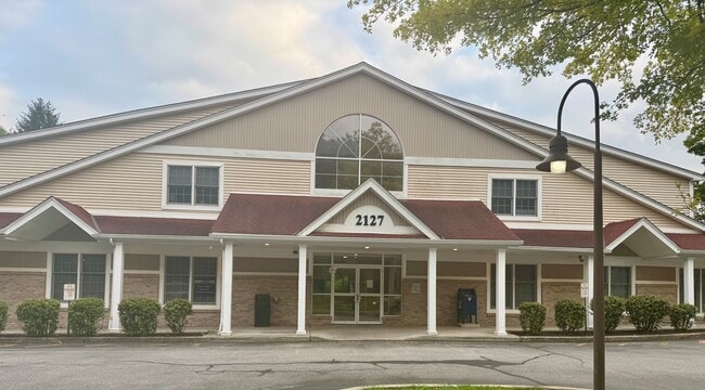
Property Record
2127 Crompond Rd, Cortlandt Manor, NY 10567
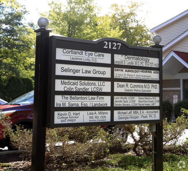

Current Lease Availabilities
NEARBY LISTINGS FOR SALE OR LEASE
Property Detail
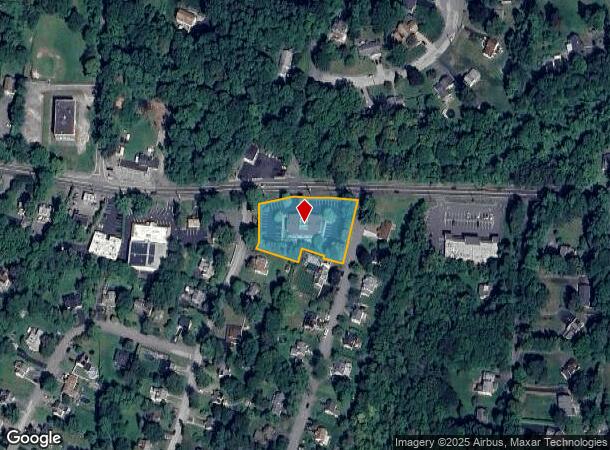
2127 Crompond Rd
New York-Jersey City-White Plains, NY-NJ
Map #2 Emery Hill Gardens
2289-034-005-00007-000-0013
12.12A-000-030
Officebuilding
Westchester
X
New York
36119C0017F
13.000
2025
1.05 AC
2024
Northwest
014607
Westchester/So Connecticut
DEMOGRAPHICS near 2127 Crompond Rd
1 Mile
3 Mile
5 Mile
2024 Total Population
5,773
50,226
88,178
2029 Population
5,573
48,874
86,073
Pop Growth 2024-2029
(3.46%)
(2.69%)
(2.39%)
Average Age
43
42
43
2024 Total Households
2,024
18,058
31,965
HH Growth 2024-2029
(3.80%)
(2.89%)
(2.65%)
Median Household Inc
$127,042
$106,512
$115,638
Avg Household Size
2.80
2.70
2.60
2024 Avg HH Vehicles
2.00
2.00
2.00
Median Home Value
$430,339
$409,657
$443,078
Median Year Built
1966
1962
1964
Nearby Places
- Restaurants
- Banks
- Shops
- Fitness
- Groceries
PUBLIC TRANSPORTATION
COMMUTER RAIL
Peekskill Station (Hudson Line - Metro-North Commuter Railroad Company (Metro-North))
DRIVE
WALK
Distance
Peekskill Station (Hudson Line - Metro-North Commuter Railroad Company (Metro-North))
7 min
3.5 mi
Cortlandt Station (Hudson Line - Metro-North Commuter Railroad Company (Metro-North))
DRIVE
WALK
Distance
Cortlandt Station (Hudson Line - Metro-North Commuter Railroad Company (Metro-North))
14 min
6.6 mi
AIRPORT
Westchester County
DRIVE
WALK
Distance
Westchester County
40 min
27.0 mi
New York Stewart International
DRIVE
WALK
Distance
New York Stewart International
49 min
27.6 mi
Freight Ports
NY - Red Hook Container Terminal
DRIVE
WALK
Distance
NY - Red Hook Container Terminal
79 min
54.4 mi
Nearby Properties
Address
Land Use
TOTAL SIZE
Lot Size
Zoning
Address
Land Use
TOTAL SIZE
Lot Size
Zoning
Address
Land Use
TOTAL SIZE
Lot Size
Zoning
Address
Land Use
TOTAL SIZE
Lot Size
Zoning
Address
Land Use
TOTAL SIZE
Lot Size
Zoning
13,520 SF
1.16 AC
CC1
Address
Land Use
TOTAL SIZE
Lot Size
Zoning
21,466 SF
2.87 AC
CC1
Address
Land Use
TOTAL SIZE
Lot Size
Zoning
Address
Land Use
TOTAL SIZE
Lot Size
Zoning
Address
Land Use
TOTAL SIZE
Lot Size
Zoning
82.53 AC
Address
Land Use
TOTAL SIZE
Lot Size
Zoning
2.70 AC
Address
Land Use
TOTAL SIZE
Lot Size
Zoning
Address
Land Use
TOTAL SIZE
Lot Size
Zoning
Address
Land Use
TOTAL SIZE
Lot Size
Zoning
22.61 AC
Address
Land Use
TOTAL SIZE
Lot Size
Zoning
8.93 AC
Address
Land Use
TOTAL SIZE
Lot Size
Zoning
2.99 AC
Address
Land Use
TOTAL SIZE
Lot Size
Zoning
Address
Land Use
TOTAL SIZE
Lot Size
Zoning
7,176 SF
4.86 AC
CC1
Address
Land Use
TOTAL SIZE
Lot Size
Zoning
Address
Land Use
TOTAL SIZE
Lot Size
Zoning
7.50 AC
Address
Land Use
TOTAL SIZE
Lot Size
Zoning
38.05 AC
Address
Land Use
TOTAL SIZE
Lot Size
Zoning
6,976 SF
0.58 AC
CC1
Address
Land Use
TOTAL SIZE
Lot Size
Zoning
23.27 AC
Address
Land Use
TOTAL SIZE
Lot Size
Zoning
5,291 SF
0.43 AC
CC1
Address
Land Use
TOTAL SIZE
Lot Size
Zoning
4,670 SF
0.22 AC
CC1
Address
Land Use
TOTAL SIZE
Lot Size
Zoning
6,426 SF
0.81 AC
CC1
Address
Land Use
TOTAL SIZE
Lot Size
Zoning
48.07 AC
Address
Land Use
TOTAL SIZE
Lot Size
Zoning
3,394 SF
1 AC
CC1
Address
Land Use
TOTAL SIZE
Lot Size
Zoning
Address
Land Use
TOTAL SIZE
Lot Size
Zoning
655.36 AC
Address
Land Use
TOTAL SIZE
Lot Size
Zoning
8.50 AC
Address
Land Use
TOTAL SIZE
Lot Size
Zoning
35.97 AC
The World's #1 Commercial Real Estate Marketplace
Connect with us
© 2025 CoStar Group
The information above has been obtained from sources believed reliable. While we do not doubt its accuracy we have not verified it and make no guarantee, warranty or representation about it. It is your responsibility to independently confirm its accuracy and completeness. Any projections, opinions, assumptions, or estimates used are for example only and do not represent the current or future performance of the property. The value of this transaction to you depends on tax and other factors which should be evaluated by your tax, financial, and legal advisors. You and your advisors should conduct a careful, independent investigation of the property to determine to your satisfaction the suitability of the property for your needs.