Property Record
2128 Highway K, O Fallon, MO 63368

NEARBY LISTINGS FOR SALE OR LEASE
Property Detail
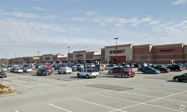
2128 Highway K
St. Louis, MO-IL
Shops At Laura Hills
2-0066-8228-00-0009.0000000
SHOPS AT LAURA HILLS LOT 8
Commercialnec
St. Charles
X
Missouri
29183C0239G
8
2024
10.18 AC
2025
St Charles County
311735
St. Louis
65,364 SF
DEMOGRAPHICS near 2128 Highway K
1 mile
3 mile
5 mile
2024 Total Population
13,715
87,152
173,608
2029 Population
14,494
91,899
183,648
Pop Growth 2024-2029
+ 5.68%
+ 5.45%
+ 5.78%
Average Age
39
40
40
2024 Total Households
4,915
31,909
64,966
HH Growth 2024-2029
+ 5.76%
+ 5.51%
+ 5.86%
Median Household Inc
$91,845
$98,800
$98,293
Avg Household Size
2.70
2.70
2.60
2024 Avg HH Vehicles
2.00
2.00
2.00
Median Home Value
$250,000
$279,054
$278,751
Median Year Built
1994
1995
1995
Nearby Places
Map Layers
Map Styles
 Street
 Aerial
Transit
 Traffic
 Biking
Places
Listings with unknown addresses are not visible on the map
- Restaurants
- Banks
- Shops
- Fitness
- Groceries
PUBLIC TRANSPORTATION
AIRPORT
St Louis Lambert International
Drive
Walk
Distance
St Louis Lambert International
34 min
23.5 mi
Freight Ports
Tulsa Port of Inola
Drive
Walk
Distance
Tulsa Port of Inola
427 min
377.6 mi
Nearby Properties
Address
Land Use
TOTAL SIZE
Lot Size
Zoning
Address
Land Use
TOTAL SIZE
Lot Size
Zoning
163,438 SF
5.76 AC
Address
Land Use
TOTAL SIZE
Lot Size
Zoning
418,104 SF
38.83 AC
Address
Land Use
TOTAL SIZE
Lot Size
Zoning
71,908 SF
8.72 AC
Address
Land Use
TOTAL SIZE
Lot Size
Zoning
254,435 SF
16.57 AC
Address
Land Use
TOTAL SIZE
Lot Size
Zoning
235,876 SF
11.35 AC
Address
Land Use
TOTAL SIZE
Lot Size
Zoning
261,357 SF
7.90 AC
Address
Land Use
TOTAL SIZE
Lot Size
Zoning
399,520 SF
16.98 AC
AB3
Address
Land Use
TOTAL SIZE
Lot Size
Zoning
93.68 AC
AF0
Address
Land Use
TOTAL SIZE
Lot Size
Zoning
591,516 SF
28.79 AC
AB2
Address
Land Use
TOTAL SIZE
Lot Size
Zoning
36,438 SF
2.08 AC
AC4
Address
Land Use
TOTAL SIZE
Lot Size
Zoning
167,090 SF
19.85 AC
Address
Land Use
TOTAL SIZE
Lot Size
Zoning
49,680 SF
2.22 AC
Address
Land Use
TOTAL SIZE
Lot Size
Zoning
562,434 SF
40.73 AC
AB3
Address
Land Use
TOTAL SIZE
Lot Size
Zoning
99,168 SF
14.29 AC
Address
Land Use
TOTAL SIZE
Lot Size
Zoning
210,095 SF
12.29 AC
AE9
Address
Land Use
TOTAL SIZE
Lot Size
Zoning
53,636 SF
Address
Land Use
TOTAL SIZE
Lot Size
Zoning
201,531 SF
22.28 AC
Address
Land Use
TOTAL SIZE
Lot Size
Zoning
48.76 AC
AF0
Address
Land Use
TOTAL SIZE
Lot Size
Zoning
109,400 SF
19.94 AC
Address
Land Use
TOTAL SIZE
Lot Size
Zoning
197,791 SF
18.58 AC
Address
Land Use
TOTAL SIZE
Lot Size
Zoning
261,016 SF
15.27 AC
Address
Land Use
TOTAL SIZE
Lot Size
Zoning
47.95 AC
AF0
Address
Land Use
TOTAL SIZE
Lot Size
Zoning
5,548 SF
68.46 AC
Address
Land Use
TOTAL SIZE
Lot Size
Zoning
129,472 SF
22 AC
AC2
Address
Land Use
TOTAL SIZE
Lot Size
Zoning
113,099 SF
12.12 AC
Address
Land Use
TOTAL SIZE
Lot Size
Zoning
147,526 SF
7.51 AC
AE8
Address
Land Use
TOTAL SIZE
Lot Size
Zoning
155,630 SF
10.83 AC
Address
Land Use
TOTAL SIZE
Lot Size
Zoning
40,804 SF
7.98 AC
Address
Land Use
TOTAL SIZE
Lot Size
Zoning
93,798 SF
6.42 AC
Address
Land Use
TOTAL SIZE
Lot Size
Zoning
49,680 SF
1.15 AC
The World's #1 Commercial Real Estate Marketplace
Connect with us
© 2026 CoStar Group
The information above has been obtained from sources believed reliable. While we do not doubt its accuracy we have not verified it and make no guarantee, warranty or representation about it. It is your responsibility to independently confirm its accuracy and completeness. Any projections, opinions, assumptions, or estimates used are for example only and do not represent the current or future performance of the property. The value of this transaction to you depends on tax and other factors which should be evaluated by your tax, financial, and legal advisors. You and your advisors should conduct a careful, independent investigation of the property to determine to your satisfaction the suitability of the property for your needs.