Property Record
2129 Us Highway 41, Schererville, IN 46375
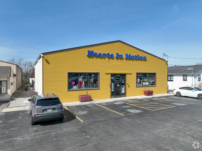
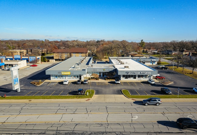
This Property Is For Sale
NEARBY LISTINGS FOR SALE OR LEASE
Property Detail
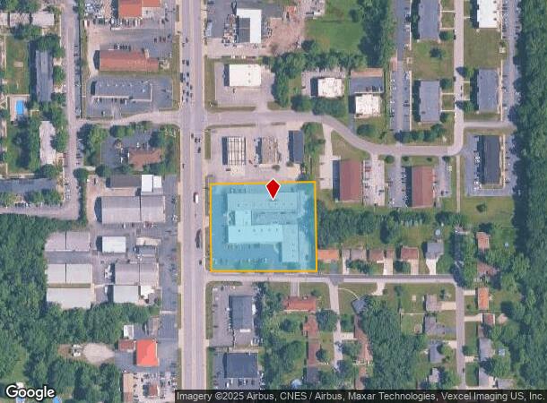
2129 Us Highway 41
Chicago-Naperville-Elgin, IL-IN-WI
Oakside Place
45-11-16-303-004.000-036
RESUBDIVISION OF OAKSIDE PLACE LOT 1
Regionalshoppingcenterormallwithanchorstore
Lake
X
Indiana
18089C0226E
1
2023
2.27 AC
2024
Indiana
042704
Chicago
28,618 SF
DEMOGRAPHICS near 2129 Us Highway 41
1 Mile
3 Mile
5 Mile
2024 Total Population
6,834
44,868
128,495
2029 Population
6,769
44,553
128,005
Pop Growth 2024-2029
(0.95%)
(0.70%)
(0.38%)
Average Age
43
44
42
2024 Total Households
2,971
17,616
50,231
HH Growth 2024-2029
(0.94%)
(0.75%)
(0.46%)
Median Household Inc
$72,028
$95,147
$87,395
Avg Household Size
2.30
2.50
2.50
2024 Avg HH Vehicles
2.00
2.00
2.00
Median Home Value
$272,745
$283,036
$260,601
Median Year Built
1980
1988
1983
Nearby Places
- Restaurants
- Banks
- Shops
- Fitness
- Groceries
PUBLIC TRANSPORTATION
COMMUTER RAIL
DRIVE
WALK
Distance
10 min
4.6 mi
AIRPORT
Chicago Midway International
DRIVE
WALK
Distance
Chicago Midway International
52 min
32.9 mi
Nearby Properties
Address
Land Use
TOTAL SIZE
Lot Size
Zoning
Address
Land Use
TOTAL SIZE
Lot Size
Zoning
552,813 SF
26.48 AC
Address
Land Use
TOTAL SIZE
Lot Size
Zoning
168,766 SF
19.16 AC
Address
Land Use
TOTAL SIZE
Lot Size
Zoning
143,274 SF
17.90 AC
1116
Address
Land Use
TOTAL SIZE
Lot Size
Zoning
130,558 SF
9.89 AC
R33
Address
Land Use
TOTAL SIZE
Lot Size
Zoning
81,622 SF
9.20 AC
Address
Land Use
TOTAL SIZE
Lot Size
Zoning
100,659 SF
3.89 AC
Address
Land Use
TOTAL SIZE
Lot Size
Zoning
190,457 SF
10.63 AC
Address
Land Use
TOTAL SIZE
Lot Size
Zoning
246,302 SF
13.08 AC
Address
Land Use
TOTAL SIZE
Lot Size
Zoning
90,526 SF
22.99 AC
R33
Address
Land Use
TOTAL SIZE
Lot Size
Zoning
132,147 SF
44.38 AC
R33
Address
Land Use
TOTAL SIZE
Lot Size
Zoning
64,855 SF
5 AC
Address
Land Use
TOTAL SIZE
Lot Size
Zoning
87,836 SF
14.12 AC
R33
Address
Land Use
TOTAL SIZE
Lot Size
Zoning
62,026 SF
9.70 AC
Address
Land Use
TOTAL SIZE
Lot Size
Zoning
64,971 SF
6.98 AC
Address
Land Use
TOTAL SIZE
Lot Size
Zoning
119,059 SF
10.12 AC
R33
Address
Land Use
TOTAL SIZE
Lot Size
Zoning
67,446 SF
10.02 AC
R33
Address
Land Use
TOTAL SIZE
Lot Size
Zoning
176,859 SF
12.01 AC
R33
Address
Land Use
TOTAL SIZE
Lot Size
Zoning
66,240 SF
0.45 AC
Address
Land Use
TOTAL SIZE
Lot Size
Zoning
60,992 SF
11.38 AC
R33
Address
Land Use
TOTAL SIZE
Lot Size
Zoning
34,116 SF
73.40 AC
Address
Land Use
TOTAL SIZE
Lot Size
Zoning
129,320 SF
3.96 AC
Address
Land Use
TOTAL SIZE
Lot Size
Zoning
158,292 SF
8.20 AC
Address
Land Use
TOTAL SIZE
Lot Size
Zoning
47,881 SF
23.63 AC
R33
Address
Land Use
TOTAL SIZE
Lot Size
Zoning
134,080 SF
10 AC
Address
Land Use
TOTAL SIZE
Lot Size
Zoning
78,221 SF
6.37 AC
Address
Land Use
TOTAL SIZE
Lot Size
Zoning
156,258 SF
4.80 AC
Address
Land Use
TOTAL SIZE
Lot Size
Zoning
123,693 SF
12.45 AC
Address
Land Use
TOTAL SIZE
Lot Size
Zoning
68.50 AC
Address
Land Use
TOTAL SIZE
Lot Size
Zoning
66,464 SF
43.30 AC
Address
Land Use
TOTAL SIZE
Lot Size
Zoning
119,758 SF
3.80 AC
The World's #1 Commercial Real Estate Marketplace
Connect with us
© 2025 CoStar Group
The information above has been obtained from sources believed reliable. While we do not doubt its accuracy we have not verified it and make no guarantee, warranty or representation about it. It is your responsibility to independently confirm its accuracy and completeness. Any projections, opinions, assumptions, or estimates used are for example only and do not represent the current or future performance of the property. The value of this transaction to you depends on tax and other factors which should be evaluated by your tax, financial, and legal advisors. You and your advisors should conduct a careful, independent investigation of the property to determine to your satisfaction the suitability of the property for your needs.