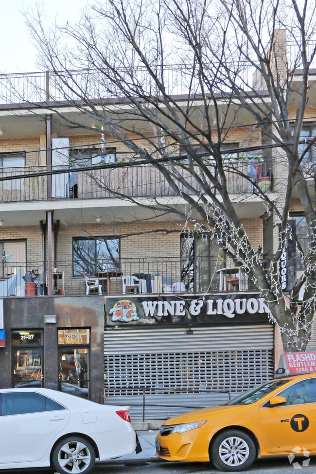
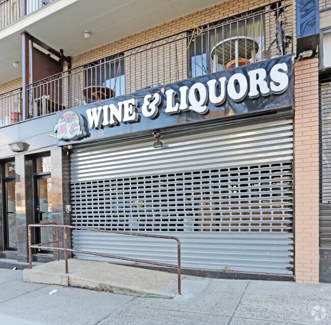
Property Record
2129 21St Ave, Astoria, NY 11105
NEARBY LISTINGS FOR SALE OR LEASE
Property Detail
2129 21St Ave
00882-0005
Queens
Commercialofficeresidentialmixeduse
New York
X
5
3604970091F
0.05 AC
2024
Northeast Queens
2025
Long Island (New York)
010500
New York-Jersey City-White Plains, NY-NJ
3,613 SF
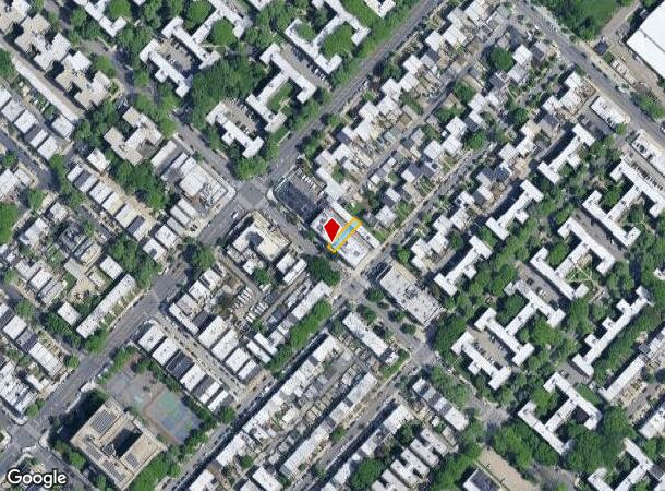
DEMOGRAPHICS near 2129 21St Ave
1 mile
3 mile
5 mile
2024 Total Population
53,823
1,039,306
2,835,346
2029 Population
50,337
969,564
2,643,208
Pop Growth 2024-2029
(6.48%)
(6.71%)
(6.78%)
Average Age
40
40
40
2024 Total Households
22,854
443,050
1,168,561
HH Growth 2024-2029
(7.08%)
(6.99%)
(7.06%)
Median Household Inc
$92,877
$69,168
$68,439
Avg Household Size
2.20
2.20
2.30
2024 Avg HH Vehicles
1.00
.00
.00
Median Home Value
$935,503
$821,923
$790,447
Median Year Built
1947
1957
1956
Nearby Places
Map Layers
Map Styles
 Street
 Aerial
Transit
 Traffic
 Biking
Places
Listings with unknown addresses are not visible on the map
- Restaurants
- Banks
- Shops
- Fitness
- Groceries
PUBLIC TRANSPORTATION
COMMUTER RAIL
Woodside Station (Babylon Branch - Long Island Rail Road, Far Rockaway Branch - Long Island Rail Road, Hempstead Branch - Long Island Rail Road, Long Beach Branch - Long Island Rail Road, Montauk Branch - Long Island Rail Road, Port Jefferson Branch - Long Island Rail Road, Port Washington Branch - Long Island Rail Road, Ronkonkoma Branch - Long Island Rail Road)
Drive
Walk
Distance
Woodside Station (Babylon Branch - Long Island Rail Road, Far Rockaway Branch - Long Island Rail Road, Hempstead Branch - Long Island Rail Road, Long Beach Branch - Long Island Rail Road, Montauk Branch - Long Island Rail Road, Port Jefferson Branch - Long Island Rail Road, Port Washington Branch - Long Island Rail Road, Ronkonkoma Branch - Long Island Rail Road)
9 min
3.3 mi
Hunterspoint Avenue Station (Hempstead Branch - Long Island Rail Road, Oyster Bay Branch - Long Island Rail Road)
Drive
Walk
Distance
Hunterspoint Avenue Station (Hempstead Branch - Long Island Rail Road, Oyster Bay Branch - Long Island Rail Road)
9 min
3.6 mi
AIRPORT
LaGuardia
Drive
Walk
Distance
LaGuardia
10 min
3.4 mi
John F Kennedy International
Drive
Walk
Distance
John F Kennedy International
25 min
14.7 mi
Newark Liberty International
Drive
Walk
Distance
Newark Liberty International
34 min
20.1 mi
Freight Ports
NY - Red Hook Container Terminal
Drive
Walk
Distance
NY - Red Hook Container Terminal
23 min
11.6 mi
Nearby Properties
Address
Land Use
TOTAL SIZE
Lot Size
Zoning
Address
Land Use
TOTAL SIZE
Lot Size
Zoning
97.14 AC
R7-2
Address
Land Use
TOTAL SIZE
Lot Size
Zoning
1.22 AC
R7-2
Address
Land Use
TOTAL SIZE
Lot Size
Zoning
0.92 AC
R7-2
Address
Land Use
TOTAL SIZE
Lot Size
Zoning
97.14 AC
R7-2
Address
Land Use
TOTAL SIZE
Lot Size
Zoning
4,380,201 SF
97.06 AC
R7-2
Address
Land Use
TOTAL SIZE
Lot Size
Zoning
5,519,372 SF
409.21 AC
C8-2
Address
Land Use
TOTAL SIZE
Lot Size
Zoning
2,215,000 SF
6.43 AC
R9
Address
Land Use
TOTAL SIZE
Lot Size
Zoning
2,230,742 SF
6.33 AC
R9
Address
Land Use
TOTAL SIZE
Lot Size
Zoning
988,829 SF
1.44 AC
R10
Address
Land Use
TOTAL SIZE
Lot Size
Zoning
988,829 SF
1.44 AC
R10
Address
Land Use
TOTAL SIZE
Lot Size
Zoning
988,829 SF
1.44 AC
R10
Address
Land Use
TOTAL SIZE
Lot Size
Zoning
988,829 SF
1.44 AC
R10
Address
Land Use
TOTAL SIZE
Lot Size
Zoning
988,829 SF
1.44 AC
R10
Address
Land Use
TOTAL SIZE
Lot Size
Zoning
988,829 SF
1.44 AC
R10
Address
Land Use
TOTAL SIZE
Lot Size
Zoning
988,829 SF
1.44 AC
R10
Address
Land Use
TOTAL SIZE
Lot Size
Zoning
988,829 SF
1.44 AC
R10
Address
Land Use
TOTAL SIZE
Lot Size
Zoning
988,829 SF
1.44 AC
R10
Address
Land Use
TOTAL SIZE
Lot Size
Zoning
988,829 SF
1.44 AC
R10
Address
Land Use
TOTAL SIZE
Lot Size
Zoning
988,829 SF
1.44 AC
R10
Address
Land Use
TOTAL SIZE
Lot Size
Zoning
988,829 SF
1.44 AC
R10
Address
Land Use
TOTAL SIZE
Lot Size
Zoning
988,829 SF
1.44 AC
R10
Address
Land Use
TOTAL SIZE
Lot Size
Zoning
988,829 SF
1.44 AC
R10
Address
Land Use
TOTAL SIZE
Lot Size
Zoning
988,829 SF
1.44 AC
R10
Address
Land Use
TOTAL SIZE
Lot Size
Zoning
988,829 SF
1.44 AC
R10
Address
Land Use
TOTAL SIZE
Lot Size
Zoning
988,829 SF
1.44 AC
R10
Address
Land Use
TOTAL SIZE
Lot Size
Zoning
988,829 SF
1.44 AC
R10
Address
Land Use
TOTAL SIZE
Lot Size
Zoning
988,829 SF
1.44 AC
R10
Address
Land Use
TOTAL SIZE
Lot Size
Zoning
988,829 SF
1.44 AC
R10
Address
Land Use
TOTAL SIZE
Lot Size
Zoning
988,829 SF
1.44 AC
R10
Address
Land Use
TOTAL SIZE
Lot Size
Zoning
988,829 SF
1.44 AC
R10
The World's #1 Commercial Real Estate Marketplace
Connect with us
© 2026 CoStar Group
The information above has been obtained from sources believed reliable. While we do not doubt its accuracy we have not verified it and make no guarantee, warranty or representation about it. It is your responsibility to independently confirm its accuracy and completeness. Any projections, opinions, assumptions, or estimates used are for example only and do not represent the current or future performance of the property. The value of this transaction to you depends on tax and other factors which should be evaluated by your tax, financial, and legal advisors. You and your advisors should conduct a careful, independent investigation of the property to determine to your satisfaction the suitability of the property for your needs.