Property Record
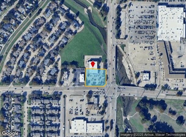
2129 E Belt Line Rd, Richardson, TX 75081


NEARBY LISTINGS FOR SALE OR LEASE
Property Detail
2129 E Belt Line Rd
Dallas-Fort Worth-Arlington, TX
Meadowcreek 4
421067000A01A0000
MEADOWCREEK 4 BLK A PT LT 1A ACS 0.9513 VOL2002210/08312 DD10252002 CO-DC 1067000A01A00 3421067000A
Storebuilding
Dallas
X
Texas
48113C0210L
1a
2024
0.95 AC
2025
Richardson
019023
Dallas/Ft Worth
13,216 SF
DEMOGRAPHICS near 2129 E Belt Line Rd
1 Mile
3 Mile
5 Mile
2024 Total Population
16,306
134,386
356,718
2029 Population
15,976
133,079
363,812
Pop Growth 2024-2029
(2.02%)
(0.97%)
+ 1.99%
Average Age
41
38
37
2024 Total Households
6,039
47,867
132,421
HH Growth 2024-2029
(2.32%)
(1.07%)
+ 2.46%
Median Household Inc
$76,648
$67,071
$64,771
Avg Household Size
2.60
2.70
2.60
2024 Avg HH Vehicles
2.00
2.00
2.00
Median Home Value
$254,572
$254,371
$277,751
Median Year Built
1978
1978
1979
Nearby Places
Map Layers
Map Styles
 Street
 Aerial
- Restaurants
- Banks
- Shops
- Fitness
- Groceries
PUBLIC TRANSPORTATION
AIRPORT
Dallas Love Field
DRIVE
WALK
Distance
Dallas Love Field
29 min
18.0 mi
Dallas-Fort Worth International
DRIVE
WALK
Distance
Dallas-Fort Worth International
37 min
26.9 mi
Freight Ports
Port of Shreveport
DRIVE
WALK
Distance
Port of Shreveport
216 min
197.8 mi
Nearby Properties
Address
Land Use
TOTAL SIZE
Lot Size
Zoning
Address
Land Use
TOTAL SIZE
Lot Size
Zoning
641,243 SF
20.67 AC
Z109
Address
Land Use
TOTAL SIZE
Lot Size
Zoning
630,247 SF
42 AC
Z239
Address
Land Use
TOTAL SIZE
Lot Size
Zoning
768,061 SF
42.03 AC
Z02
Address
Land Use
TOTAL SIZE
Lot Size
Zoning
428,956 SF
18.76 AC
Z291
Address
Land Use
TOTAL SIZE
Lot Size
Zoning
548,300 SF
17.29 AC
Z239
Address
Land Use
TOTAL SIZE
Lot Size
Zoning
129,810 SF
14.93 AC
Z236
Address
Land Use
TOTAL SIZE
Lot Size
Zoning
374,266 SF
19.42 AC
Z239
Address
Land Use
TOTAL SIZE
Lot Size
Zoning
795,714 SF
5.36 AC
Z109
Address
Land Use
TOTAL SIZE
Lot Size
Zoning
402,815 SF
5.64 AC
Z236
Address
Land Use
TOTAL SIZE
Lot Size
Zoning
537,928 SF
11.13 AC
Z109
Address
Land Use
TOTAL SIZE
Lot Size
Zoning
353,347 SF
17 AC
Z02
Address
Land Use
TOTAL SIZE
Lot Size
Zoning
426,467 SF
24.12 AC
Z142
Address
Land Use
TOTAL SIZE
Lot Size
Zoning
433,745 SF
15.18 AC
Z02
Address
Land Use
TOTAL SIZE
Lot Size
Zoning
1,464,834 SF
18.37 AC
Z109
Address
Land Use
TOTAL SIZE
Lot Size
Zoning
316,085 SF
13.73 AC
Z107
Address
Land Use
TOTAL SIZE
Lot Size
Zoning
181,200 SF
15.11 AC
Address
Land Use
TOTAL SIZE
Lot Size
Zoning
181,854 SF
14.51 AC
Z239
Address
Land Use
TOTAL SIZE
Lot Size
Zoning
388,059 SF
21.80 AC
Z239
Address
Land Use
TOTAL SIZE
Lot Size
Zoning
470,129 SF
4.43 AC
Z112
Address
Land Use
TOTAL SIZE
Lot Size
Zoning
244,025 SF
17.80 AC
Z02
Address
Land Use
TOTAL SIZE
Lot Size
Zoning
572,364 SF
8.41 AC
Z112
Address
Land Use
TOTAL SIZE
Lot Size
Zoning
303,169 SF
19.67 AC
Z239
Address
Land Use
TOTAL SIZE
Lot Size
Zoning
276,236 SF
8.96 AC
Z239
Address
Land Use
TOTAL SIZE
Lot Size
Zoning
699,105 SF
5.12 AC
Z137
Address
Land Use
TOTAL SIZE
Lot Size
Zoning
277,296 SF
13.54 AC
Z207
Address
Land Use
TOTAL SIZE
Lot Size
Zoning
107,686 SF
30.09 AC
Z386
Address
Land Use
TOTAL SIZE
Lot Size
Zoning
280,598 SF
7.36 AC
Z239
Address
Land Use
TOTAL SIZE
Lot Size
Zoning
130,039 SF
8.09 AC
Z31
Address
Land Use
TOTAL SIZE
Lot Size
Zoning
275,557 SF
13.64 AC
Z291
Address
Land Use
TOTAL SIZE
Lot Size
Zoning
232,771 SF
15.69 AC
Z160
The World's #1 Commercial Real Estate Marketplace
Connect with us
© 2025 CoStar Group
The information above has been obtained from sources believed reliable. While we do not doubt its accuracy we have not verified it and make no guarantee, warranty or representation about it. It is your responsibility to independently confirm its accuracy and completeness. Any projections, opinions, assumptions, or estimates used are for example only and do not represent the current or future performance of the property. The value of this transaction to you depends on tax and other factors which should be evaluated by your tax, financial, and legal advisors. You and your advisors should conduct a careful, independent investigation of the property to determine to your satisfaction the suitability of the property for your needs.