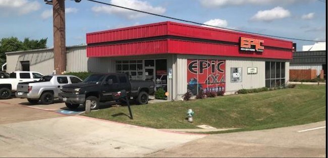
Property Record
2129 S Stemmons Fwy, Lewisville, TX 75067

Save to a Folder
{{folder.Name}}
{{folder.ListingIds.length}} Properties
{{folder.ListingIds.length}} Property
Create a New Folder
Property Detail
2129 S Stemmons Fwy
Dallas-Fort Worth-Arlington, TX
VISTA RIDGE POINTE ADDITION BLK A LOT 6
R331382
Denton
Commercialnec
Texas
AE The base floodplain where base flood elevations are provided. AE Zones are now used on new format FIRMs instead of A1-A30 Zones.
6
2024
5.28 AC
2025
Lewisville
021735
Dallas/Ft Worth
17,750 SF
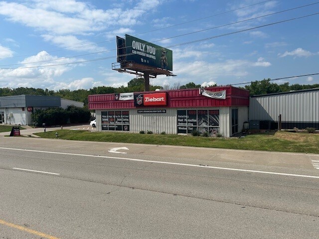
NEARBY LISTINGS FOR SALE OR LEASE
DEMOGRAPHICS near 2129 S Stemmons Fwy
1 mile
3 mile
5 mile
2025 Total Population
19,209
103,267
243,924
2030 Population
21,234
113,074
266,985
Pop Growth 2025-2030
+ 10.54%
+ 9.50%
+ 9.45%
Average Age
35
37
38
2025 Total Households
9,278
39,977
92,318
HH Growth 2025-2030
+ 10.79%
+ 10.01%
+ 9.71%
Median Household Inc
$65,347
$89,701
$102,788
Avg Household Size
2.10
2.50
2.60
2025 Avg HH Vehicles
2.00
2.00
2.00
Median Home Value
$390,532
$406,425
$441,178
Median Year Built
1994
1994
1995
Nearby Places
Map Layers
Map Styles
 Street
 Aerial
Layers
 Traffic
 Biking
Places
Listings with unknown addresses are not visible on the map
- Restaurants
- Banks
- Shops
- Fitness
- Groceries
PUBLIC TRANSPORTATION
COMMUTER RAIL
Drive
Walk
Distance
5 min
1.6 mi
Drive
Walk
Distance
8 min
4.2 mi
AIRPORT
Dallas-Fort Worth International
Drive
Walk
Distance
Dallas-Fort Worth International
16 min
11.5 mi
Dallas Love Field
Drive
Walk
Distance
Dallas Love Field
27 min
18.3 mi
SALE & LEASE HISTORY
LISTING DATE
SALE/LEASE

Sep 06, 2024
For Lease
May 21, 2019
For Lease
Jul 02, 2018
For Lease
Aug 02, 2019
For Lease
Nearby Properties
Address
Land Use
TOTAL SIZE
Lot Size
Zoning
Address
Land Use
TOTAL SIZE
Lot Size
Zoning
481,511 SF
34.76 AC
Z172
Address
Land Use
TOTAL SIZE
Lot Size
Zoning
599,705 SF
10.38 AC
Address
Land Use
TOTAL SIZE
Lot Size
Zoning
462,692 SF
30.77 AC
2G
Address
Land Use
TOTAL SIZE
Lot Size
Zoning
835,344 SF
143.50 AC
Address
Land Use
TOTAL SIZE
Lot Size
Zoning
452,167 SF
5.80 AC
Address
Land Use
TOTAL SIZE
Lot Size
Zoning
352,209 SF
17.54 AC
Z172
Address
Land Use
TOTAL SIZE
Lot Size
Zoning
394,048 SF
16.36 AC
Address
Land Use
TOTAL SIZE
Lot Size
Zoning
379,940 SF
63.48 AC
Z31
Address
Land Use
TOTAL SIZE
Lot Size
Zoning
382,330 SF
21.43 AC
3B
Address
Land Use
TOTAL SIZE
Lot Size
Zoning
385,247 SF
22.59 AC
3B
Address
Land Use
TOTAL SIZE
Lot Size
Zoning
344,868 SF
19.44 AC
Address
Land Use
TOTAL SIZE
Lot Size
Zoning
514,192 SF
21.56 AC
3B
Address
Land Use
TOTAL SIZE
Lot Size
Zoning
412,389 SF
16.69 AC
3B
Address
Land Use
TOTAL SIZE
Lot Size
Zoning
354,546 SF
19.38 AC
3B
Address
Land Use
TOTAL SIZE
Lot Size
Zoning
424,064 SF
22.15 AC
2B
Address
Land Use
TOTAL SIZE
Lot Size
Zoning
269,300 SF
60.39 AC
Address
Land Use
TOTAL SIZE
Lot Size
Zoning
947,236 SF
52.19 AC
Address
Land Use
TOTAL SIZE
Lot Size
Zoning
411,223 SF
24.07 AC
3B
Address
Land Use
TOTAL SIZE
Lot Size
Zoning
1,030,000 SF
53.43 AC
Address
Land Use
TOTAL SIZE
Lot Size
Zoning
344,926 SF
19.93 AC
3B
Address
Land Use
TOTAL SIZE
Lot Size
Zoning
380,316 SF
26.10 AC
Address
Land Use
TOTAL SIZE
Lot Size
Zoning
347,181 SF
18.51 AC
3B
Address
Land Use
TOTAL SIZE
Lot Size
Zoning
392,646 SF
19.65 AC
3B
Address
Land Use
TOTAL SIZE
Lot Size
Zoning
297,932 SF
14.05 AC
Address
Land Use
TOTAL SIZE
Lot Size
Zoning
266,959 SF
3.83 AC
Address
Land Use
TOTAL SIZE
Lot Size
Zoning
330,816 SF
14.97 AC
Address
Land Use
TOTAL SIZE
Lot Size
Zoning
310,788 SF
15.05 AC
Address
Land Use
TOTAL SIZE
Lot Size
Zoning
315,084 SF
13.76 AC
3B
Address
Land Use
TOTAL SIZE
Lot Size
Zoning
295,668 SF
13.03 AC
Address
Land Use
TOTAL SIZE
Lot Size
Zoning
659,218 SF
34.29 AC
The World's #1 Commercial Real Estate Marketplace
Connect with us
© 2026 CoStar Group
The information above has been obtained from sources believed reliable. While we do not doubt its accuracy we have not verified it and make no guarantee, warranty or representation about it. It is your responsibility to independently confirm its accuracy and completeness. Any projections, opinions, assumptions, or estimates used are for example only and do not represent the current or future performance of the property. The value of this transaction to you depends on tax and other factors which should be evaluated by your tax, financial, and legal advisors. You and your advisors should conduct a careful, independent investigation of the property to determine to your satisfaction the suitability of the property for your needs.