Property Record
213 E 8Th Ave, Homestead, PA 15120


NEARBY LISTINGS FOR SALE OR LEASE
Property Detail
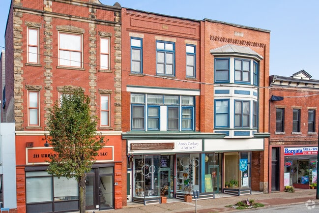
213 E 8Th Ave
Pittsburgh, PA
Life Ins Co Plan
0130-K-00209-0000-00
HOMESTEAD BK & LIFE INS CO PLAN #322 LOT 40X110 E 8TH AVE 3 STY BRK APT & STO BLDG 213 215
Retailwithmorethanonenonretailuse
Allegheny
X
Pennsylvania
42003C0366H
209
2024
0.10 AC
2025
Munhall
483800
Pittsburgh
DEMOGRAPHICS near 213 E 8Th Ave
1 mile
3 mile
5 mile
2024 Total Population
9,802
107,373
340,562
2029 Population
9,816
106,029
337,175
Pop Growth 2024-2029
+ 0.14%
(1.25%)
(0.99%)
Average Age
43
41
40
2024 Total Households
4,717
48,981
155,377
HH Growth 2024-2029
+ 0.17%
(1.37%)
(1.10%)
Median Household Inc
$39,233
$56,888
$50,772
Avg Household Size
2.00
2.10
2.00
2024 Avg HH Vehicles
1.00
1.00
1.00
Median Home Value
$138,714
$172,349
$153,437
Median Year Built
1956
1949
1950
Nearby Places
Map Layers
Map Styles
 Street
 Aerial
Transit
 Traffic
 Biking
Places
Listings with unknown addresses are not visible on the map
- Restaurants
- Banks
- Shops
- Fitness
- Groceries
PUBLIC TRANSPORTATION
COMMUTER RAIL
Drive
Walk
Distance
15 min
6.7 mi
AIRPORT
Pittsburgh International
Drive
Walk
Distance
Pittsburgh International
40 min
23.1 mi
Arnold Palmer Regional
Drive
Walk
Distance
Arnold Palmer Regional
63 min
33.6 mi
SALE & LEASE HISTORY
LISTING DATE
SALE/LEASE

May 20, 2019
For Lease
Nearby Properties
Address
Land Use
TOTAL SIZE
Lot Size
Zoning
Address
Land Use
TOTAL SIZE
Lot Size
Zoning
Address
Land Use
TOTAL SIZE
Lot Size
Zoning
31.36 AC
Address
Land Use
TOTAL SIZE
Lot Size
Zoning
2.30 AC
Address
Land Use
TOTAL SIZE
Lot Size
Zoning
1,950 SF
21.62 AC
Address
Land Use
TOTAL SIZE
Lot Size
Zoning
5.32 AC
Address
Land Use
TOTAL SIZE
Lot Size
Zoning
18.66 AC
Address
Land Use
TOTAL SIZE
Lot Size
Zoning
Address
Land Use
TOTAL SIZE
Lot Size
Zoning
7.79 AC
Address
Land Use
TOTAL SIZE
Lot Size
Zoning
15.90 AC
Address
Land Use
TOTAL SIZE
Lot Size
Zoning
4.49 AC
Address
Land Use
TOTAL SIZE
Lot Size
Zoning
16.49 AC
Address
Land Use
TOTAL SIZE
Lot Size
Zoning
Address
Land Use
TOTAL SIZE
Lot Size
Zoning
Address
Land Use
TOTAL SIZE
Lot Size
Zoning
9.69 AC
Address
Land Use
TOTAL SIZE
Lot Size
Zoning
23.87 AC
Address
Land Use
TOTAL SIZE
Lot Size
Zoning
Address
Land Use
TOTAL SIZE
Lot Size
Zoning
162.82 AC
Address
Land Use
TOTAL SIZE
Lot Size
Zoning
2.92 AC
Address
Land Use
TOTAL SIZE
Lot Size
Zoning
0.93 AC
Address
Land Use
TOTAL SIZE
Lot Size
Zoning
19.85 AC
Address
Land Use
TOTAL SIZE
Lot Size
Zoning
121.64 AC
Address
Land Use
TOTAL SIZE
Lot Size
Zoning
Address
Land Use
TOTAL SIZE
Lot Size
Zoning
4.53 AC
Address
Land Use
TOTAL SIZE
Lot Size
Zoning
Address
Land Use
TOTAL SIZE
Lot Size
Zoning
Address
Land Use
TOTAL SIZE
Lot Size
Zoning
0.64 AC
Address
Land Use
TOTAL SIZE
Lot Size
Zoning
14.79 AC
Address
Land Use
TOTAL SIZE
Lot Size
Zoning
12.51 AC
Address
Land Use
TOTAL SIZE
Lot Size
Zoning
Address
Land Use
TOTAL SIZE
Lot Size
Zoning
17.52 AC
The World's #1 Commercial Real Estate Marketplace
Connect with us
© 2026 CoStar Group
The information above has been obtained from sources believed reliable. While we do not doubt its accuracy we have not verified it and make no guarantee, warranty or representation about it. It is your responsibility to independently confirm its accuracy and completeness. Any projections, opinions, assumptions, or estimates used are for example only and do not represent the current or future performance of the property. The value of this transaction to you depends on tax and other factors which should be evaluated by your tax, financial, and legal advisors. You and your advisors should conduct a careful, independent investigation of the property to determine to your satisfaction the suitability of the property for your needs.