Property Record
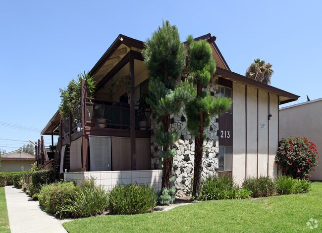
213 E Orangewood Ave, Anaheim, CA 92802


NEARBY LISTINGS FOR SALE OR LEASE
Property Detail
213 E Orangewood Ave
Anaheim-Santa Ana-Irvine, CA
Tr 4551
137-344-06
N TR 4551 BLK LOT 26
Multifamilydwelling
Orange
X
California
06059C0142J
26
2024
0.20 AC
2025
Anaheim Resort
087504
Orange County (California)
3,844 SF
DEMOGRAPHICS near 213 E Orangewood Ave
1 Mile
3 Mile
5 Mile
2024 Total Population
38,396
250,008
768,036
2029 Population
38,196
247,585
758,489
Pop Growth 2024-2029
(0.52%)
(0.97%)
(1.24%)
Average Age
35
37
37
2024 Total Households
12,461
73,012
211,699
HH Growth 2024-2029
(0.34%)
(0.91%)
(1.30%)
Median Household Inc
$77,450
$80,719
$78,184
Avg Household Size
2.90
3.20
3.40
2024 Avg HH Vehicles
2.00
2.00
2.00
Median Home Value
$612,617
$690,972
$687,593
Median Year Built
1985
1969
1967
Nearby Places
Map Layers
Map Styles
 Street
 Aerial
- Restaurants
- Banks
- Shops
- Fitness
- Groceries
PUBLIC TRANSPORTATION
COMMUTER RAIL
Anaheim (Pacific Surfliner - Amtrak)
DRIVE
WALK
Distance
Anaheim (Pacific Surfliner - Amtrak)
6 min
2.4 mi
Anaheim-Artic Metrolink Station (Metrolink Orange County Line - Metrolink Trains)
DRIVE
WALK
Distance
Anaheim-Artic Metrolink Station (Metrolink Orange County Line - Metrolink Trains)
6 min
2.5 mi
AIRPORT
John Wayne/Orange County
DRIVE
WALK
Distance
John Wayne/Orange County
15 min
11.4 mi
Long Beach (Daugherty Field)
DRIVE
WALK
Distance
Long Beach (Daugherty Field)
25 min
19.1 mi
Ontario International
DRIVE
WALK
Distance
Ontario International
44 min
33.8 mi
Freight Ports
Port of Long Beach
DRIVE
WALK
Distance
Port of Long Beach
29 min
18.6 mi
SALE & LEASE HISTORY
LISTING DATE
SALE/LEASE

Apr 02, 2024
For Sale
Nearby Properties
Address
Land Use
TOTAL SIZE
Lot Size
Zoning
Address
Land Use
TOTAL SIZE
Lot Size
Zoning
31.01 AC
Address
Land Use
TOTAL SIZE
Lot Size
Zoning
2.60 AC
Address
Land Use
TOTAL SIZE
Lot Size
Zoning
24.50 AC
Address
Land Use
TOTAL SIZE
Lot Size
Zoning
16.07 AC
Address
Land Use
TOTAL SIZE
Lot Size
Zoning
Address
Land Use
TOTAL SIZE
Lot Size
Zoning
2.86 AC
Address
Land Use
TOTAL SIZE
Lot Size
Zoning
6.45 AC
Address
Land Use
TOTAL SIZE
Lot Size
Zoning
860 SF
13 AC
Address
Land Use
TOTAL SIZE
Lot Size
Zoning
Address
Land Use
TOTAL SIZE
Lot Size
Zoning
41.12 AC
Address
Land Use
TOTAL SIZE
Lot Size
Zoning
5.07 AC
Address
Land Use
TOTAL SIZE
Lot Size
Zoning
4.89 AC
Address
Land Use
TOTAL SIZE
Lot Size
Zoning
Address
Land Use
TOTAL SIZE
Lot Size
Zoning
2.17 AC
Address
Land Use
TOTAL SIZE
Lot Size
Zoning
46,514 SF
9.18 AC
Address
Land Use
TOTAL SIZE
Lot Size
Zoning
4.13 AC
Address
Land Use
TOTAL SIZE
Lot Size
Zoning
12.20 AC
Address
Land Use
TOTAL SIZE
Lot Size
Zoning
6.60 AC
Address
Land Use
TOTAL SIZE
Lot Size
Zoning
Address
Land Use
TOTAL SIZE
Lot Size
Zoning
4.71 AC
Address
Land Use
TOTAL SIZE
Lot Size
Zoning
11.61 AC
Address
Land Use
TOTAL SIZE
Lot Size
Zoning
52.51 AC
Address
Land Use
TOTAL SIZE
Lot Size
Zoning
8.80 AC
Address
Land Use
TOTAL SIZE
Lot Size
Zoning
Address
Land Use
TOTAL SIZE
Lot Size
Zoning
Address
Land Use
TOTAL SIZE
Lot Size
Zoning
7,939 SF
9.37 AC
Address
Land Use
TOTAL SIZE
Lot Size
Zoning
9.36 AC
Address
Land Use
TOTAL SIZE
Lot Size
Zoning
3.47 AC
Address
Land Use
TOTAL SIZE
Lot Size
Zoning
9.28 AC
Address
Land Use
TOTAL SIZE
Lot Size
Zoning
The World's #1 Commercial Real Estate Marketplace
Connect with us
© 2026 CoStar Group
The information above has been obtained from sources believed reliable. While we do not doubt its accuracy we have not verified it and make no guarantee, warranty or representation about it. It is your responsibility to independently confirm its accuracy and completeness. Any projections, opinions, assumptions, or estimates used are for example only and do not represent the current or future performance of the property. The value of this transaction to you depends on tax and other factors which should be evaluated by your tax, financial, and legal advisors. You and your advisors should conduct a careful, independent investigation of the property to determine to your satisfaction the suitability of the property for your needs.