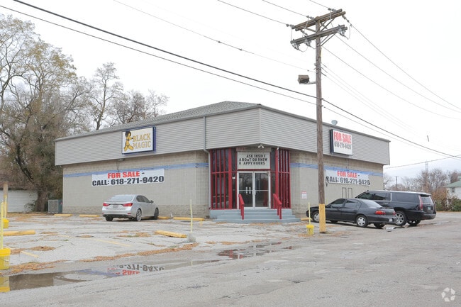
Property Record
213 N Third St, Lovejoy, IL 62059
NEARBY LISTINGS FOR SALE OR LEASE
Property Detail
213 N Third St
St. Louis
Upper Brooklyn
St. Louis, MO-IL
UPPER BROOKLYN LOT/SEC-13-BLK/RG-4 PT LT 13 BLK 4 A02799622
01-02.0-203-023
St. Clair
Commercialnec
Illinois
2024
13
2024
0.10 AC
504502
Metro East Illinois
DEMOGRAPHICS near 213 N Third St
1 Mile
3 Mile
5 Mile
2024 Total Population
1,136
40,250
151,747
2029 Population
1,160
39,535
148,733
Pop Growth 2024-2029
+ 2.11%
(1.78%)
(1.99%)
Average Age
37
39
39
2024 Total Households
488
19,449
69,598
HH Growth 2024-2029
+ 2.25%
(2.06%)
(2.27%)
Median Household Inc
$34,435
$38,558
$41,169
Avg Household Size
2.30
1.90
2.00
2024 Avg HH Vehicles
1.00
1.00
1.00
Median Home Value
$53,910
$107,674
$92,785
Median Year Built
1964
1952
1949
Nearby Places
Map Layers
Map Styles
 Street
 Aerial
- Restaurants
- Banks
- Shops
- Fitness
- Groceries
PUBLIC TRANSPORTATION
COMMUTER RAIL
East Riverfront (Lambert Airport Shiloh-Scott - St. Louis MetroLink (MetroLink), Shrewsbury-Lansdowne I-44 Emerson Park - St. Louis MetroLink (MetroLink))
DRIVE
WALK
Distance
East Riverfront (Lambert Airport Shiloh-Scott - St. Louis MetroLink (MetroLink), Shrewsbury-Lansdowne I-44 Emerson Park - St. Louis MetroLink (MetroLink))
7 min
3.2 mi
Arch-Laclede's Landing (Lambert Airport Shiloh-Scott - St. Louis MetroLink (MetroLink), Shrewsbury-Lansdowne I-44 Emerson Park - St. Louis MetroLink (MetroLink))
DRIVE
WALK
Distance
Arch-Laclede's Landing (Lambert Airport Shiloh-Scott - St. Louis MetroLink (MetroLink), Shrewsbury-Lansdowne I-44 Emerson Park - St. Louis MetroLink (MetroLink))
7 min
3.6 mi
AIRPORT
St Louis Lambert International
DRIVE
WALK
Distance
St Louis Lambert International
22 min
14.5 mi
Scott AFB/Midamerica St Louis
DRIVE
WALK
Distance
Scott AFB/Midamerica St Louis
38 min
24.5 mi
Freight Ports
Port Milwaukee
DRIVE
WALK
Distance
Port Milwaukee
417 min
368.8 mi
Nearby Properties
Address
Land Use
TOTAL SIZE
Lot Size
Zoning
Address
Land Use
TOTAL SIZE
Lot Size
Zoning
467,000 SF
11.19 AC
I
Address
Land Use
TOTAL SIZE
Lot Size
Zoning
1,037,632 SF
3.34 AC
I
Address
Land Use
TOTAL SIZE
Lot Size
Zoning
661,472 SF
7.29 AC
L
Address
Land Use
TOTAL SIZE
Lot Size
Zoning
1.72 AC
I
Address
Land Use
TOTAL SIZE
Lot Size
Zoning
1.71 AC
I
Address
Land Use
TOTAL SIZE
Lot Size
Zoning
355,000 SF
0.75 AC
I
Address
Land Use
TOTAL SIZE
Lot Size
Zoning
472,328 SF
19.85 AC
I
Address
Land Use
TOTAL SIZE
Lot Size
Zoning
10.97 AC
I
Address
Land Use
TOTAL SIZE
Lot Size
Zoning
1,165,128 SF
1.70 AC
L
Address
Land Use
TOTAL SIZE
Lot Size
Zoning
1,189,932 SF
1.45 AC
I
Address
Land Use
TOTAL SIZE
Lot Size
Zoning
7.38 AC
I
Address
Land Use
TOTAL SIZE
Lot Size
Zoning
593,701 SF
2.08 AC
I
Address
Land Use
TOTAL SIZE
Lot Size
Zoning
1,925 SF
79.42 AC
Address
Land Use
TOTAL SIZE
Lot Size
Zoning
702,704 SF
2.10 AC
I
Address
Land Use
TOTAL SIZE
Lot Size
Zoning
3.26 AC
Address
Land Use
TOTAL SIZE
Lot Size
Zoning
570,135 SF
0.52 AC
I
Address
Land Use
TOTAL SIZE
Lot Size
Zoning
359,040 SF
1.33 AC
L
Address
Land Use
TOTAL SIZE
Lot Size
Zoning
439,346 SF
1.45 AC
I
Address
Land Use
TOTAL SIZE
Lot Size
Zoning
303,680 SF
2.09 AC
I
Address
Land Use
TOTAL SIZE
Lot Size
Zoning
190,000 SF
2.71 AC
I
Address
Land Use
TOTAL SIZE
Lot Size
Zoning
192,892 SF
4.44 AC
I
Address
Land Use
TOTAL SIZE
Lot Size
Zoning
15.11 AC
I
Address
Land Use
TOTAL SIZE
Lot Size
Zoning
413,353 SF
2.56 AC
L
Address
Land Use
TOTAL SIZE
Lot Size
Zoning
870,868 SF
1.53 AC
I
Address
Land Use
TOTAL SIZE
Lot Size
Zoning
5.79 AC
I
Address
Land Use
TOTAL SIZE
Lot Size
Zoning
149,586 SF
60.20 AC
Address
Land Use
TOTAL SIZE
Lot Size
Zoning
264,261 SF
0.54 AC
I
Address
Land Use
TOTAL SIZE
Lot Size
Zoning
5.29 AC
I
Address
Land Use
TOTAL SIZE
Lot Size
Zoning
98,308 SF
97.62 AC
H
Address
Land Use
TOTAL SIZE
Lot Size
Zoning
892,500 SF
3.18 AC
L
The World's #1 Commercial Real Estate Marketplace
Connect with us
© 2026 CoStar Group
The information above has been obtained from sources believed reliable. While we do not doubt its accuracy we have not verified it and make no guarantee, warranty or representation about it. It is your responsibility to independently confirm its accuracy and completeness. Any projections, opinions, assumptions, or estimates used are for example only and do not represent the current or future performance of the property. The value of this transaction to you depends on tax and other factors which should be evaluated by your tax, financial, and legal advisors. You and your advisors should conduct a careful, independent investigation of the property to determine to your satisfaction the suitability of the property for your needs.