Property Record
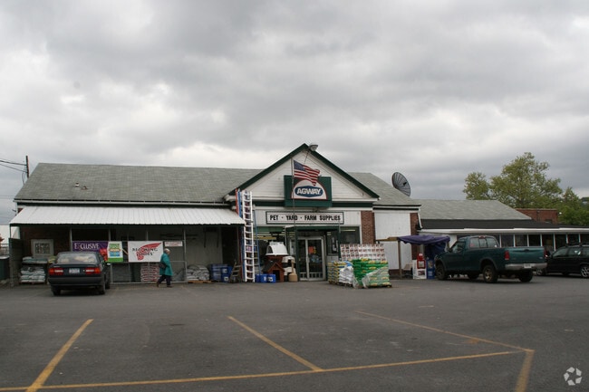
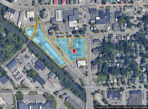
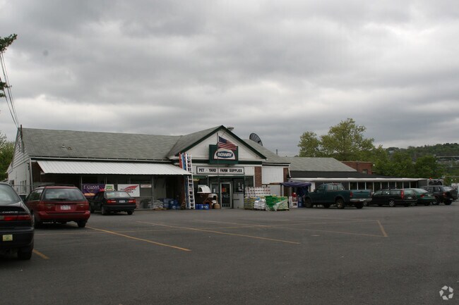
213 S Fulton St S, Ithaca, NY 14850
NEARBY LISTINGS FOR SALE OR LEASE
Property Detail
213 S Fulton St S
500700-072-000-0007-010-000-0000
Tompkins
Vehiclerentalsvehiclesales
New York
AE
10.000
36109C0184D
3.62 AC
2025
Ithaca
2024
Other Market Areas
000800
Ithaca, NY
26,860 SF
DEMOGRAPHICS near 213 S Fulton St S
1 Mile
3 Mile
5 Mile
2024 Total Population
12,075
46,992
61,103
2029 Population
10,313
41,221
53,440
Pop Growth 2024-2029
(14.59%)
(12.28%)
(12.54%)
Average Age
39
33
35
2024 Total Households
6,004
16,574
22,713
HH Growth 2024-2029
(16.64%)
(16.85%)
(16.49%)
Median Household Inc
$52,708
$50,812
$62,355
Avg Household Size
1.90
2.00
2.00
2024 Avg HH Vehicles
1.00
1.00
1.00
Median Home Value
$279,887
$329,180
$323,326
Median Year Built
1957
1968
1972
Nearby Places
- Restaurants
- Banks
- Shops
- Fitness
- Groceries
PUBLIC TRANSPORTATION
AIRPORT
Ithaca Tompkins International
DRIVE
WALK
Distance
Ithaca Tompkins International
10 min
5.6 mi
Elmira/Corning Regional
DRIVE
WALK
Distance
Elmira/Corning Regional
45 min
34.0 mi
Freight Ports
Albany, NY Port
DRIVE
WALK
Distance
Albany, NY Port
220 min
166.8 mi
Nearby Properties
Address
Land Use
TOTAL SIZE
Lot Size
Zoning
Address
Land Use
TOTAL SIZE
Lot Size
Zoning
5,000 SF
154.28 AC
U-1
Address
Land Use
TOTAL SIZE
Lot Size
Zoning
2,212,226 SF
588.22 AC
Address
Land Use
TOTAL SIZE
Lot Size
Zoning
43 AC
Address
Land Use
TOTAL SIZE
Lot Size
Zoning
36,275 SF
157.84 AC
Address
Land Use
TOTAL SIZE
Lot Size
Zoning
378,445 SF
4.39 AC
Address
Land Use
TOTAL SIZE
Lot Size
Zoning
338,706 SF
2.08 AC
U-1
Address
Land Use
TOTAL SIZE
Lot Size
Zoning
276,302 SF
15.94 AC
Address
Land Use
TOTAL SIZE
Lot Size
Zoning
1.30 AC
U-1
Address
Land Use
TOTAL SIZE
Lot Size
Zoning
50,319 SF
25.92 AC
Address
Land Use
TOTAL SIZE
Lot Size
Zoning
19,600 SF
22.51 AC
P-1
Address
Land Use
TOTAL SIZE
Lot Size
Zoning
218,211 SF
0.76 AC
CBD-60
Address
Land Use
TOTAL SIZE
Lot Size
Zoning
4,400 SF
30.50 AC
Address
Land Use
TOTAL SIZE
Lot Size
Zoning
150,015 SF
4.94 AC
U-1
Address
Land Use
TOTAL SIZE
Lot Size
Zoning
199,578 SF
0.56 AC
CBD-60
Address
Land Use
TOTAL SIZE
Lot Size
Zoning
364,128 SF
107.14 AC
Address
Land Use
TOTAL SIZE
Lot Size
Zoning
140,488 SF
5.90 AC
Address
Land Use
TOTAL SIZE
Lot Size
Zoning
131,532 SF
2.20 AC
U-1
Address
Land Use
TOTAL SIZE
Lot Size
Zoning
93,573 SF
0.91 AC
Address
Land Use
TOTAL SIZE
Lot Size
Zoning
8,100 SF
0.51 AC
CBD-60
Address
Land Use
TOTAL SIZE
Lot Size
Zoning
116,854 SF
1.16 AC
Address
Land Use
TOTAL SIZE
Lot Size
Zoning
115,796 SF
26.51 AC
Address
Land Use
TOTAL SIZE
Lot Size
Zoning
0.93 AC
U-1
Address
Land Use
TOTAL SIZE
Lot Size
Zoning
228,978 SF
4.96 AC
Address
Land Use
TOTAL SIZE
Lot Size
Zoning
75,168 SF
22.92 AC
Address
Land Use
TOTAL SIZE
Lot Size
Zoning
3,000 SF
97.73 AC
Address
Land Use
TOTAL SIZE
Lot Size
Zoning
112,392 SF
0.76 AC
B-2B
Address
Land Use
TOTAL SIZE
Lot Size
Zoning
185,997 SF
0.17 AC
CBD-140
Address
Land Use
TOTAL SIZE
Lot Size
Zoning
26,658 SF
0.69 AC
R-3A
Address
Land Use
TOTAL SIZE
Lot Size
Zoning
5,555 SF
12.07 AC
P-1
The World's #1 Commercial Real Estate Marketplace
Connect with us
© 2025 CoStar Group
The information above has been obtained from sources believed reliable. While we do not doubt its accuracy we have not verified it and make no guarantee, warranty or representation about it. It is your responsibility to independently confirm its accuracy and completeness. Any projections, opinions, assumptions, or estimates used are for example only and do not represent the current or future performance of the property. The value of this transaction to you depends on tax and other factors which should be evaluated by your tax, financial, and legal advisors. You and your advisors should conduct a careful, independent investigation of the property to determine to your satisfaction the suitability of the property for your needs.