Property Record
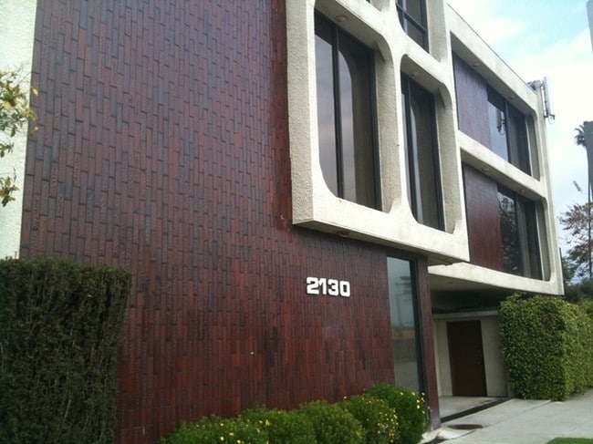
2130 Huntington Dr, South Pasadena, CA 91030


Current Lease Availabilities
NEARBY LISTINGS FOR SALE OR LEASE
Property Detail
2130 Huntington Dr
Los Angeles-Long Beach-Glendale, CA
6273
5321-015-021
TRACT NO 6273 SW 25 FT OF LOT 3 AND ALL OF LOT 4
Officebuilding
Los Angeles
X
California
06037C1635F
3,4
2024
0.20 AC
2025
Pasadena
480500
Los Angeles
10,868 SF
DEMOGRAPHICS near 2130 Huntington Dr
1 Mile
3 Mile
5 Mile
2024 Total Population
30,084
241,163
640,080
2029 Population
29,264
233,983
618,925
Pop Growth 2024-2029
(2.73%)
(2.98%)
(3.31%)
Average Age
42
42
42
2024 Total Households
11,745
90,711
224,128
HH Growth 2024-2029
(2.97%)
(3.16%)
(3.50%)
Median Household Inc
$92,575
$89,821
$83,699
Avg Household Size
2.50
2.60
2.70
2024 Avg HH Vehicles
2.00
2.00
2.00
Median Home Value
$1,035,772
$892,258
$849,030
Median Year Built
1957
1960
1957
Nearby Places
Map Layers
Map Styles
 Street
 Aerial
- Restaurants
- Banks
- Shops
- Fitness
- Groceries
PUBLIC TRANSPORTATION
COMMUTER RAIL
El Monte (San Bernardino Line - Southern California Regional Rail Authority (Metrolink))
DRIVE
WALK
Distance
El Monte (San Bernardino Line - Southern California Regional Rail Authority (Metrolink))
15 min
9.2 mi
Union Station (91 Line - Southern California Regional Rail Authority (Metrolink), Antelope Valley Line - Southern California Regional Rail Authority (Metrolink), Orange County Line - Southern California Regional Rail Authority (Metrolink), Riverside Line - Southern California Regional Rail Authority (Metrolink), San Bernardino Line - Southern California Regional Rail Authority (Metrolink), Ventura County Line - Southern California Regional Rail Authority (Metrolink))
DRIVE
WALK
Distance
Union Station (91 Line - Southern California Regional Rail Authority (Metrolink), Antelope Valley Line - Southern California Regional Rail Authority (Metrolink), Orange County Line - Southern California Regional Rail Authority (Metrolink), Riverside Line - Southern California Regional Rail Authority (Metrolink), San Bernardino Line - Southern California Regional Rail Authority (Metrolink), Ventura County Line - Southern California Regional Rail Authority (Metrolink))
17 min
9.4 mi
AIRPORT
Bob Hope
DRIVE
WALK
Distance
Bob Hope
29 min
19.8 mi
Long Beach (Daugherty Field)
DRIVE
WALK
Distance
Long Beach (Daugherty Field)
36 min
23.8 mi
Los Angeles International
DRIVE
WALK
Distance
Los Angeles International
39 min
24.6 mi
Nearby Properties
Address
Land Use
TOTAL SIZE
Lot Size
Zoning
Address
Land Use
TOTAL SIZE
Lot Size
Zoning
874,871 SF
25.01 AC
PSC*
Address
Land Use
TOTAL SIZE
Lot Size
Zoning
327,804 SF
17.76 AC
PSR*
Address
Land Use
TOTAL SIZE
Lot Size
Zoning
1,067,590 SF
7.22 AC
PSC-
Address
Land Use
TOTAL SIZE
Lot Size
Zoning
346,537 SF
3.33 AC
PSC-
Address
Land Use
TOTAL SIZE
Lot Size
Zoning
460,590 SF
23.95 AC
ALMPD*
Address
Land Use
TOTAL SIZE
Lot Size
Zoning
11,590 SF
14.43 AC
PSC*
Address
Land Use
TOTAL SIZE
Lot Size
Zoning
262,988 SF
1.42 AC
PSR*
Address
Land Use
TOTAL SIZE
Lot Size
Zoning
91,229 SF
206.59 AC
SOH
Address
Land Use
TOTAL SIZE
Lot Size
Zoning
278,741 SF
1.21 AC
PSC*
Address
Land Use
TOTAL SIZE
Lot Size
Zoning
291,667 SF
0.83 AC
PSC-
Address
Land Use
TOTAL SIZE
Lot Size
Zoning
255,411 SF
0.81 AC
PSC-
Address
Land Use
TOTAL SIZE
Lot Size
Zoning
231,187 SF
1.47 AC
PSC-
Address
Land Use
TOTAL SIZE
Lot Size
Zoning
516,474 SF
4.37 AC
ALCBD/DRD*
Address
Land Use
TOTAL SIZE
Lot Size
Zoning
192,792 SF
14.52 AC
PSR
Address
Land Use
TOTAL SIZE
Lot Size
Zoning
588,972 SF
2.59 AC
PSC-
Address
Land Use
TOTAL SIZE
Lot Size
Zoning
372,451 SF
3.24 AC
PSC*
Address
Land Use
TOTAL SIZE
Lot Size
Zoning
247,960 SF
1.99 AC
SLC3
Address
Land Use
TOTAL SIZE
Lot Size
Zoning
255,343 SF
0.80 AC
PSC-
Address
Land Use
TOTAL SIZE
Lot Size
Zoning
266,947 SF
10.91 AC
PSC2
Address
Land Use
TOTAL SIZE
Lot Size
Zoning
91,145 SF
1.21 AC
PSC-
Address
Land Use
TOTAL SIZE
Lot Size
Zoning
100,653 SF
1.41 AC
PSC-
Address
Land Use
TOTAL SIZE
Lot Size
Zoning
593,133 SF
SLR1YY
Address
Land Use
TOTAL SIZE
Lot Size
Zoning
151,450 SF
6.59 AC
MPSP*
Address
Land Use
TOTAL SIZE
Lot Size
Zoning
203,067 SF
0.62 AC
PSC-
Address
Land Use
TOTAL SIZE
Lot Size
Zoning
220,717 SF
2.14 AC
MPSP*
Address
Land Use
TOTAL SIZE
Lot Size
Zoning
452,713 SF
28.21 AC
PSC*
Address
Land Use
TOTAL SIZE
Lot Size
Zoning
383,924 SF
2.10 AC
PSC-
Address
Land Use
TOTAL SIZE
Lot Size
Zoning
217,778 SF
1.81 AC
PSC-
Address
Land Use
TOTAL SIZE
Lot Size
Zoning
161,825 SF
4.04 AC
PSC*
The World's #1 Commercial Real Estate Marketplace
Connect with us
© 2026 CoStar Group
The information above has been obtained from sources believed reliable. While we do not doubt its accuracy we have not verified it and make no guarantee, warranty or representation about it. It is your responsibility to independently confirm its accuracy and completeness. Any projections, opinions, assumptions, or estimates used are for example only and do not represent the current or future performance of the property. The value of this transaction to you depends on tax and other factors which should be evaluated by your tax, financial, and legal advisors. You and your advisors should conduct a careful, independent investigation of the property to determine to your satisfaction the suitability of the property for your needs.