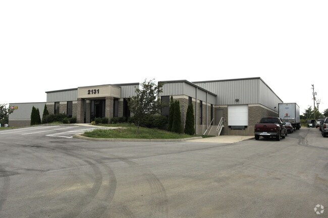
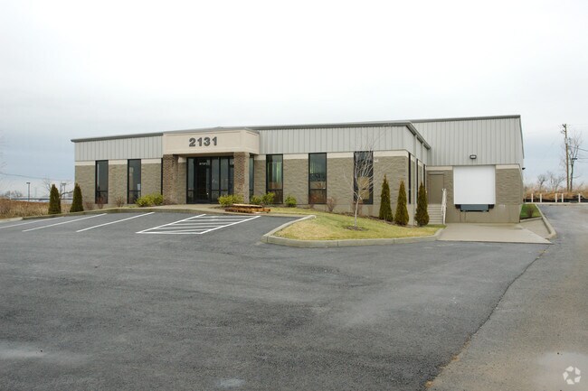
Property Record
2131 Capstone Dr, Lexington, KY 40511

Property Detail
2131 Capstone Dr
38107170
N-595 NORTHHAMPTON TRADE CENTER UNIT 3 LOT 2B; BOOK: 3006 PAGE: 321
Multipleuses
Fayette
I-1
Kentucky
B and X Area of moderate flood hazard, usually the area between the limits of the 100-year and 500-year floods.
2b
2025
1.10 AC
2025
West Lexington/Fayette
003704
Lexington/Fayette
12,184 SF
Lexington-Fayette, KY
NEARBY LISTINGS FOR SALE OR LEASE
DEMOGRAPHICS near 2131 Capstone Dr
1 mile
3 mile
5 mile
2025 Total Population
5,720
49,568
137,182
2030 Population
5,991
51,828
142,492
Pop Growth 2025-2030
+ 4.74%
+ 4.56%
+ 3.87%
Average Age
37
37
37
2025 Total Households
2,294
19,739
56,301
HH Growth 2025-2030
+ 4.88%
+ 4.81%
+ 4.26%
Median Household Inc
$92,592
$67,476
$53,293
Avg Household Size
2.40
2.40
2.20
2025 Avg HH Vehicles
2.00
2.00
2.00
Median Home Value
$241,255
$238,852
$245,994
Median Year Built
2005
1996
1972
Nearby Places
Map Layers
Map Styles
 Street
 Aerial
Layers
 Traffic
 Biking
Places
Listings with unknown addresses are not visible on the map
- Restaurants
- Banks
- Shops
- Fitness
- Groceries
PUBLIC TRANSPORTATION
AIRPORT
Blue Grass
Drive
Walk
Distance
Blue Grass
18 min
9.9 mi
Nearby Properties
Address
Land Use
TOTAL SIZE
Lot Size
Zoning
Address
Land Use
TOTAL SIZE
Lot Size
Zoning
6,173 SF
301.57 AC
A-R
Address
Land Use
TOTAL SIZE
Lot Size
Zoning
1,344 SF
150.76 AC
A-U
Address
Land Use
TOTAL SIZE
Lot Size
Zoning
163,536 SF
117.26 AC
I-1
Address
Land Use
TOTAL SIZE
Lot Size
Zoning
Address
Land Use
TOTAL SIZE
Lot Size
Zoning
292,191 SF
19.74 AC
B-5P
Address
Land Use
TOTAL SIZE
Lot Size
Zoning
61,965 SF
46.96 AC
A-U
Address
Land Use
TOTAL SIZE
Lot Size
Zoning
6,462 SF
332.36 AC
I-1
Address
Land Use
TOTAL SIZE
Lot Size
Zoning
70.44 AC
I-1
Address
Land Use
TOTAL SIZE
Lot Size
Zoning
210 SF
46.68 AC
M-1P
Address
Land Use
TOTAL SIZE
Lot Size
Zoning
107,473 SF
17 AC
A-U
Address
Land Use
TOTAL SIZE
Lot Size
Zoning
2,864 SF
7.34 AC
R-3
Address
Land Use
TOTAL SIZE
Lot Size
Zoning
16.93 AC
R-3
Address
Land Use
TOTAL SIZE
Lot Size
Zoning
441,100 SF
30 AC
I-1
Address
Land Use
TOTAL SIZE
Lot Size
Zoning
94,835 SF
21.09 AC
A-U
Address
Land Use
TOTAL SIZE
Lot Size
Zoning
Address
Land Use
TOTAL SIZE
Lot Size
Zoning
54,525 SF
25.78 AC
P-2
Address
Land Use
TOTAL SIZE
Lot Size
Zoning
255,490 SF
55.45 AC
I-1
Address
Land Use
TOTAL SIZE
Lot Size
Zoning
9.05 AC
R-3
Address
Land Use
TOTAL SIZE
Lot Size
Zoning
407,736 SF
29.54 AC
P-1
Address
Land Use
TOTAL SIZE
Lot Size
Zoning
187,120 SF
17.52 AC
I-1
Address
Land Use
TOTAL SIZE
Lot Size
Zoning
210,498 SF
18.36 AC
I-1
Address
Land Use
TOTAL SIZE
Lot Size
Zoning
286,060 SF
P-2
Address
Land Use
TOTAL SIZE
Lot Size
Zoning
604,000 SF
60.19 AC
I-1
Address
Land Use
TOTAL SIZE
Lot Size
Zoning
128,136 SF
P-2
Address
Land Use
TOTAL SIZE
Lot Size
Zoning
76,701 SF
14.98 AC
R-3
Address
Land Use
TOTAL SIZE
Lot Size
Zoning
79,463 SF
7.80 AC
R-1C
Address
Land Use
TOTAL SIZE
Lot Size
Zoning
13.50 AC
R-3
Address
Land Use
TOTAL SIZE
Lot Size
Zoning
7.01 AC
R-3
Address
Land Use
TOTAL SIZE
Lot Size
Zoning
172,215 SF
P-2
Address
Land Use
TOTAL SIZE
Lot Size
Zoning
26,470 SF
24.36 AC
I-1
The World's #1 Commercial Real Estate Marketplace
Connect with us
© 2026 CoStar Group
The information above has been obtained from sources believed reliable. While we do not doubt its accuracy we have not verified it and make no guarantee, warranty or representation about it. It is your responsibility to independently confirm its accuracy and completeness. Any projections, opinions, assumptions, or estimates used are for example only and do not represent the current or future performance of the property. The value of this transaction to you depends on tax and other factors which should be evaluated by your tax, financial, and legal advisors. You and your advisors should conduct a careful, independent investigation of the property to determine to your satisfaction the suitability of the property for your needs.