Property Record
2131 S Neil St, Champaign, IL 61820


NEARBY LISTINGS FOR SALE OR LEASE
Property Detail
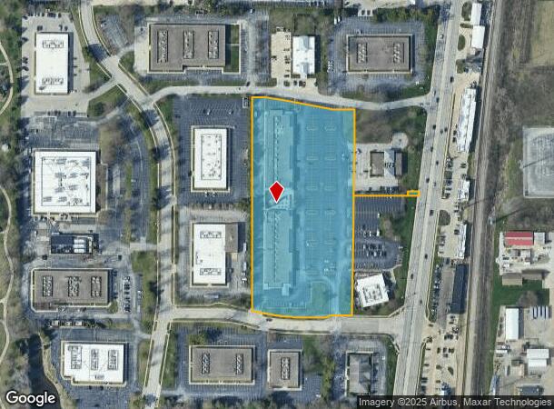
2131 S Neil St
Other Market Areas
2020R01597
Champaign-Urbana, IL
Champaign
452024401015
Illinois
Commercialnec
2020r
2023
5.41 AC
2024
Champaign-Urbana
001301
DEMOGRAPHICS near 2131 S Neil St
1 Mile
3 Mile
5 Mile
2024 Total Population
5,590
100,600
149,358
2029 Population
5,564
100,769
149,602
Pop Growth 2024-2029
(0.47%)
+ 0.17%
+ 0.16%
Average Age
43
34
35
2024 Total Households
2,545
41,280
62,251
HH Growth 2024-2029
(0.51%)
+ 0.24%
+ 0.20%
Median Household Inc
$76,136
$47,755
$51,767
Avg Household Size
2.10
2.00
2.10
2024 Avg HH Vehicles
1.00
1.00
1.00
Median Home Value
$195,642
$191,730
$184,435
Median Year Built
1968
1978
1984
Nearby Places
Map Layers
Map Styles
 Street
 Aerial
- Restaurants
- Banks
- Shops
- Fitness
- Groceries
PUBLIC TRANSPORTATION
COMMUTER RAIL
Champaign-Urbana (City of New Orleans - Amtrak, Illini - Amtrak, Saluki - Amtrak)
DRIVE
WALK
Distance
Champaign-Urbana (City of New Orleans - Amtrak, Illini - Amtrak, Saluki - Amtrak)
6 min
2.3 mi
AIRPORT
University of Illinois/Willard
DRIVE
WALK
Distance
University of Illinois/Willard
19 min
8.2 mi
Freight Ports
Port Milwaukee
DRIVE
WALK
Distance
Port Milwaukee
263 min
221.7 mi
SALE & LEASE HISTORY
LISTING DATE
SALE/LEASE

Sep 22, 2021
For Lease
Nearby Properties
Address
Land Use
TOTAL SIZE
Lot Size
Zoning
Address
Land Use
TOTAL SIZE
Lot Size
Zoning
Address
Land Use
TOTAL SIZE
Lot Size
Zoning
0.13 AC
Address
Land Use
TOTAL SIZE
Lot Size
Zoning
10.70 AC
Address
Land Use
TOTAL SIZE
Lot Size
Zoning
0.56 AC
Address
Land Use
TOTAL SIZE
Lot Size
Zoning
32.35 AC
Address
Land Use
TOTAL SIZE
Lot Size
Zoning
Address
Land Use
TOTAL SIZE
Lot Size
Zoning
0.82 AC
Address
Land Use
TOTAL SIZE
Lot Size
Zoning
Address
Land Use
TOTAL SIZE
Lot Size
Zoning
Address
Land Use
TOTAL SIZE
Lot Size
Zoning
1.31 AC
Address
Land Use
TOTAL SIZE
Lot Size
Zoning
0.18 AC
Address
Land Use
TOTAL SIZE
Lot Size
Zoning
Address
Land Use
TOTAL SIZE
Lot Size
Zoning
Address
Land Use
TOTAL SIZE
Lot Size
Zoning
Address
Land Use
TOTAL SIZE
Lot Size
Zoning
Address
Land Use
TOTAL SIZE
Lot Size
Zoning
0.75 AC
Address
Land Use
TOTAL SIZE
Lot Size
Zoning
120.50 AC
Address
Land Use
TOTAL SIZE
Lot Size
Zoning
2.35 AC
Address
Land Use
TOTAL SIZE
Lot Size
Zoning
0.20 AC
Address
Land Use
TOTAL SIZE
Lot Size
Zoning
0.81 AC
Address
Land Use
TOTAL SIZE
Lot Size
Zoning
1.85 AC
Address
Land Use
TOTAL SIZE
Lot Size
Zoning
0.70 AC
Address
Land Use
TOTAL SIZE
Lot Size
Zoning
Address
Land Use
TOTAL SIZE
Lot Size
Zoning
12.42 AC
Address
Land Use
TOTAL SIZE
Lot Size
Zoning
14.39 AC
Address
Land Use
TOTAL SIZE
Lot Size
Zoning
0.22 AC
Address
Land Use
TOTAL SIZE
Lot Size
Zoning
0.85 AC
Address
Land Use
TOTAL SIZE
Lot Size
Zoning
2.01 AC
Address
Land Use
TOTAL SIZE
Lot Size
Zoning
Address
Land Use
TOTAL SIZE
Lot Size
Zoning
The World's #1 Commercial Real Estate Marketplace
Connect with us
© 2026 CoStar Group
The information above has been obtained from sources believed reliable. While we do not doubt its accuracy we have not verified it and make no guarantee, warranty or representation about it. It is your responsibility to independently confirm its accuracy and completeness. Any projections, opinions, assumptions, or estimates used are for example only and do not represent the current or future performance of the property. The value of this transaction to you depends on tax and other factors which should be evaluated by your tax, financial, and legal advisors. You and your advisors should conduct a careful, independent investigation of the property to determine to your satisfaction the suitability of the property for your needs.