Property Record
2132 Fordem Ave, Madison, WI 53704


Property Detail
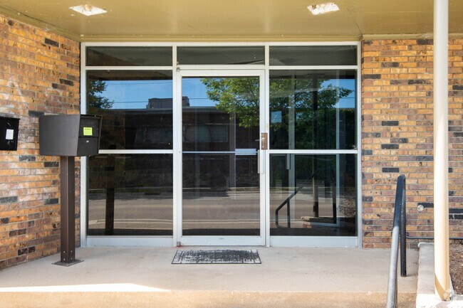
2132 Fordem Ave
0709-121-0108-0
T7N R9E, SEC 12, PART OF GOVERNMENT LOT 1, DESC AS FOL: BEG AT NE COR OF SD GOV LOT 1; TH S 0 DEG 15 MIN W ALG E LINE OF SEC 12, 1234.1 FT; TH N 65 DEG W 212.5 FT; TH N 25 DEG E & PARA TO C/L OF SHERMAN AVE & 165 FT SELY THEREFROM 119 FT TO POB; TH N
Commercialnec
Dane
NMX
Wisconsin
B and X Area of moderate flood hazard, usually the area between the limits of the 100-year and 500-year floods.
1
2025
0.19 AC
2025
Northeast Madison
001804
Milwaukee/Madison
2,636 SF
Madison, WI
NEARBY LISTINGS FOR SALE OR LEASE
DEMOGRAPHICS near 2132 Fordem Ave
1 mile
3 mile
5 mile
2025 Total Population
12,016
106,729
222,720
2030 Population
12,534
113,003
236,803
Pop Growth 2025-2030
+ 4.31%
+ 5.88%
+ 6.32%
Average Age
40
35
36
2025 Total Households
6,400
48,920
99,530
HH Growth 2025-2030
+ 4.53%
+ 6.14%
+ 6.68%
Median Household Inc
$68,485
$59,103
$66,394
Avg Household Size
1.90
2.00
2.10
2025 Avg HH Vehicles
2.00
1.00
1.00
Median Home Value
$333,873
$358,378
$362,875
Median Year Built
1953
1974
1978
Nearby Places
Map Layers
Map Styles
 Street
 Aerial
Transit
 Traffic
 Biking
Places
Listings with unknown addresses are not visible on the map
- Restaurants
- Banks
- Shops
- Fitness
- Groceries
PUBLIC TRANSPORTATION
AIRPORT
Dane County Regional/Truax Field
Drive
Walk
Distance
Dane County Regional/Truax Field
7 min
3.2 mi
SALE & LEASE HISTORY
LISTING DATE
SALE/LEASE

Jun 23, 2021
For Lease
Jun 23, 2021
For Sale
Nearby Properties
Address
Land Use
TOTAL SIZE
Lot Size
Zoning
Address
Land Use
TOTAL SIZE
Lot Size
Zoning
489,181 SF
1.82 AC
PD
Address
Land Use
TOTAL SIZE
Lot Size
Zoning
459,624 SF
1.62 AC
DC
Address
Land Use
TOTAL SIZE
Lot Size
Zoning
383,873 SF
0.99 AC
UMX
Address
Land Use
TOTAL SIZE
Lot Size
Zoning
324,916 SF
1.08 AC
PD
Address
Land Use
TOTAL SIZE
Lot Size
Zoning
466,790 SF
761.23 AC
PD
Address
Land Use
TOTAL SIZE
Lot Size
Zoning
287,341 SF
40.17 AC
IL
Address
Land Use
TOTAL SIZE
Lot Size
Zoning
461,594 SF
3.37 AC
CC-T
Address
Land Use
TOTAL SIZE
Lot Size
Zoning
374,339 SF
1.43 AC
UMX
Address
Land Use
TOTAL SIZE
Lot Size
Zoning
212,429 SF
0.66 AC
UMX
Address
Land Use
TOTAL SIZE
Lot Size
Zoning
210,515 SF
0.80 AC
UMX
Address
Land Use
TOTAL SIZE
Lot Size
Zoning
259,663 SF
414.76 AC
PD
Address
Land Use
TOTAL SIZE
Lot Size
Zoning
188,206 SF
0.80 AC
UMX
Address
Land Use
TOTAL SIZE
Lot Size
Zoning
278,154 SF
3.88 AC
TE
Address
Land Use
TOTAL SIZE
Lot Size
Zoning
158,832 SF
0.58 AC
WP-17
Address
Land Use
TOTAL SIZE
Lot Size
Zoning
403,079 SF
1.08 AC
WP-17
Address
Land Use
TOTAL SIZE
Lot Size
Zoning
412,945 SF
1.30 AC
WP-17
Address
Land Use
TOTAL SIZE
Lot Size
Zoning
212,259 SF
0.87 AC
UMX
Address
Land Use
TOTAL SIZE
Lot Size
Zoning
296,708 SF
1 AC
WP-24
Address
Land Use
TOTAL SIZE
Lot Size
Zoning
289,884 SF
19.36 AC
SR-V2
Address
Land Use
TOTAL SIZE
Lot Size
Zoning
211,457 SF
329.05 AC
WP-24
Address
Land Use
TOTAL SIZE
Lot Size
Zoning
145,539 SF
0.60 AC
UMX
Address
Land Use
TOTAL SIZE
Lot Size
Zoning
194,232 SF
2.25 AC
TR-U2
Address
Land Use
TOTAL SIZE
Lot Size
Zoning
230,007 SF
0.76 AC
PD
Address
Land Use
TOTAL SIZE
Lot Size
Zoning
153,684 SF
0.50 AC
DC
Address
Land Use
TOTAL SIZE
Lot Size
Zoning
181,893 SF
0.64 AC
PD
Address
Land Use
TOTAL SIZE
Lot Size
Zoning
268,388 SF
1 AC
WP-24
Address
Land Use
TOTAL SIZE
Lot Size
Zoning
135,478 SF
0.41 AC
UMX
Address
Land Use
TOTAL SIZE
Lot Size
Zoning
104,936 SF
1.19 AC
PD
Address
Land Use
TOTAL SIZE
Lot Size
Zoning
216,017 SF
3.35 AC
TE
Address
Land Use
TOTAL SIZE
Lot Size
Zoning
425,812 SF
1 AC
WP-17
The World's #1 Commercial Real Estate Marketplace
Connect with us
© 2026 CoStar Group
The information above has been obtained from sources believed reliable. While we do not doubt its accuracy we have not verified it and make no guarantee, warranty or representation about it. It is your responsibility to independently confirm its accuracy and completeness. Any projections, opinions, assumptions, or estimates used are for example only and do not represent the current or future performance of the property. The value of this transaction to you depends on tax and other factors which should be evaluated by your tax, financial, and legal advisors. You and your advisors should conduct a careful, independent investigation of the property to determine to your satisfaction the suitability of the property for your needs.