Property Record
21320 Ethanac Rd, Perris, CA 92570

Property Detail
21320 Ethanac Rd
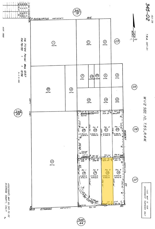
345-020-018
10.00 ACRES GRS IN PARS C, G & 3 PM 077/094 PM 12157
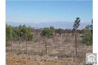
Agriculturalland
RIVERSIDE
RR
California
B and X Area of moderate flood hazard, usually the area between the limits of the 100-year and 500-year floods.
c,g,3
2024
10 AC
2025
South Riverside
042903
Inland Empire (California)
696 SF
Riverside-San Bernardino-Ontario, CA
NEARBY LISTINGS FOR SALE OR LEASE
DEMOGRAPHICS near 21320 Ethanac Rd
1 mile
3 mile
5 mile
2025 Total Population
1,535
13,941
75,551
2030 Population
1,593
14,287
77,906
Pop Growth 2025-2030
+ 3.78%
+ 2.48%
+ 3.12%
Average Age
35
35
37
2025 Total Households
369
3,432
21,537
HH Growth 2025-2030
+ 3.79%
+ 2.13%
+ 2.84%
Median Household Inc
$55,357
$72,442
$85,726
Avg Household Size
3.90
3.80
3.40
2025 Avg HH Vehicles
3.00
3.00
2.00
Median Home Value
$297,367
$514,648
$563,754
Median Year Built
1985
1987
1991
Nearby Places
Map Layers
Map Styles
 Street
 Aerial
Transit
 Traffic
 Biking
Places
Listings with unknown addresses are not visible on the map
- Restaurants
- Banks
- Shops
- Fitness
- Groceries
PUBLIC TRANSPORTATION
COMMUTER RAIL
Drive
Walk
Distance
8 min
4.8 mi
Drive
Walk
Distance
11 min
6.7 mi
AIRPORT
Ontario International
Drive
Walk
Distance
Ontario International
48 min
37.4 mi
SALE & LEASE HISTORY
LISTING DATE
SALE/LEASE

Feb 19, 2018
For Sale
Nearby Properties
Address
Land Use
TOTAL SIZE
Lot Size
Zoning
Address
Land Use
TOTAL SIZE
Lot Size
Zoning
198.39 AC
RR
Address
Land Use
TOTAL SIZE
Lot Size
Zoning
7,549 SF
1.97 AC
RR
Address
Land Use
TOTAL SIZE
Lot Size
Zoning
3,000 SF
3.07 AC
MSC
Address
Land Use
TOTAL SIZE
Lot Size
Zoning
44,323 SF
20.31 AC
Address
Land Use
TOTAL SIZE
Lot Size
Zoning
1,200 SF
C1CP
Address
Land Use
TOTAL SIZE
Lot Size
Zoning
10,133 SF
10 AC
RA10
Address
Land Use
TOTAL SIZE
Lot Size
Zoning
720 SF
6.11 AC
RR
Address
Land Use
TOTAL SIZE
Lot Size
Zoning
4,586 SF
9.93 AC
RR
Address
Land Use
TOTAL SIZE
Lot Size
Zoning
1,272 SF
14.65 AC
RR
Address
Land Use
TOTAL SIZE
Lot Size
Zoning
40 AC
RR
Address
Land Use
TOTAL SIZE
Lot Size
Zoning
12,554 SF
76.20 AC
RA5
Address
Land Use
TOTAL SIZE
Lot Size
Zoning
1,440 SF
2.22 AC
RR
Address
Land Use
TOTAL SIZE
Lot Size
Zoning
40.19 AC
RR
Address
Land Use
TOTAL SIZE
Lot Size
Zoning
1,243 SF
9 AC
RR
Address
Land Use
TOTAL SIZE
Lot Size
Zoning
2,080 SF
0.95 AC
M3
Address
Land Use
TOTAL SIZE
Lot Size
Zoning
2,432 SF
2.13 AC
RR
The World's #1 Commercial Real Estate Marketplace
Connect with us
© 2026 CoStar Group
The information above has been obtained from sources believed reliable. While we do not doubt its accuracy we have not verified it and make no guarantee, warranty or representation about it. It is your responsibility to independently confirm its accuracy and completeness. Any projections, opinions, assumptions, or estimates used are for example only and do not represent the current or future performance of the property. The value of this transaction to you depends on tax and other factors which should be evaluated by your tax, financial, and legal advisors. You and your advisors should conduct a careful, independent investigation of the property to determine to your satisfaction the suitability of the property for your needs.