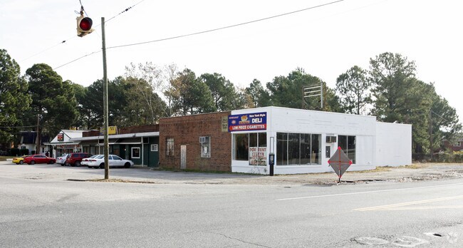
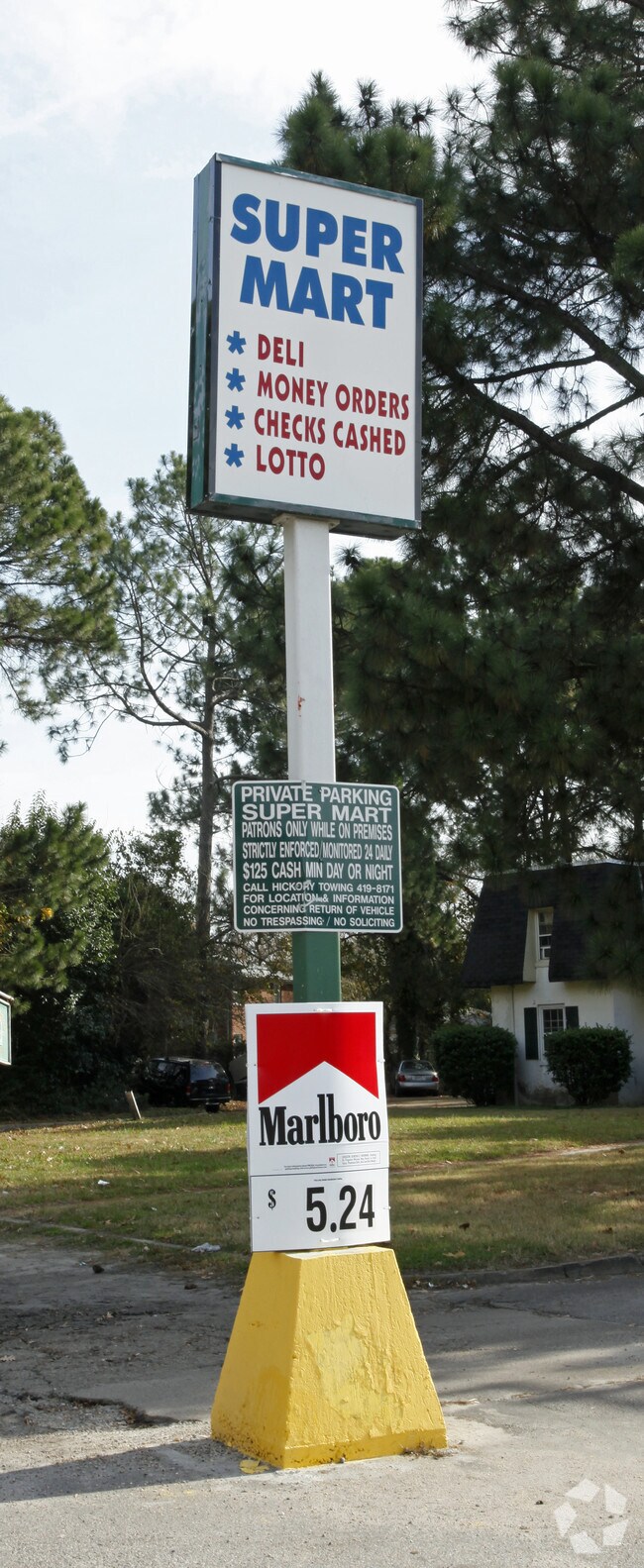
Property Record
2133 Chesapeake Dr, Chesapeake, VA 23324
Property Detail
2133 Chesapeake Dr
1390000001900
LOT B-1 RESUB LOTS A&B SUB FOR JOHN A BURFOOT FOR SUNNYBROOK APTS LLC 1.243AC
Storebuilding
Chesapeake City
B2: GENERA
Virginia
AE The base floodplain where base flood elevations are provided. AE Zones are now used on new format FIRMs instead of A1-A30 Zones.
1.24 AC
2024
Campostella/S Norfolk
2025
Hampton Roads
020400
Virginia Beach-Chesapeake-Norfolk, VA-NC
12,979 SF
NEARBY LISTINGS FOR SALE OR LEASE
DEMOGRAPHICS near 2133 Chesapeake Dr
1 mile
3 mile
5 mile
2025 Total Population
10,865
82,152
253,161
2030 Population
11,089
82,873
253,466
Pop Growth 2025-2030
+ 2.06%
+ 0.88%
+ 0.12%
Average Age
37
37
38
2025 Total Households
3,968
32,163
102,651
HH Growth 2025-2030
+ 2.17%
+ 0.84%
+ 0.03%
Median Household Inc
$67,012
$57,274
$64,324
Avg Household Size
2.70
2.40
2.40
2025 Avg HH Vehicles
2.00
2.00
2.00
Median Home Value
$263,001
$254,195
$285,001
Median Year Built
1961
1973
1976
Nearby Places
Map Layers
Map Styles
 Street
 Aerial
Transit
 Traffic
 Biking
Places
Listings with unknown addresses are not visible on the map
- Restaurants
- Banks
- Shops
- Fitness
- Groceries
PUBLIC TRANSPORTATION
COMMUTER RAIL
Norfolk (Northeast Regional - Amtrak)
Drive
Walk
Distance
Norfolk (Northeast Regional - Amtrak)
6 min
3.8 mi
AIRPORT
Norfolk International
Drive
Walk
Distance
Norfolk International
18 min
9.1 mi
Newport News/Williamsburg International
Drive
Walk
Distance
Newport News/Williamsburg International
47 min
31.9 mi
Freight Ports
Virginia Port Authority - Portsmouth
Drive
Walk
Distance
Virginia Port Authority - Portsmouth
15 min
7.7 mi
SALE & LEASE HISTORY
LISTING DATE
SALE/LEASE

Oct 06, 2016
For Sale
Nov 15, 2016
For Sale
May 12, 2017
For Sale
Nearby Properties
Address
Land Use
TOTAL SIZE
Lot Size
Zoning
Address
Land Use
TOTAL SIZE
Lot Size
Zoning
5,704 SF
4.67 AC
D2
Address
Land Use
TOTAL SIZE
Lot Size
Zoning
482.38 AC
MULTI: MUL
Address
Land Use
TOTAL SIZE
Lot Size
Zoning
743,121 SF
57.42 AC
RMF1: MULT
Address
Land Use
TOTAL SIZE
Lot Size
Zoning
421,856 SF
2.64 AC
D1
Address
Land Use
TOTAL SIZE
Lot Size
Zoning
689,954 SF
63.25 AC
Address
Land Use
TOTAL SIZE
Lot Size
Zoning
473,072 SF
9.72 AC
SD
Address
Land Use
TOTAL SIZE
Lot Size
Zoning
358,908 SF
22.21 AC
MULTI: MUL
Address
Land Use
TOTAL SIZE
Lot Size
Zoning
258,000 SF
1.38 AC
M2: GENERA
Address
Land Use
TOTAL SIZE
Lot Size
Zoning
363,974 SF
1.49 AC
Address
Land Use
TOTAL SIZE
Lot Size
Zoning
264,213 SF
17.59 AC
PUD: PLANN
Address
Land Use
TOTAL SIZE
Lot Size
Zoning
356,598 SF
1.84 AC
D2
Address
Land Use
TOTAL SIZE
Lot Size
Zoning
252,524 SF
20 AC
R8S: RESID
Address
Land Use
TOTAL SIZE
Lot Size
Zoning
197,074 SF
6.69 AC
Address
Land Use
TOTAL SIZE
Lot Size
Zoning
188,152 SF
16.93 AC
Address
Land Use
TOTAL SIZE
Lot Size
Zoning
32,163 SF
17.59 AC
MULTI: MUL
Address
Land Use
TOTAL SIZE
Lot Size
Zoning
608,074 SF
0.60 AC
Address
Land Use
TOTAL SIZE
Lot Size
Zoning
366,720 SF
23 AC
RMF1: MULT
Address
Land Use
TOTAL SIZE
Lot Size
Zoning
56,217 SF
1.31 AC
Address
Land Use
TOTAL SIZE
Lot Size
Zoning
401,302 SF
18.74 AC
M2: GENERA
Address
Land Use
TOTAL SIZE
Lot Size
Zoning
128,596 SF
16.91 AC
M2: GENERA
Address
Land Use
TOTAL SIZE
Lot Size
Zoning
142,656 SF
22.17 AC
RMF1: MULT
Address
Land Use
TOTAL SIZE
Lot Size
Zoning
287,268 SF
83.63 AC
MULTI: MUL
Address
Land Use
TOTAL SIZE
Lot Size
Zoning
34.54 AC
IN2
Address
Land Use
TOTAL SIZE
Lot Size
Zoning
127,755 SF
14.68 AC
PUD: PLANN
Address
Land Use
TOTAL SIZE
Lot Size
Zoning
186,138 SF
0.26 AC
Address
Land Use
TOTAL SIZE
Lot Size
Zoning
20.11 AC
Address
Land Use
TOTAL SIZE
Lot Size
Zoning
237,629 SF
2.65 AC
T6
Address
Land Use
TOTAL SIZE
Lot Size
Zoning
175,679 SF
9.83 AC
IN1
Address
Land Use
TOTAL SIZE
Lot Size
Zoning
1,880 SF
13.30 AC
PUD: PLANN
Address
Land Use
TOTAL SIZE
Lot Size
Zoning
750 SF
103.88 AC
I5
The World's #1 Commercial Real Estate Marketplace
Connect with us
© 2026 CoStar Group
The information above has been obtained from sources believed reliable. While we do not doubt its accuracy we have not verified it and make no guarantee, warranty or representation about it. It is your responsibility to independently confirm its accuracy and completeness. Any projections, opinions, assumptions, or estimates used are for example only and do not represent the current or future performance of the property. The value of this transaction to you depends on tax and other factors which should be evaluated by your tax, financial, and legal advisors. You and your advisors should conduct a careful, independent investigation of the property to determine to your satisfaction the suitability of the property for your needs.