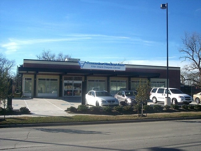
Property Record
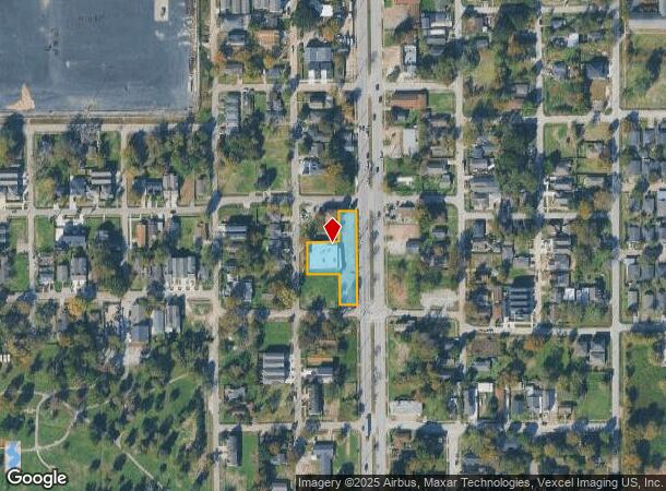
2133 Lockwood Dr, Houston, TX 77020
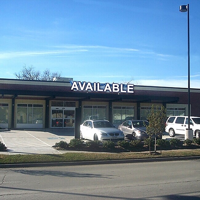
This Property Is For Sale
NEARBY LISTINGS FOR SALE OR LEASE
Property Detail
2133 Lockwood Dr
1301700010001
Lockwood Professional Building
Medicalbuilding
RES A BLK 1 LOCKWOOD PROFESSIONAL BUILDING
X
Harris
48201C0690N
Texas
2024
0.60 AC
2025
I-10 East
211302
Houston
7,550 SF
Houston-The Woodlands-Sugar Land, TX
DEMOGRAPHICS near 2133 Lockwood Dr
1 Mile
3 Mile
5 Mile
2024 Total Population
18,511
109,174
332,157
2029 Population
19,155
113,153
344,529
Pop Growth 2024-2029
+ 3.48%
+ 3.64%
+ 3.72%
Average Age
37
38
37
2024 Total Households
6,570
37,614
128,311
HH Growth 2024-2029
+ 3.55%
+ 4.14%
+ 4.08%
Median Household Inc
$33,630
$38,445
$52,122
Avg Household Size
2.80
2.60
2.40
2024 Avg HH Vehicles
2.00
2.00
2.00
Median Home Value
$110,149
$157,627
$224,744
Median Year Built
1958
1959
1968
Nearby Places
- Restaurants
- Banks
- Shops
- Fitness
- Groceries
PUBLIC TRANSPORTATION
COMMUTER RAIL
Houston (Sunset Limited - Amtrak)
DRIVE
WALK
Distance
Houston (Sunset Limited - Amtrak)
8 min
4.2 mi
AIRPORT
William P Hobby
DRIVE
WALK
Distance
William P Hobby
25 min
13.1 mi
George Bush Intcntl/Houston
DRIVE
WALK
Distance
George Bush Intcntl/Houston
25 min
17.6 mi
Freight Ports
Port of Houston
DRIVE
WALK
Distance
Port of Houston
14 min
7.4 mi
Nearby Properties
Address
Land Use
TOTAL SIZE
Lot Size
Zoning
Address
Land Use
TOTAL SIZE
Lot Size
Zoning
100.26 AC
Address
Land Use
TOTAL SIZE
Lot Size
Zoning
12,206,592 SF
212.18 AC
Address
Land Use
TOTAL SIZE
Lot Size
Zoning
575,578 SF
1.46 AC
Address
Land Use
TOTAL SIZE
Lot Size
Zoning
644,794 SF
3.38 AC
Address
Land Use
TOTAL SIZE
Lot Size
Zoning
587,515 SF
4.85 AC
Address
Land Use
TOTAL SIZE
Lot Size
Zoning
400,641 SF
1.86 AC
Address
Land Use
TOTAL SIZE
Lot Size
Zoning
406,772 SF
4.30 AC
Address
Land Use
TOTAL SIZE
Lot Size
Zoning
793,077 SF
49.76 AC
Address
Land Use
TOTAL SIZE
Lot Size
Zoning
199,210 SF
1.44 AC
Address
Land Use
TOTAL SIZE
Lot Size
Zoning
463,768 SF
6.23 AC
Address
Land Use
TOTAL SIZE
Lot Size
Zoning
406,586 SF
4.03 AC
Address
Land Use
TOTAL SIZE
Lot Size
Zoning
186,808 SF
4.73 AC
Address
Land Use
TOTAL SIZE
Lot Size
Zoning
186,460 SF
1.45 AC
Address
Land Use
TOTAL SIZE
Lot Size
Zoning
Address
Land Use
TOTAL SIZE
Lot Size
Zoning
498,726 SF
4.97 AC
Address
Land Use
TOTAL SIZE
Lot Size
Zoning
923,370 SF
13.72 AC
Address
Land Use
TOTAL SIZE
Lot Size
Zoning
224,741 SF
10.75 AC
Address
Land Use
TOTAL SIZE
Lot Size
Zoning
111,415 SF
0.93 AC
Address
Land Use
TOTAL SIZE
Lot Size
Zoning
240,968 SF
12.45 AC
Address
Land Use
TOTAL SIZE
Lot Size
Zoning
923,370 SF
13.76 AC
Address
Land Use
TOTAL SIZE
Lot Size
Zoning
143,834 SF
0.68 AC
Address
Land Use
TOTAL SIZE
Lot Size
Zoning
200,902 SF
4.36 AC
Address
Land Use
TOTAL SIZE
Lot Size
Zoning
190,512 SF
8.81 AC
Address
Land Use
TOTAL SIZE
Lot Size
Zoning
225,393 SF
20.59 AC
Address
Land Use
TOTAL SIZE
Lot Size
Zoning
80,150 SF
0.65 AC
Address
Land Use
TOTAL SIZE
Lot Size
Zoning
217,701 SF
1.45 AC
Address
Land Use
TOTAL SIZE
Lot Size
Zoning
433,639 SF
19.89 AC
Address
Land Use
TOTAL SIZE
Lot Size
Zoning
369,170 SF
2.46 AC
Address
Land Use
TOTAL SIZE
Lot Size
Zoning
238,125 SF
12.73 AC
Address
Land Use
TOTAL SIZE
Lot Size
Zoning
789,346 SF
52.49 AC
The World's #1 Commercial Real Estate Marketplace
Connect with us
© 2025 CoStar Group
The information above has been obtained from sources believed reliable. While we do not doubt its accuracy we have not verified it and make no guarantee, warranty or representation about it. It is your responsibility to independently confirm its accuracy and completeness. Any projections, opinions, assumptions, or estimates used are for example only and do not represent the current or future performance of the property. The value of this transaction to you depends on tax and other factors which should be evaluated by your tax, financial, and legal advisors. You and your advisors should conduct a careful, independent investigation of the property to determine to your satisfaction the suitability of the property for your needs.