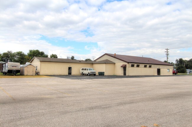
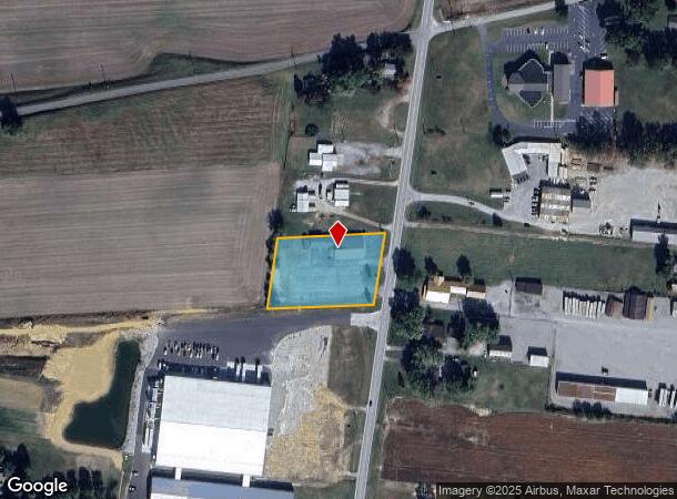
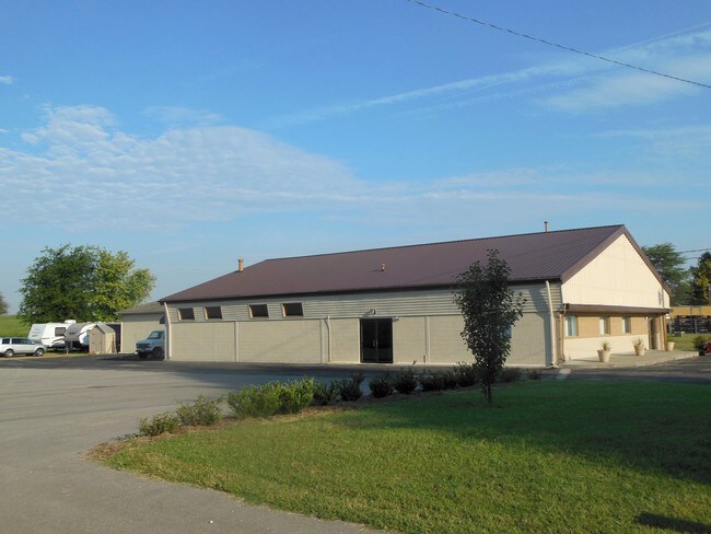
Property Record
2134 Calhoun Rd, Owensboro, KY 42301
NEARBY LISTINGS FOR SALE OR LEASE
Property Detail
2134 Calhoun Rd
039-00-00-044-00-000
2134 HWY 81
Taxexempt
Daviess
X
Kentucky
21059C0256E
1.35 AC
0
Kentucky West Area
2025
Other Market Areas
001800
Owensboro, KY
6,357 SF
DEMOGRAPHICS near 2134 Calhoun Rd
1 Mile
3 Mile
5 Mile
2024 Total Population
559
29,479
58,171
2029 Population
558
29,397
58,270
Pop Growth 2024-2029
(0.18%)
(0.28%)
+ 0.17%
Average Age
40
40
40
2024 Total Households
223
12,077
24,302
HH Growth 2024-2029
0.00%
(0.26%)
+ 0.21%
Median Household Inc
$96,341
$56,649
$52,037
Avg Household Size
2.50
2.40
2.30
2024 Avg HH Vehicles
2.00
2.00
2.00
Median Home Value
$227,500
$155,190
$149,065
Median Year Built
1991
1973
1970
Nearby Places
Map Layers
Map Styles
 Street
 Aerial
- Restaurants
- Banks
- Shops
- Fitness
- Groceries
PUBLIC TRANSPORTATION
AIRPORT
Evansville Regional
DRIVE
WALK
Distance
Evansville Regional
58 min
41.1 mi
Freight Ports
Port of Toledo
DRIVE
WALK
Distance
Port of Toledo
479 min
418.3 mi
SALE & LEASE HISTORY
LISTING DATE
SALE/LEASE

Sep 24, 2016
For Sale
Mar 13, 2017
For Sale
Nearby Properties
Address
Land Use
TOTAL SIZE
Lot Size
Zoning
Address
Land Use
TOTAL SIZE
Lot Size
Zoning
198,394 SF
49.52 AC
Address
Land Use
TOTAL SIZE
Lot Size
Zoning
454,200 SF
44.55 AC
Address
Land Use
TOTAL SIZE
Lot Size
Zoning
424,078 SF
43.02 AC
Address
Land Use
TOTAL SIZE
Lot Size
Zoning
215,439 SF
15.02 AC
Address
Land Use
TOTAL SIZE
Lot Size
Zoning
326,232 SF
29.64 AC
Address
Land Use
TOTAL SIZE
Lot Size
Zoning
54,713 SF
20 AC
Address
Land Use
TOTAL SIZE
Lot Size
Zoning
45,860 SF
13.88 AC
Address
Land Use
TOTAL SIZE
Lot Size
Zoning
69,884 SF
61.31 AC
Address
Land Use
TOTAL SIZE
Lot Size
Zoning
82,396 SF
28.50 AC
Address
Land Use
TOTAL SIZE
Lot Size
Zoning
24.58 AC
Address
Land Use
TOTAL SIZE
Lot Size
Zoning
212,423 SF
Address
Land Use
TOTAL SIZE
Lot Size
Zoning
17,289 SF
810.94 AC
Address
Land Use
TOTAL SIZE
Lot Size
Zoning
125,000 SF
20.10 AC
Address
Land Use
TOTAL SIZE
Lot Size
Zoning
87,184 SF
8.62 AC
Address
Land Use
TOTAL SIZE
Lot Size
Zoning
25,087 SF
22.57 AC
Address
Land Use
TOTAL SIZE
Lot Size
Zoning
69,192 SF
8.84 AC
Address
Land Use
TOTAL SIZE
Lot Size
Zoning
38,101 SF
2.35 AC
Address
Land Use
TOTAL SIZE
Lot Size
Zoning
67,443 SF
19.77 AC
Address
Land Use
TOTAL SIZE
Lot Size
Zoning
116,208 SF
Address
Land Use
TOTAL SIZE
Lot Size
Zoning
24,020 SF
2.14 AC
Address
Land Use
TOTAL SIZE
Lot Size
Zoning
43,857 SF
7.35 AC
Address
Land Use
TOTAL SIZE
Lot Size
Zoning
37,579 SF
2.41 AC
Address
Land Use
TOTAL SIZE
Lot Size
Zoning
101,280 SF
8.23 AC
Address
Land Use
TOTAL SIZE
Lot Size
Zoning
51,288 SF
Address
Land Use
TOTAL SIZE
Lot Size
Zoning
45,832 SF
3.64 AC
Address
Land Use
TOTAL SIZE
Lot Size
Zoning
62,361 SF
4.60 AC
Address
Land Use
TOTAL SIZE
Lot Size
Zoning
77,450 SF
3.76 AC
Address
Land Use
TOTAL SIZE
Lot Size
Zoning
121,307 SF
20.26 AC
Address
Land Use
TOTAL SIZE
Lot Size
Zoning
64,736 SF
39.34 AC
Address
Land Use
TOTAL SIZE
Lot Size
Zoning
1,752 SF
4.57 AC
The World's #1 Commercial Real Estate Marketplace
Connect with us
© 2025 CoStar Group
The information above has been obtained from sources believed reliable. While we do not doubt its accuracy we have not verified it and make no guarantee, warranty or representation about it. It is your responsibility to independently confirm its accuracy and completeness. Any projections, opinions, assumptions, or estimates used are for example only and do not represent the current or future performance of the property. The value of this transaction to you depends on tax and other factors which should be evaluated by your tax, financial, and legal advisors. You and your advisors should conduct a careful, independent investigation of the property to determine to your satisfaction the suitability of the property for your needs.