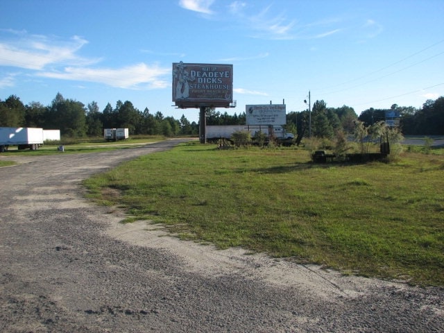
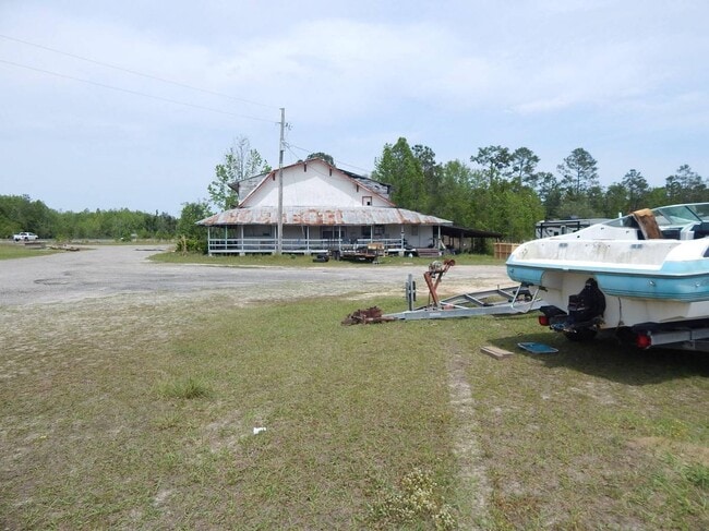
Property Record
2134 Highway 231, Cottondale, FL 32431

Property Detail
2134 Highway 231
25-4N-12-0000-0040-0130
OR 1042 P 80 COMM AT SEC OF NE1/4 OF SECT, RUN N 88* W 1380.28 FT, N 519.26 FT TO N/LY RTWY OF ROWELL RD TO BEGIN, N 1334.78 FT, N 88* W 236.24 FT, N 168.27 FT TO S/LY RTWY OF HWY 276, S 69* W ALONG SAID RTWY 89.63 FT TO E/LY RTWY OF HWY 231 BEING CU
Miscellaneous
JACKSON
A Areas with a 1% annual chance of flooding and a 26% chance of flooding over the life of a 30-year mortgage.
Florida
2025
40
2025
31.54 AC
211100
Florida Panhandle Area
9,938 SF
Other Market Areas
NEARBY LISTINGS FOR SALE OR LEASE
DEMOGRAPHICS near 2134 Highway 231
1 mile
3 mile
5 mile
2025 Total Population
266
2,108
4,095
2030 Population
272
2,155
4,202
Pop Growth 2025-2030
+ 2.26%
+ 2.23%
+ 2.61%
Average Age
41
42
42
2025 Total Households
107
850
1,657
HH Growth 2025-2030
+ 2.80%
+ 2.94%
+ 3.32%
Median Household Inc
$54,687
$53,520
$53,058
Avg Household Size
2.40
2.40
2.40
2025 Avg HH Vehicles
2.00
2.00
2.00
Median Home Value
$187,999
$183,415
$187,189
Median Year Built
1985
1985
1987
Nearby Places
Map Layers
Map Styles
 Street
 Aerial
Layers
 Traffic
 Biking
Places
Listings with unknown addresses are not visible on the map
- Restaurants
- Banks
- Shops
- Fitness
- Groceries
SALE & LEASE HISTORY
LISTING DATE
SALE/LEASE

Apr 21, 2021
For Sale
Nearby Properties
Address
Land Use
TOTAL SIZE
Lot Size
Zoning
Address
Land Use
TOTAL SIZE
Lot Size
Zoning
95,512 SF
146.60 AC
Address
Land Use
TOTAL SIZE
Lot Size
Zoning
17,467 SF
10 AC
Address
Land Use
TOTAL SIZE
Lot Size
Zoning
10,430 SF
6.31 AC
Address
Land Use
TOTAL SIZE
Lot Size
Zoning
7,784 SF
0.62 AC
Address
Land Use
TOTAL SIZE
Lot Size
Zoning
10,748 SF
4.44 AC
Address
Land Use
TOTAL SIZE
Lot Size
Zoning
3,933 SF
6.11 AC
Address
Land Use
TOTAL SIZE
Lot Size
Zoning
13,102 SF
16.64 AC
Address
Land Use
TOTAL SIZE
Lot Size
Zoning
9,731 SF
2.55 AC
Address
Land Use
TOTAL SIZE
Lot Size
Zoning
17,236 SF
2.82 AC
Address
Land Use
TOTAL SIZE
Lot Size
Zoning
8,420 SF
1.32 AC
Address
Land Use
TOTAL SIZE
Lot Size
Zoning
4,868 SF
40 AC
Address
Land Use
TOTAL SIZE
Lot Size
Zoning
9,208 SF
44 AC
Address
Land Use
TOTAL SIZE
Lot Size
Zoning
4,514 SF
16.02 AC
Address
Land Use
TOTAL SIZE
Lot Size
Zoning
8,744 SF
47.54 AC
Address
Land Use
TOTAL SIZE
Lot Size
Zoning
10,924 SF
7.70 AC
Address
Land Use
TOTAL SIZE
Lot Size
Zoning
8,300 SF
10 AC
Address
Land Use
TOTAL SIZE
Lot Size
Zoning
8,860 SF
10 AC
Address
Land Use
TOTAL SIZE
Lot Size
Zoning
8,146 SF
5 AC
Address
Land Use
TOTAL SIZE
Lot Size
Zoning
5,460 SF
13.96 AC
Address
Land Use
TOTAL SIZE
Lot Size
Zoning
5,206 SF
12.14 AC
Address
Land Use
TOTAL SIZE
Lot Size
Zoning
5,291 SF
19 AC
Address
Land Use
TOTAL SIZE
Lot Size
Zoning
7,433 SF
3.70 AC
Address
Land Use
TOTAL SIZE
Lot Size
Zoning
6,113 SF
77 AC
Address
Land Use
TOTAL SIZE
Lot Size
Zoning
3,656 SF
0.47 AC
Address
Land Use
TOTAL SIZE
Lot Size
Zoning
4,240 SF
38.90 AC
Address
Land Use
TOTAL SIZE
Lot Size
Zoning
6,492 SF
5.70 AC
Address
Land Use
TOTAL SIZE
Lot Size
Zoning
9,100 SF
10 AC
Address
Land Use
TOTAL SIZE
Lot Size
Zoning
39.47 AC
Address
Land Use
TOTAL SIZE
Lot Size
Zoning
2,916 SF
25 AC
Address
Land Use
TOTAL SIZE
Lot Size
Zoning
7,357 SF
13 AC
The World's #1 Commercial Real Estate Marketplace
Connect with us
© 2026 CoStar Group
The information above has been obtained from sources believed reliable. While we do not doubt its accuracy we have not verified it and make no guarantee, warranty or representation about it. It is your responsibility to independently confirm its accuracy and completeness. Any projections, opinions, assumptions, or estimates used are for example only and do not represent the current or future performance of the property. The value of this transaction to you depends on tax and other factors which should be evaluated by your tax, financial, and legal advisors. You and your advisors should conduct a careful, independent investigation of the property to determine to your satisfaction the suitability of the property for your needs.