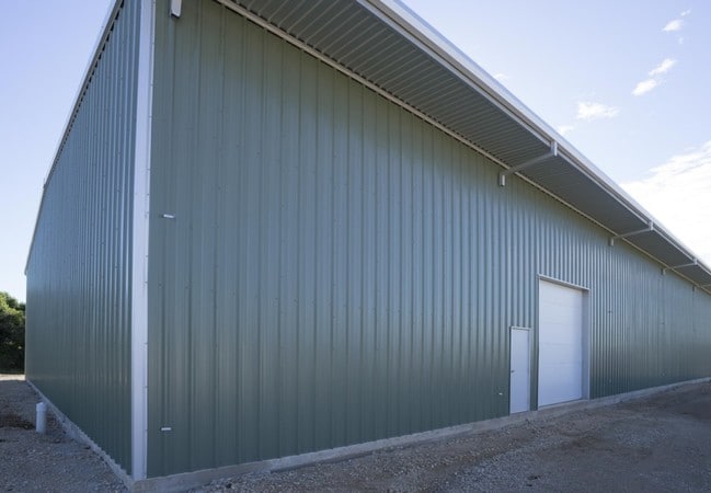
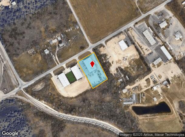
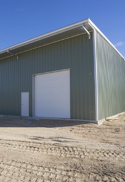
Property Record
2135 Wald Rd, New Braunfels, TX 78132
Property Detail
2135 Wald Rd
San Antonio-New Braunfels, TX
WALD ROAD SERVICE CENTER, LOT 1
56-0194-0001-00
COMAL
Commercialnec
Texas
B and X Area of moderate flood hazard, usually the area between the limits of the 100-year and 500-year floods.
1
2024
1.60 AC
2025
Comal County
310804
San Antonio
12,000 SF
NEARBY LISTINGS FOR SALE OR LEASE
DEMOGRAPHICS near 2135 Wald Rd
1 mile
3 mile
5 mile
2025 Total Population
1,124
31,174
85,389
2030 Population
1,321
36,216
98,420
Pop Growth 2025-2030
+ 17.53%
+ 16.17%
+ 15.26%
Average Age
35
38
39
2025 Total Households
395
11,701
31,835
HH Growth 2025-2030
+ 17.47%
+ 16.22%
+ 15.63%
Median Household Inc
$90,373
$93,979
$97,968
Avg Household Size
2.80
2.60
2.60
2025 Avg HH Vehicles
2.00
2.00
2.00
Median Home Value
$442,424
$391,074
$379,877
Median Year Built
2005
2003
2003
Nearby Places
Map Layers
Map Styles
 Street
 Aerial
Layers
 Traffic
 Biking
Places
Listings with unknown addresses are not visible on the map
- Restaurants
- Banks
- Shops
- Fitness
- Groceries
PUBLIC TRANSPORTATION
AIRPORT
San Antonio International
Drive
Walk
Distance
San Antonio International
31 min
23.7 mi
SALE & LEASE HISTORY
LISTING DATE
SALE/LEASE

Sep 25, 2016
For Lease
Nearby Properties
Address
Land Use
TOTAL SIZE
Lot Size
Zoning
Address
Land Use
TOTAL SIZE
Lot Size
Zoning
433,083 SF
16.24 AC
Address
Land Use
TOTAL SIZE
Lot Size
Zoning
251,498 SF
8.63 AC
Address
Land Use
TOTAL SIZE
Lot Size
Zoning
1.80 AC
Address
Land Use
TOTAL SIZE
Lot Size
Zoning
Address
Land Use
TOTAL SIZE
Lot Size
Zoning
215,244 SF
11.38 AC
Address
Land Use
TOTAL SIZE
Lot Size
Zoning
397,600 SF
25.95 AC
Address
Land Use
TOTAL SIZE
Lot Size
Zoning
132,319 SF
8.80 AC
Address
Land Use
TOTAL SIZE
Lot Size
Zoning
97,200 SF
12.87 AC
Address
Land Use
TOTAL SIZE
Lot Size
Zoning
130,210 SF
13.57 AC
Address
Land Use
TOTAL SIZE
Lot Size
Zoning
127,491 SF
11 AC
Address
Land Use
TOTAL SIZE
Lot Size
Zoning
205,071 SF
23.66 AC
Address
Land Use
TOTAL SIZE
Lot Size
Zoning
92,822 SF
4.94 AC
Address
Land Use
TOTAL SIZE
Lot Size
Zoning
67,722 SF
6.88 AC
Address
Land Use
TOTAL SIZE
Lot Size
Zoning
66,336 SF
7.90 AC
Address
Land Use
TOTAL SIZE
Lot Size
Zoning
102,000 SF
8.26 AC
Address
Land Use
TOTAL SIZE
Lot Size
Zoning
36,904 SF
16.71 AC
Address
Land Use
TOTAL SIZE
Lot Size
Zoning
Address
Land Use
TOTAL SIZE
Lot Size
Zoning
60,296 SF
5.73 AC
Address
Land Use
TOTAL SIZE
Lot Size
Zoning
52,898 SF
39.39 AC
Address
Land Use
TOTAL SIZE
Lot Size
Zoning
3,372 SF
76.62 AC
Address
Land Use
TOTAL SIZE
Lot Size
Zoning
106,075 SF
4.30 AC
Address
Land Use
TOTAL SIZE
Lot Size
Zoning
969.31 AC
Address
Land Use
TOTAL SIZE
Lot Size
Zoning
89,582 SF
9.04 AC
Address
Land Use
TOTAL SIZE
Lot Size
Zoning
137,524 SF
15.34 AC
Address
Land Use
TOTAL SIZE
Lot Size
Zoning
77,487 SF
9 AC
Address
Land Use
TOTAL SIZE
Lot Size
Zoning
92,496 SF
6.91 AC
Address
Land Use
TOTAL SIZE
Lot Size
Zoning
52,722 SF
11.76 AC
Address
Land Use
TOTAL SIZE
Lot Size
Zoning
30,204 SF
2.62 AC
Address
Land Use
TOTAL SIZE
Lot Size
Zoning
141,551 SF
16 AC
Address
Land Use
TOTAL SIZE
Lot Size
Zoning
The World's #1 Commercial Real Estate Marketplace
Connect with us
© 2026 CoStar Group
The information above has been obtained from sources believed reliable. While we do not doubt its accuracy we have not verified it and make no guarantee, warranty or representation about it. It is your responsibility to independently confirm its accuracy and completeness. Any projections, opinions, assumptions, or estimates used are for example only and do not represent the current or future performance of the property. The value of this transaction to you depends on tax and other factors which should be evaluated by your tax, financial, and legal advisors. You and your advisors should conduct a careful, independent investigation of the property to determine to your satisfaction the suitability of the property for your needs.