Property Record
21365 Sw Baler Way, Sherwood, OR 97140
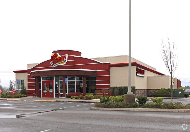

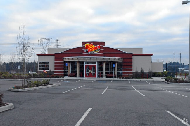
Property Detail
21365 Sw Baler Way
R2128769
2004-037 PARTITION PLAT, LOT 3, ACRES 10.89
Commercialbuilding
Washington
RC_PUD
Oregon
B and X Area of moderate flood hazard, usually the area between the limits of the 100-year and 500-year floods.
3
2024
10.89 AC
2026
Sherwood
032112
Portland
124,718 SF
Portland-Vancouver-Hillsboro, OR-WA
NEARBY LISTINGS FOR SALE OR LEASE
DEMOGRAPHICS near 21365 Sw Baler Way
1 mile
3 mile
5 mile
2025 Total Population
9,270
42,392
133,151
2030 Population
9,460
42,918
134,861
Pop Growth 2025-2030
+ 2.05%
+ 1.24%
+ 1.28%
Average Age
38
41
41
2025 Total Households
3,271
15,238
50,354
HH Growth 2025-2030
+ 2.26%
+ 1.39%
+ 1.31%
Median Household Inc
$99,110
$112,859
$111,078
Avg Household Size
2.80
2.70
2.60
2025 Avg HH Vehicles
2.00
2.00
2.00
Median Home Value
$592,915
$638,908
$668,302
Median Year Built
1997
1996
1994
Nearby Places
Map Layers
Map Styles
 Street
 Aerial
Layers
 Traffic
 Biking
Places
Listings with unknown addresses are not visible on the map
- Restaurants
- Banks
- Shops
- Fitness
- Groceries
PUBLIC TRANSPORTATION
COMMUTER RAIL
Tualatin (Westside Express Service - Tri-County Metropolitan Transportation District of Oregon Rail (TriMet Rail))
Drive
Walk
Distance
Tualatin (Westside Express Service - Tri-County Metropolitan Transportation District of Oregon Rail (TriMet Rail))
9 min
4.1 mi
Tigard Transit Center (Westside Express Service - Tri-County Metropolitan Transportation District of Oregon Rail (TriMet Rail))
Drive
Walk
Distance
Tigard Transit Center (Westside Express Service - Tri-County Metropolitan Transportation District of Oregon Rail (TriMet Rail))
14 min
6.5 mi
AIRPORT
Portland International
Drive
Walk
Distance
Portland International
45 min
28.0 mi
Freight Ports
Port of Portland
Drive
Walk
Distance
Port of Portland
31 min
19.2 mi
Nearby Properties
Address
Land Use
TOTAL SIZE
Lot Size
Zoning
Address
Land Use
TOTAL SIZE
Lot Size
Zoning
23.98 AC
EI
Address
Land Use
TOTAL SIZE
Lot Size
Zoning
508,000 SF
69.72 AC
PFC
Address
Land Use
TOTAL SIZE
Lot Size
Zoning
353,000 SF
69.95 AC
IP
Address
Land Use
TOTAL SIZE
Lot Size
Zoning
27.23 AC
MP
Address
Land Use
TOTAL SIZE
Lot Size
Zoning
27.85 AC
IP
Address
Land Use
TOTAL SIZE
Lot Size
Zoning
9.12 AC
R-7
Address
Land Use
TOTAL SIZE
Lot Size
Zoning
1,232 SF
27.77 AC
EI
Address
Land Use
TOTAL SIZE
Lot Size
Zoning
18.06 AC
Address
Land Use
TOTAL SIZE
Lot Size
Zoning
127,476 SF
13.48 AC
RC
Address
Land Use
TOTAL SIZE
Lot Size
Zoning
15,000 SF
21.08 AC
MG
Address
Land Use
TOTAL SIZE
Lot Size
Zoning
22.05 AC
MP
Address
Land Use
TOTAL SIZE
Lot Size
Zoning
168,065 SF
5.09 AC
HDR_PUD
Address
Land Use
TOTAL SIZE
Lot Size
Zoning
225,780 SF
10.01 AC
R-24
Address
Land Use
TOTAL SIZE
Lot Size
Zoning
261,104 SF
13.52 AC
HDR_PUD
Address
Land Use
TOTAL SIZE
Lot Size
Zoning
13.76 AC
RMH
Address
Land Use
TOTAL SIZE
Lot Size
Zoning
139,356 SF
13.99 AC
LI_PUD
Address
Land Use
TOTAL SIZE
Lot Size
Zoning
190,000 SF
24.86 AC
IP
Address
Land Use
TOTAL SIZE
Lot Size
Zoning
220,472 SF
8.99 AC
RH
Address
Land Use
TOTAL SIZE
Lot Size
Zoning
1,360 SF
7.41 AC
HDR
Address
Land Use
TOTAL SIZE
Lot Size
Zoning
131,000 SF
13.90 AC
RL
Address
Land Use
TOTAL SIZE
Lot Size
Zoning
145,000 SF
4.01 AC
RC
Address
Land Use
TOTAL SIZE
Lot Size
Zoning
226,960 SF
11.38 AC
MG
Address
Land Use
TOTAL SIZE
Lot Size
Zoning
13 AC
MP
Address
Land Use
TOTAL SIZE
Lot Size
Zoning
5.35 AC
ML
Address
Land Use
TOTAL SIZE
Lot Size
Zoning
1,089 SF
8.97 AC
MG
Address
Land Use
TOTAL SIZE
Lot Size
Zoning
14.47 AC
R-24
Address
Land Use
TOTAL SIZE
Lot Size
Zoning
10.82 AC
RMH
The World's #1 Commercial Real Estate Marketplace
Connect with us
© 2026 CoStar Group
The information above has been obtained from sources believed reliable. While we do not doubt its accuracy we have not verified it and make no guarantee, warranty or representation about it. It is your responsibility to independently confirm its accuracy and completeness. Any projections, opinions, assumptions, or estimates used are for example only and do not represent the current or future performance of the property. The value of this transaction to you depends on tax and other factors which should be evaluated by your tax, financial, and legal advisors. You and your advisors should conduct a careful, independent investigation of the property to determine to your satisfaction the suitability of the property for your needs.