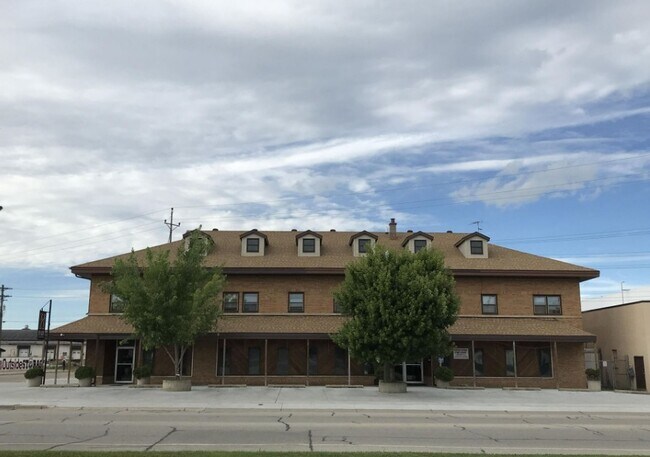
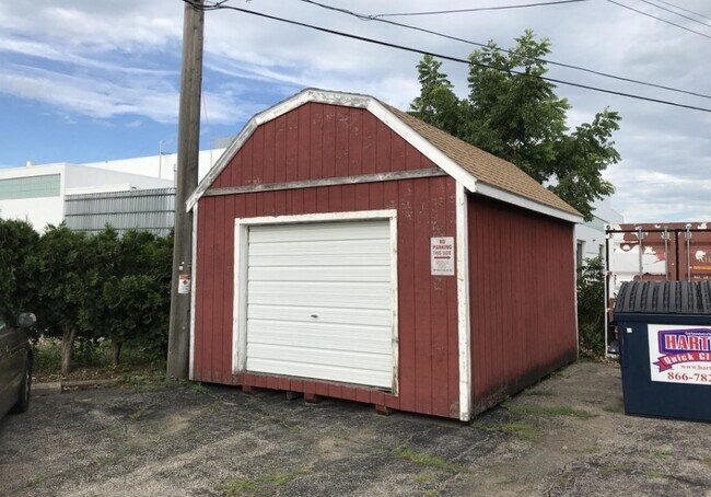
Property Record
2137 Ward Ave, La Crosse, WI 54601

NEARBY LISTINGS FOR SALE OR LEASE
Property Detail
2137 Ward Ave
017-050297-020
Section 9 T15n R7w
Commercialnec
PRT SE-SW BEG 67FT N & 33FT E OF SW COR SE-SW N1D11ME 189.8FT TO SW LN CB&Q RR R/W S56D15ME ALG SW LN 150.6FT S0D32ME 107.5FT TO N LN WARD AVE N89D48MW ALG N LN 128.1FT TO POB LOT SZ: IRR
X
La Crosse
27055C0115E
Wisconsin
2023
0.43 AC
2023
La Crosse/Onalaska
001101
Other Market Areas
5,168 SF
La Crosse-Onalaska, WI-MN
DEMOGRAPHICS near 2137 Ward Ave
1 Mile
3 Mile
5 Mile
2024 Total Population
12,223
48,217
61,460
2029 Population
12,694
48,946
62,356
Pop Growth 2024-2029
+ 3.85%
+ 1.51%
+ 1.46%
Average Age
43
38
38
2024 Total Households
5,690
20,632
26,658
HH Growth 2024-2029
+ 4.11%
+ 1.74%
+ 1.58%
Median Household Inc
$56,444
$49,305
$49,579
Avg Household Size
2.00
2.00
2.10
2024 Avg HH Vehicles
2.00
2.00
2.00
Median Home Value
$161,914
$184,484
$180,257
Median Year Built
1966
1969
1968
Nearby Places
Map Layers
Map Styles
 Street
 Aerial
- Restaurants
- Banks
- Shops
- Fitness
- Groceries
PUBLIC TRANSPORTATION
COMMUTER RAIL
La Crosse (Empire Builder - Amtrak)
DRIVE
WALK
Distance
La Crosse (Empire Builder - Amtrak)
11 min
5.1 mi
AIRPORT
La Crosse Regional
DRIVE
WALK
Distance
La Crosse Regional
20 min
11.6 mi
Freight Ports
Port Milwaukee
DRIVE
WALK
Distance
Port Milwaukee
238 min
212.4 mi
SALE & LEASE HISTORY
LISTING DATE
SALE/LEASE

Oct 07, 2022
For Sale
Apr 10, 2025
For Lease
Nearby Properties
Address
Land Use
TOTAL SIZE
Lot Size
Zoning
Address
Land Use
TOTAL SIZE
Lot Size
Zoning
4.65 AC
Address
Land Use
TOTAL SIZE
Lot Size
Zoning
38,407 SF
3.12 AC
MZA
Address
Land Use
TOTAL SIZE
Lot Size
Zoning
0.75 AC
MZA
Address
Land Use
TOTAL SIZE
Lot Size
Zoning
131,552 SF
0.89 AC
Address
Land Use
TOTAL SIZE
Lot Size
Zoning
3.91 AC
Address
Land Use
TOTAL SIZE
Lot Size
Zoning
73,056 SF
0.62 AC
Address
Land Use
TOTAL SIZE
Lot Size
Zoning
64,480 SF
0.69 AC
MZA
Address
Land Use
TOTAL SIZE
Lot Size
Zoning
0.12 AC
Address
Land Use
TOTAL SIZE
Lot Size
Zoning
11.56 AC
Address
Land Use
TOTAL SIZE
Lot Size
Zoning
54,884 SF
1.09 AC
MZA
Address
Land Use
TOTAL SIZE
Lot Size
Zoning
10.21 AC
MZA
Address
Land Use
TOTAL SIZE
Lot Size
Zoning
2.10 AC
MZA
Address
Land Use
TOTAL SIZE
Lot Size
Zoning
2.12 AC
MZA
Address
Land Use
TOTAL SIZE
Lot Size
Zoning
5.79 AC
MZA
Address
Land Use
TOTAL SIZE
Lot Size
Zoning
2.43 AC
Address
Land Use
TOTAL SIZE
Lot Size
Zoning
186,812 SF
15.04 AC
MZA
Address
Land Use
TOTAL SIZE
Lot Size
Zoning
0.56 AC
MZA
Address
Land Use
TOTAL SIZE
Lot Size
Zoning
27,000 SF
0.22 AC
MZA
Address
Land Use
TOTAL SIZE
Lot Size
Zoning
81,664 SF
1.06 AC
MZA
Address
Land Use
TOTAL SIZE
Lot Size
Zoning
32,153 SF
3.16 AC
MZA
Address
Land Use
TOTAL SIZE
Lot Size
Zoning
1.70 AC
MZA
Address
Land Use
TOTAL SIZE
Lot Size
Zoning
15.48 AC
MZA
Address
Land Use
TOTAL SIZE
Lot Size
Zoning
1.19 AC
Address
Land Use
TOTAL SIZE
Lot Size
Zoning
1.20 AC
MZA
Address
Land Use
TOTAL SIZE
Lot Size
Zoning
32.76 AC
MZA
Address
Land Use
TOTAL SIZE
Lot Size
Zoning
0.62 AC
Address
Land Use
TOTAL SIZE
Lot Size
Zoning
4.71 AC
Address
Land Use
TOTAL SIZE
Lot Size
Zoning
9,330 SF
1.42 AC
MZA
Address
Land Use
TOTAL SIZE
Lot Size
Zoning
5.01 AC
MZA
Address
Land Use
TOTAL SIZE
Lot Size
Zoning
3.04 AC
MZA
The World's #1 Commercial Real Estate Marketplace
Connect with us
© 2025 CoStar Group
The information above has been obtained from sources believed reliable. While we do not doubt its accuracy we have not verified it and make no guarantee, warranty or representation about it. It is your responsibility to independently confirm its accuracy and completeness. Any projections, opinions, assumptions, or estimates used are for example only and do not represent the current or future performance of the property. The value of this transaction to you depends on tax and other factors which should be evaluated by your tax, financial, and legal advisors. You and your advisors should conduct a careful, independent investigation of the property to determine to your satisfaction the suitability of the property for your needs.