Property Record
21370 St Theresa Ln, Ashburn, VA 20147


NEARBY LISTINGS FOR SALE OR LEASE
Property Detail
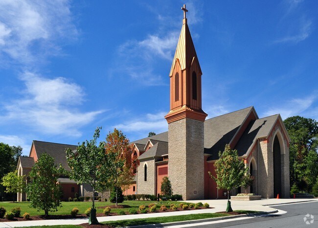
21370 St Theresa Ln
Washington-Arlington-Alexandria, DC-VA-MD-WV
Near Ryan
118-38-8107
NEAR RYAN 201902190007732/3P CONSOLIDATE, 201711020068752/3P BLA 1247--251 CONSOLIDATION, PC A SL.643 PG.5
Religious
Loudoun
X
Virginia
51107C0244E
643
0
25.29 AC
2025
Route 7 Corridor
611019
Washington, DC
92,234 SF
DEMOGRAPHICS near 21370 St Theresa Ln
1 Mile
3 Mile
5 Mile
2024 Total Population
18,783
95,900
180,692
2029 Population
20,163
103,543
195,628
Pop Growth 2024-2029
+ 7.35%
+ 7.97%
+ 8.27%
Average Age
36
38
37
2024 Total Households
6,433
33,096
61,974
HH Growth 2024-2029
+ 7.48%
+ 8.26%
+ 8.53%
Median Household Inc
$149,712
$160,549
$159,098
Avg Household Size
2.90
2.90
2.90
2024 Avg HH Vehicles
2.00
2.00
2.00
Median Home Value
$635,328
$697,059
$692,762
Median Year Built
1997
2003
2004
Nearby Places
Map Layers
Map Styles
 Street
 Aerial
- Restaurants
- Banks
- Shops
- Fitness
- Groceries
PUBLIC TRANSPORTATION
AIRPORT
Washington Dulles International
DRIVE
WALK
Distance
Washington Dulles International
19 min
9.8 mi
Ronald Reagan Washington Ntl
DRIVE
WALK
Distance
Ronald Reagan Washington Ntl
51 min
34.7 mi
Freight Ports
Port of Baltimore
DRIVE
WALK
Distance
Port of Baltimore
91 min
66.7 mi
Nearby Properties
Address
Land Use
TOTAL SIZE
Lot Size
Zoning
Address
Land Use
TOTAL SIZE
Lot Size
Zoning
2,735,138 SF
123.03 AC
PDAAAR
Address
Land Use
TOTAL SIZE
Lot Size
Zoning
431.05 AC
LB:PRC
Address
Land Use
TOTAL SIZE
Lot Size
Zoning
125.80 AC
TRC
Address
Land Use
TOTAL SIZE
Lot Size
Zoning
341,831 SF
31.21 AC
PDH6
Address
Land Use
TOTAL SIZE
Lot Size
Zoning
624,852 SF
22.54 AC
R24
Address
Land Use
TOTAL SIZE
Lot Size
Zoning
549,027 SF
21.01 AC
R16
Address
Land Use
TOTAL SIZE
Lot Size
Zoning
340,152 SF
119.26 AC
TR10
Address
Land Use
TOTAL SIZE
Lot Size
Zoning
100,121 SF
2.20 AC
PDIP
Address
Land Use
TOTAL SIZE
Lot Size
Zoning
264,155 SF
10.95 AC
PDTRC
Address
Land Use
TOTAL SIZE
Lot Size
Zoning
164,455 SF
14.15 AC
PDIP
Address
Land Use
TOTAL SIZE
Lot Size
Zoning
320,609 SF
2.02 AC
PDTRC
Address
Land Use
TOTAL SIZE
Lot Size
Zoning
198,672 SF
21.41 AC
R16
Address
Land Use
TOTAL SIZE
Lot Size
Zoning
287,479 SF
14.90 AC
PDAAAR
Address
Land Use
TOTAL SIZE
Lot Size
Zoning
152,394 SF
10.73 AC
PDIP
Address
Land Use
TOTAL SIZE
Lot Size
Zoning
61,692 SF
19.86 AC
PDH4
Address
Land Use
TOTAL SIZE
Lot Size
Zoning
218,277 SF
14.54 AC
PDH3
Address
Land Use
TOTAL SIZE
Lot Size
Zoning
260,741 SF
37.30 AC
PDH4
Address
Land Use
TOTAL SIZE
Lot Size
Zoning
259,361 SF
65.01 AC
PDH4
Address
Land Use
TOTAL SIZE
Lot Size
Zoning
238,594 SF
50.64 AC
PDGI
Address
Land Use
TOTAL SIZE
Lot Size
Zoning
29.72 AC
OP
Address
Land Use
TOTAL SIZE
Lot Size
Zoning
29.66 AC
OP
Address
Land Use
TOTAL SIZE
Lot Size
Zoning
240,844 SF
12.11 AC
PDH4
Address
Land Use
TOTAL SIZE
Lot Size
Zoning
290,695 SF
3.32 AC
PDOP
Address
Land Use
TOTAL SIZE
Lot Size
Zoning
243,052 SF
50.01 AC
PDH3
Address
Land Use
TOTAL SIZE
Lot Size
Zoning
247,082 SF
57.50 AC
PDH4
Address
Land Use
TOTAL SIZE
Lot Size
Zoning
190,014 SF
22.23 AC
PDCCSC
Address
Land Use
TOTAL SIZE
Lot Size
Zoning
507,073 SF
3.81 AC
TRC
Address
Land Use
TOTAL SIZE
Lot Size
Zoning
141,978 SF
15.92 AC
PDCCCC
Address
Land Use
TOTAL SIZE
Lot Size
Zoning
180,278 SF
23.95 AC
PDH3
Address
Land Use
TOTAL SIZE
Lot Size
Zoning
192,639 SF
0.96 AC
PDTRC
The World's #1 Commercial Real Estate Marketplace
Connect with us
© 2026 CoStar Group
The information above has been obtained from sources believed reliable. While we do not doubt its accuracy we have not verified it and make no guarantee, warranty or representation about it. It is your responsibility to independently confirm its accuracy and completeness. Any projections, opinions, assumptions, or estimates used are for example only and do not represent the current or future performance of the property. The value of this transaction to you depends on tax and other factors which should be evaluated by your tax, financial, and legal advisors. You and your advisors should conduct a careful, independent investigation of the property to determine to your satisfaction the suitability of the property for your needs.