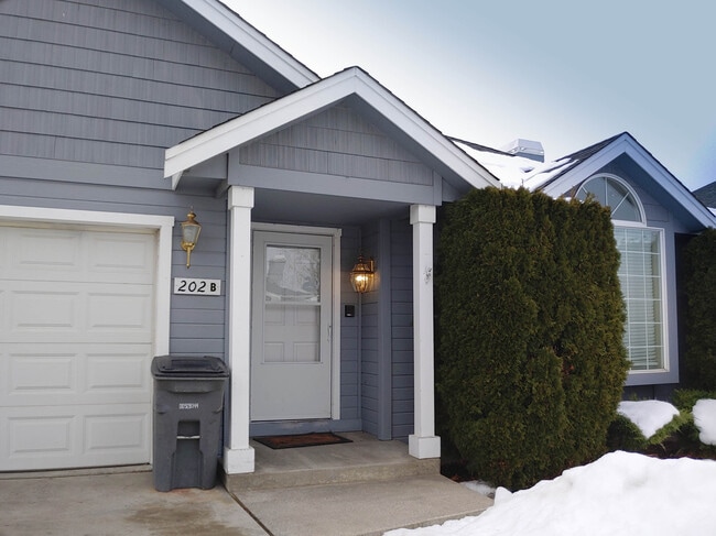
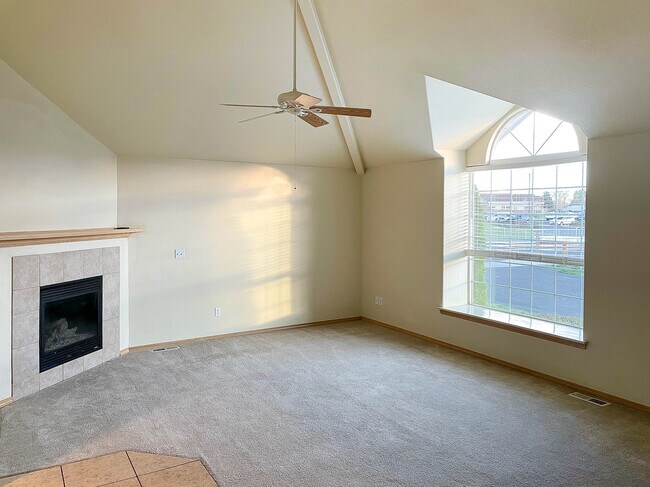
Property Record
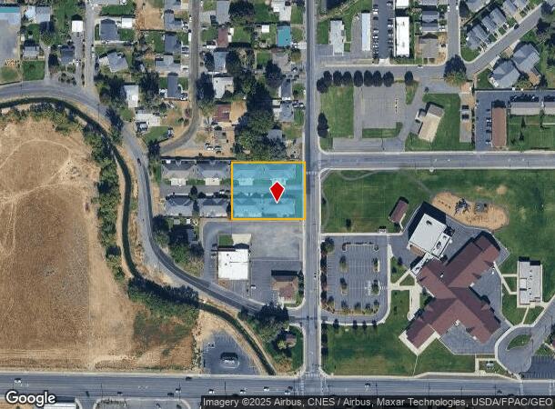
214 A & B N 41St, Yakima, WA 98901

NEARBY LISTINGS FOR SALE OR LEASE
Property Detail
214 A & B N 41St
191316-44438
Cherry Ridge
Multifamilydwelling
PARCEL D BOOK B-0015
X
Yakima
53077C1052D
Washington
2025
0.83 AC
2025
East Yakima County
001602
Yakima
10,620 SF
Yakima, WA
DEMOGRAPHICS near 214 A & B N 41St
1 Mile
3 Mile
5 Mile
2024 Total Population
6,531
27,391
82,227
2029 Population
6,607
27,566
82,459
Pop Growth 2024-2029
+ 1.16%
+ 0.64%
+ 0.28%
Average Age
40
35
35
2024 Total Households
2,605
9,454
28,119
HH Growth 2024-2029
+ 1.11%
+ 0.63%
+ 0.23%
Median Household Inc
$71,793
$48,705
$49,046
Avg Household Size
2.40
2.80
2.80
2024 Avg HH Vehicles
2.00
2.00
2.00
Median Home Value
$317,414
$249,939
$213,826
Median Year Built
1995
1975
1970
Nearby Places
Map Layers
Map Styles
 Street
 Aerial
- Restaurants
- Banks
- Shops
- Fitness
- Groceries
PUBLIC TRANSPORTATION
AIRPORT
Yakima Air Trml/McAllister Field
DRIVE
WALK
Distance
Yakima Air Trml/McAllister Field
17 min
6.8 mi
Freight Ports
Port of Tacoma
DRIVE
WALK
Distance
Port of Tacoma
185 min
156.9 mi
SALE & LEASE HISTORY
LISTING DATE
SALE/LEASE

Feb 23, 2022
For Sale
Nearby Properties
Address
Land Use
TOTAL SIZE
Lot Size
Zoning
Address
Land Use
TOTAL SIZE
Lot Size
Zoning
295,494 SF
32.20 AC
R1
Address
Land Use
TOTAL SIZE
Lot Size
Zoning
197,341 SF
36.70 AC
GC
Address
Land Use
TOTAL SIZE
Lot Size
Zoning
87,068 SF
2.89 AC
CBD
Address
Land Use
TOTAL SIZE
Lot Size
Zoning
176,098 SF
1.67 AC
CBD
Address
Land Use
TOTAL SIZE
Lot Size
Zoning
106,878 SF
3.46 AC
RD
Address
Land Use
TOTAL SIZE
Lot Size
Zoning
129,042 SF
6.53 AC
R3
Address
Land Use
TOTAL SIZE
Lot Size
Zoning
82,436 SF
11 AC
RD
Address
Land Use
TOTAL SIZE
Lot Size
Zoning
121,488 SF
5.97 AC
R3
Address
Land Use
TOTAL SIZE
Lot Size
Zoning
100,992 SF
9.15 AC
RD
Address
Land Use
TOTAL SIZE
Lot Size
Zoning
91,856 SF
9.17 AC
RD
Address
Land Use
TOTAL SIZE
Lot Size
Zoning
56,505 SF
2.75 AC
C1
Address
Land Use
TOTAL SIZE
Lot Size
Zoning
97,056 SF
5.80 AC
R3
Address
Land Use
TOTAL SIZE
Lot Size
Zoning
197,263 SF
18.08 AC
C1
Address
Land Use
TOTAL SIZE
Lot Size
Zoning
84,714 SF
4.40 AC
R3
Address
Land Use
TOTAL SIZE
Lot Size
Zoning
83,856 SF
4.23 AC
R3
Address
Land Use
TOTAL SIZE
Lot Size
Zoning
94,724 SF
0.79 AC
CBD
Address
Land Use
TOTAL SIZE
Lot Size
Zoning
73,917 SF
1.01 AC
CBD
Address
Land Use
TOTAL SIZE
Lot Size
Zoning
43,687 SF
3.33 AC
C1
Address
Land Use
TOTAL SIZE
Lot Size
Zoning
64,593 SF
10.02 AC
R1
Address
Land Use
TOTAL SIZE
Lot Size
Zoning
76,160 SF
39.51 AC
M1
Address
Land Use
TOTAL SIZE
Lot Size
Zoning
69.87 AC
SR
Address
Land Use
TOTAL SIZE
Lot Size
Zoning
204,600 SF
12.54 AC
B2
Address
Land Use
TOTAL SIZE
Lot Size
Zoning
9,121 SF
0.22 AC
C1
Address
Land Use
TOTAL SIZE
Lot Size
Zoning
163,130 SF
1.95 AC
CBD
Address
Land Use
TOTAL SIZE
Lot Size
Zoning
427,713 SF
22.43 AC
M1
Address
Land Use
TOTAL SIZE
Lot Size
Zoning
142,546 SF
0.55 AC
CBD
Address
Land Use
TOTAL SIZE
Lot Size
Zoning
50,919 SF
1.99 AC
C1
Address
Land Use
TOTAL SIZE
Lot Size
Zoning
141,696 SF
6.42 AC
M1
Address
Land Use
TOTAL SIZE
Lot Size
Zoning
70,164 SF
16.03 AC
M1
The World's #1 Commercial Real Estate Marketplace
Connect with us
© 2026 CoStar Group
The information above has been obtained from sources believed reliable. While we do not doubt its accuracy we have not verified it and make no guarantee, warranty or representation about it. It is your responsibility to independently confirm its accuracy and completeness. Any projections, opinions, assumptions, or estimates used are for example only and do not represent the current or future performance of the property. The value of this transaction to you depends on tax and other factors which should be evaluated by your tax, financial, and legal advisors. You and your advisors should conduct a careful, independent investigation of the property to determine to your satisfaction the suitability of the property for your needs.