Property Record
214 N Magnolia Dr, Cedar Falls, IA 50613

NEARBY LISTINGS FOR SALE OR LEASE
-
-
View all Cedar Falls listings for sale on LoopNet.com
Property Detail
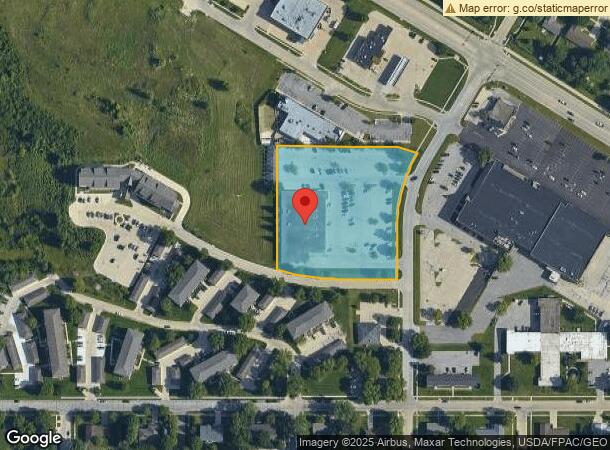
214 N Magnolia Dr
8914-11-106-011
THAT PART NE SEC 10 AND NW SEC 11 T 89 R 14 COM AT INTER OF W LINE MAGNOLIA DR AND N LINE CRESCENT DR IN CEDAR CREST ADDN TH
Supermarket
Black Hawk
X
Iowa
19013C0161G
3.19 AC
2024
Iowa City/Waterloo
2025
Other Market Areas
002605
Waterloo-Cedar Falls, IA
24,371 SF
DEMOGRAPHICS near 214 N Magnolia Dr
1 Mile
3 Mile
5 Mile
2024 Total Population
6,054
26,475
44,250
2029 Population
5,959
26,206
43,857
Pop Growth 2024-2029
(1.57%)
(1.02%)
(0.89%)
Average Age
38
35
37
2024 Total Households
2,473
10,142
17,715
HH Growth 2024-2029
(1.58%)
(1.15%)
(0.99%)
Median Household Inc
$88,600
$67,245
$71,347
Avg Household Size
2.40
2.30
2.30
2024 Avg HH Vehicles
2.00
2.00
2.00
Median Home Value
$276,396
$220,876
$209,584
Median Year Built
1981
1971
1975
Nearby Places
Map Layers
Map Styles
 Street
 Aerial
- Restaurants
- Banks
- Shops
- Fitness
- Groceries
Nearby Properties
Address
Land Use
TOTAL SIZE
Lot Size
Zoning
Address
Land Use
TOTAL SIZE
Lot Size
Zoning
1,536 SF
50.01 AC
Address
Land Use
TOTAL SIZE
Lot Size
Zoning
16,044 SF
Address
Land Use
TOTAL SIZE
Lot Size
Zoning
13,584 SF
Address
Land Use
TOTAL SIZE
Lot Size
Zoning
1,800 SF
14.60 AC
Address
Land Use
TOTAL SIZE
Lot Size
Zoning
18,330 SF
9.56 AC
Address
Land Use
TOTAL SIZE
Lot Size
Zoning
49,360 SF
0.80 AC
Address
Land Use
TOTAL SIZE
Lot Size
Zoning
55,078 SF
1.39 AC
Address
Land Use
TOTAL SIZE
Lot Size
Zoning
11,828 SF
6.58 AC
Address
Land Use
TOTAL SIZE
Lot Size
Zoning
42,844 SF
0.65 AC
Address
Land Use
TOTAL SIZE
Lot Size
Zoning
106,032 SF
8.22 AC
Address
Land Use
TOTAL SIZE
Lot Size
Zoning
34,707 SF
4.19 AC
Address
Land Use
TOTAL SIZE
Lot Size
Zoning
80,352 SF
1.88 AC
Address
Land Use
TOTAL SIZE
Lot Size
Zoning
105,224 SF
4.59 AC
Address
Land Use
TOTAL SIZE
Lot Size
Zoning
98,711 SF
7.91 AC
Address
Land Use
TOTAL SIZE
Lot Size
Zoning
13,305 SF
2.17 AC
Address
Land Use
TOTAL SIZE
Lot Size
Zoning
14,352 SF
4.12 AC
Address
Land Use
TOTAL SIZE
Lot Size
Zoning
28.30 AC
Address
Land Use
TOTAL SIZE
Lot Size
Zoning
75,880 SF
Address
Land Use
TOTAL SIZE
Lot Size
Zoning
3.27 AC
Address
Land Use
TOTAL SIZE
Lot Size
Zoning
11,212 SF
6.92 AC
Address
Land Use
TOTAL SIZE
Lot Size
Zoning
3,408 SF
14.56 AC
Address
Land Use
TOTAL SIZE
Lot Size
Zoning
162,000 SF
16.20 AC
Address
Land Use
TOTAL SIZE
Lot Size
Zoning
18,380 SF
0.80 AC
Address
Land Use
TOTAL SIZE
Lot Size
Zoning
27,758 SF
6.40 AC
Address
Land Use
TOTAL SIZE
Lot Size
Zoning
14.57 AC
Address
Land Use
TOTAL SIZE
Lot Size
Zoning
63,730 SF
3.52 AC
Address
Land Use
TOTAL SIZE
Lot Size
Zoning
210,788 SF
23.55 AC
Address
Land Use
TOTAL SIZE
Lot Size
Zoning
59,699 SF
4.52 AC
Address
Land Use
TOTAL SIZE
Lot Size
Zoning
5,664 SF
4.75 AC
The World's #1 Commercial Real Estate Marketplace
Connect with us
© 2026 CoStar Group
The information above has been obtained from sources believed reliable. While we do not doubt its accuracy we have not verified it and make no guarantee, warranty or representation about it. It is your responsibility to independently confirm its accuracy and completeness. Any projections, opinions, assumptions, or estimates used are for example only and do not represent the current or future performance of the property. The value of this transaction to you depends on tax and other factors which should be evaluated by your tax, financial, and legal advisors. You and your advisors should conduct a careful, independent investigation of the property to determine to your satisfaction the suitability of the property for your needs.