Property Record
214 Riffle Ln, Laurel, MD 20724

NEARBY LISTINGS FOR SALE OR LEASE
-
-
View all Laurel listings for sale on LoopNet.com
Property Detail
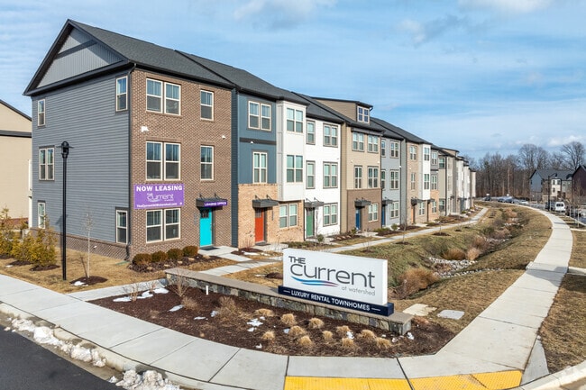
214 Riffle Ln
Baltimore
Watershed
Baltimore-Columbia-Towson, MD
LT 5-92 WATERSHED
04-067-90255085
Anne Arundel
Commercialacreage
Maryland
2024
5-92
2025
0.04 AC
751500
Outer W Anne Arundel County
2,400 SF
DEMOGRAPHICS near 214 Riffle Ln
1 mile
3 mile
5 mile
2024 Total Population
2,642
30,926
165,563
2029 Population
2,798
31,820
167,514
Pop Growth 2024-2029
+ 5.90%
+ 2.89%
+ 1.18%
Average Age
35
35
37
2024 Total Households
971
11,222
61,767
HH Growth 2024-2029
+ 5.66%
+ 2.78%
+ 1.06%
Median Household Inc
$71,320
$93,368
$96,559
Avg Household Size
2.60
2.60
2.60
2024 Avg HH Vehicles
2.00
2.00
2.00
Median Home Value
$335,000
$355,831
$379,007
Median Year Built
1992
1992
1990
Nearby Places
Map Layers
Map Styles
 Street
 Aerial
Transit
 Traffic
 Biking
Places
Listings with unknown addresses are not visible on the map
- Restaurants
- Banks
- Shops
- Fitness
- Groceries
PUBLIC TRANSPORTATION
COMMUTER RAIL
Laurel Racetrack (CAMDEN - WASHINGTON - Maryland Area Regional Commuter Trains (The MARC), Camden Line - Maryland Area Regional Commuter Trains (The MARC))
Drive
Walk
Distance
Laurel Racetrack (CAMDEN - WASHINGTON - Maryland Area Regional Commuter Trains (The MARC), Camden Line - Maryland Area Regional Commuter Trains (The MARC))
8 min
3.3 mi
Savage (Camden Line - Maryland Area Regional Commuter Trains (The MARC))
Drive
Walk
Distance
Savage (Camden Line - Maryland Area Regional Commuter Trains (The MARC))
8 min
5.0 mi
AIRPORT
Baltimore/Washington International Thurgood Marshall
Drive
Walk
Distance
Baltimore/Washington International Thurgood Marshall
18 min
11.9 mi
Ronald Reagan Washington Ntl
Drive
Walk
Distance
Ronald Reagan Washington Ntl
40 min
26.0 mi
Freight Ports
Port of Baltimore
Drive
Walk
Distance
Port of Baltimore
29 min
18.5 mi
Nearby Properties
Address
Land Use
TOTAL SIZE
Lot Size
Zoning
Address
Land Use
TOTAL SIZE
Lot Size
Zoning
8,192 SF
13,053.34 AC
R1
Address
Land Use
TOTAL SIZE
Lot Size
Zoning
238,700 SF
7.43 AC
TOD
Address
Land Use
TOTAL SIZE
Lot Size
Zoning
796,368 SF
11.80 AC
R5
Address
Land Use
TOTAL SIZE
Lot Size
Zoning
279,320 SF
15.25 AC
R15
Address
Land Use
TOTAL SIZE
Lot Size
Zoning
376,918 SF
8.55 AC
W1
Address
Land Use
TOTAL SIZE
Lot Size
Zoning
261,969 SF
12.13 AC
R5R10
Address
Land Use
TOTAL SIZE
Lot Size
Zoning
14.84 AC
R-15
Address
Land Use
TOTAL SIZE
Lot Size
Zoning
234,264 SF
5.03 AC
W1
Address
Land Use
TOTAL SIZE
Lot Size
Zoning
192,703 SF
6.67 AC
W-1
Address
Land Use
TOTAL SIZE
Lot Size
Zoning
551,529 SF
9.52 AC
W1
Address
Land Use
TOTAL SIZE
Lot Size
Zoning
539,758 SF
48.32 AC
M1
Address
Land Use
TOTAL SIZE
Lot Size
Zoning
161,528 SF
10.86 AC
W1
Address
Land Use
TOTAL SIZE
Lot Size
Zoning
164,448 SF
3.87 AC
W1
Address
Land Use
TOTAL SIZE
Lot Size
Zoning
364,609 SF
8.57 AC
R22
Address
Land Use
TOTAL SIZE
Lot Size
Zoning
126,960 SF
13.72 AC
MXDR
Address
Land Use
TOTAL SIZE
Lot Size
Zoning
418,818 SF
48.07 AC
C3
Address
Land Use
TOTAL SIZE
Lot Size
Zoning
291,250 SF
30.09 AC
CECLI
Address
Land Use
TOTAL SIZE
Lot Size
Zoning
304,575 SF
33.71 AC
TOD
Address
Land Use
TOTAL SIZE
Lot Size
Zoning
162,729 SF
10.18 AC
W1
Address
Land Use
TOTAL SIZE
Lot Size
Zoning
125,480 SF
11.30 AC
W1
Address
Land Use
TOTAL SIZE
Lot Size
Zoning
135,000 SF
11.69 AC
W1
Address
Land Use
TOTAL SIZE
Lot Size
Zoning
130,200 SF
6.60 AC
W1
Address
Land Use
TOTAL SIZE
Lot Size
Zoning
124,000 SF
15.80 AC
W-1
Address
Land Use
TOTAL SIZE
Lot Size
Zoning
130,200 SF
7.05 AC
W-1
Address
Land Use
TOTAL SIZE
Lot Size
Zoning
124,092 SF
12.65 AC
W1
Address
Land Use
TOTAL SIZE
Lot Size
Zoning
328,950 SF
8.65 AC
W1
Address
Land Use
TOTAL SIZE
Lot Size
Zoning
126,078 SF
10.57 AC
W2
Address
Land Use
TOTAL SIZE
Lot Size
Zoning
63,896 SF
229.19 AC
W1B
Address
Land Use
TOTAL SIZE
Lot Size
Zoning
120,160 SF
5.61 AC
W1
Address
Land Use
TOTAL SIZE
Lot Size
Zoning
448,300 SF
9.80 AC
W-1
The World's #1 Commercial Real Estate Marketplace
Connect with us
© 2026 CoStar Group
The information above has been obtained from sources believed reliable. While we do not doubt its accuracy we have not verified it and make no guarantee, warranty or representation about it. It is your responsibility to independently confirm its accuracy and completeness. Any projections, opinions, assumptions, or estimates used are for example only and do not represent the current or future performance of the property. The value of this transaction to you depends on tax and other factors which should be evaluated by your tax, financial, and legal advisors. You and your advisors should conduct a careful, independent investigation of the property to determine to your satisfaction the suitability of the property for your needs.