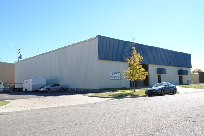
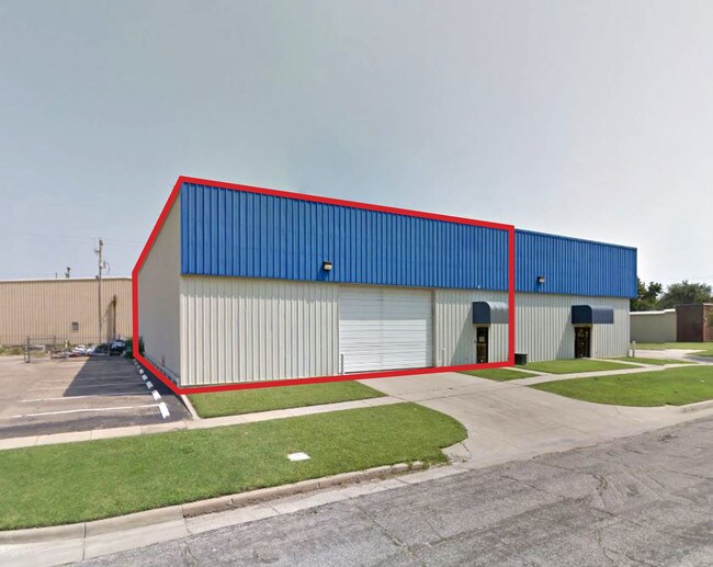
Property Record
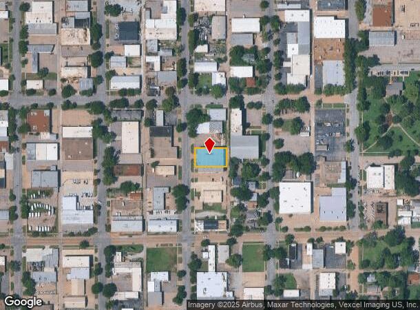
214 S Pattie Ave, Wichita, KS 67211
NEARBY LISTINGS FOR SALE OR LEASE
Property Detail
214 S Pattie Ave
Wichita, KS
Hydes Add
125-21-0-41-05-004.00
ALL LOTS 48-50-52 & N 9 2/3 FT LOT 54 PATTIE AVE. HYDES ADD.
Warehouse
Sedgwick
X
Kansas
20173C0362G
48-52
2024
0.27 AC
2025
Downtown
002400
Wichita
12,296 SF
DEMOGRAPHICS near 214 S Pattie Ave
1 Mile
3 Mile
5 Mile
2024 Total Population
11,159
119,977
242,859
2029 Population
11,683
124,264
249,548
Pop Growth 2024-2029
+ 4.70%
+ 3.57%
+ 2.75%
Average Age
36
37
37
2024 Total Households
4,680
49,376
99,843
HH Growth 2024-2029
+ 5.19%
+ 3.64%
+ 2.75%
Median Household Inc
$39,431
$41,648
$45,113
Avg Household Size
2.00
2.20
2.30
2024 Avg HH Vehicles
1.00
2.00
2.00
Median Home Value
$78,739
$84,483
$109,418
Median Year Built
1949
1953
1959
Nearby Places
Map Layers
Map Styles
 Street
 Aerial
- Restaurants
- Banks
- Shops
- Fitness
- Groceries
PUBLIC TRANSPORTATION
AIRPORT
Wichita Dwight D Eisenhower Ntl
DRIVE
WALK
Distance
Wichita Dwight D Eisenhower Ntl
14 min
7.7 mi
SALE & LEASE HISTORY
LISTING DATE
SALE/LEASE

Sep 17, 2018
For Lease
Nov 25, 2020
For Lease
Nov 12, 2020
For Lease
Nearby Properties
Address
Land Use
TOTAL SIZE
Lot Size
Zoning
Address
Land Use
TOTAL SIZE
Lot Size
Zoning
468,755 SF
10.41 AC
CBD,LI
Address
Land Use
TOTAL SIZE
Lot Size
Zoning
499,239 SF
18.70 AC
GO
Address
Land Use
TOTAL SIZE
Lot Size
Zoning
515,640 SF
14.49 AC
CBD
Address
Land Use
TOTAL SIZE
Lot Size
Zoning
481,160 SF
63.37 AC
SF-5
Address
Land Use
TOTAL SIZE
Lot Size
Zoning
154,716 SF
12.18 AC
LC
Address
Land Use
TOTAL SIZE
Lot Size
Zoning
430,593 SF
11.89 AC
GO,LC
Address
Land Use
TOTAL SIZE
Lot Size
Zoning
386,803 SF
13.33 AC
CBD
Address
Land Use
TOTAL SIZE
Lot Size
Zoning
346,728 SF
15.91 AC
SF-5
Address
Land Use
TOTAL SIZE
Lot Size
Zoning
576,707 SF
53.70 AC
B,LC
Address
Land Use
TOTAL SIZE
Lot Size
Zoning
271,541 SF
39.20 AC
GO
Address
Land Use
TOTAL SIZE
Lot Size
Zoning
237,087 SF
48.33 AC
B
Address
Land Use
TOTAL SIZE
Lot Size
Zoning
197,464 SF
4.05 AC
CBD
Address
Land Use
TOTAL SIZE
Lot Size
Zoning
227,462 SF
17.80 AC
TF-3
Address
Land Use
TOTAL SIZE
Lot Size
Zoning
109,743 SF
6.10 AC
CBD
Address
Land Use
TOTAL SIZE
Lot Size
Zoning
527,510 SF
50.27 AC
TF-3
Address
Land Use
TOTAL SIZE
Lot Size
Zoning
225,962 SF
0.24 AC
CBD
Address
Land Use
TOTAL SIZE
Lot Size
Zoning
84,757 SF
1.44 AC
GC
Address
Land Use
TOTAL SIZE
Lot Size
Zoning
328,487 SF
25.95 AC
MF-29
Address
Land Use
TOTAL SIZE
Lot Size
Zoning
103,261 SF
5.49 AC
B
Address
Land Use
TOTAL SIZE
Lot Size
Zoning
180,527 SF
1.93 AC
LI
Address
Land Use
TOTAL SIZE
Lot Size
Zoning
143,110 SF
1.57 AC
LI
Address
Land Use
TOTAL SIZE
Lot Size
Zoning
167,304 SF
6.19 AC
MF-29
Address
Land Use
TOTAL SIZE
Lot Size
Zoning
110,839 SF
0.81 AC
CBD
Address
Land Use
TOTAL SIZE
Lot Size
Zoning
169,321 SF
14.61 AC
U
Address
Land Use
TOTAL SIZE
Lot Size
Zoning
79,041 SF
19.51 AC
LC
Address
Land Use
TOTAL SIZE
Lot Size
Zoning
945,203 SF
9.53 AC
GO
Address
Land Use
TOTAL SIZE
Lot Size
Zoning
111,805 SF
20.09 AC
SF-5
Address
Land Use
TOTAL SIZE
Lot Size
Zoning
108,232 SF
3.72 AC
PUD
Address
Land Use
TOTAL SIZE
Lot Size
Zoning
98,677 SF
5.62 AC
TF-3
Address
Land Use
TOTAL SIZE
Lot Size
Zoning
84,452 SF
0.46 AC
B
The World's #1 Commercial Real Estate Marketplace
Connect with us
© 2025 CoStar Group
The information above has been obtained from sources believed reliable. While we do not doubt its accuracy we have not verified it and make no guarantee, warranty or representation about it. It is your responsibility to independently confirm its accuracy and completeness. Any projections, opinions, assumptions, or estimates used are for example only and do not represent the current or future performance of the property. The value of this transaction to you depends on tax and other factors which should be evaluated by your tax, financial, and legal advisors. You and your advisors should conduct a careful, independent investigation of the property to determine to your satisfaction the suitability of the property for your needs.