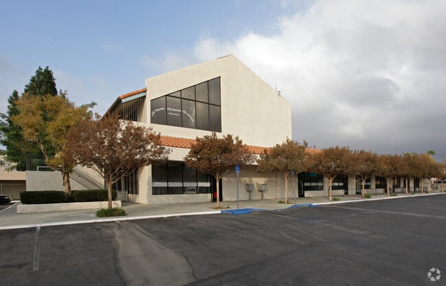
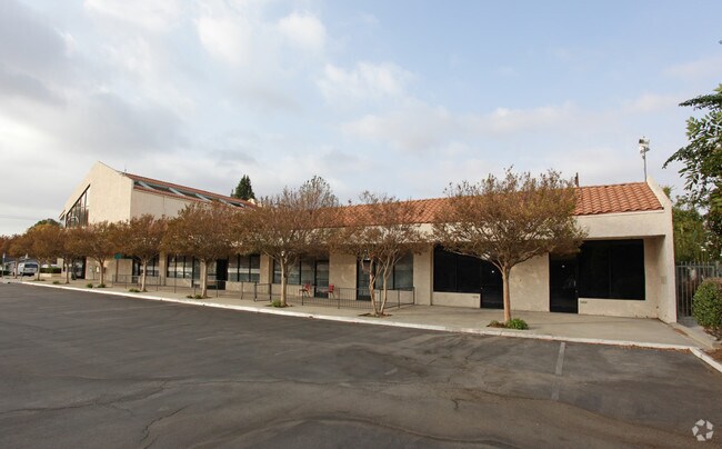
Property Record
2140 Winifred St, Simi Valley, CA 93063


Current Lease Availabilities
Property Detail
2140 Winifred St
618-0-151-495
LOT: 1 REF: 5 PM 27
Storesoffices
Ventura
CPD
California
C and X Area of minimal flood hazard, usually depicted on FIRMs as above the 500-year flood level.
1
2024
1.01 AC
2025
Moorpark/Simi Valley
008201
Los Angeles
16,344 SF
Oxnard-Thousand Oaks-Ventura, CA
NEARBY LISTINGS FOR SALE OR LEASE
DEMOGRAPHICS near 2140 Winifred St
1 mile
3 mile
5 mile
2024 Total Population
12,718
80,633
115,193
2029 Population
12,604
80,003
114,211
Pop Growth 2024-2029
(0.90%)
(0.78%)
(0.85%)
Average Age
41
42
42
2024 Total Households
4,271
26,897
38,360
HH Growth 2024-2029
(1.08%)
(1.01%)
(1.05%)
Median Household Inc
$123,607
$121,705
$118,618
Avg Household Size
2.90
2.90
2.90
2024 Avg HH Vehicles
2.00
2.00
2.00
Median Home Value
$748,794
$765,961
$780,283
Median Year Built
1974
1976
1977
Nearby Places
Map Layers
Map Styles
 Street
 Aerial
Transit
 Traffic
 Biking
Places
Listings with unknown addresses are not visible on the map
- Restaurants
- Banks
- Shops
- Fitness
- Groceries
PUBLIC TRANSPORTATION
COMMUTER RAIL
Simi Valley (Ventura County Line - Southern California Regional Rail Authority (Metrolink))
Drive
Walk
Distance
Simi Valley (Ventura County Line - Southern California Regional Rail Authority (Metrolink))
3 min
1.3 mi
Chatsworth (Ventura County Line - Southern California Regional Rail Authority (Metrolink))
Drive
Walk
Distance
Chatsworth (Ventura County Line - Southern California Regional Rail Authority (Metrolink))
15 min
9.2 mi
AIRPORT
Bob Hope
Drive
Walk
Distance
Bob Hope
32 min
24.1 mi
Los Angeles International
Drive
Walk
Distance
Los Angeles International
52 min
40.0 mi
Freight Ports
The Port of Hueneme
Drive
Walk
Distance
The Port of Hueneme
52 min
34.0 mi
Nearby Properties
Address
Land Use
TOTAL SIZE
Lot Size
Zoning
Address
Land Use
TOTAL SIZE
Lot Size
Zoning
4.77 AC
CO
Address
Land Use
TOTAL SIZE
Lot Size
Zoning
57,707 SF
14.76 AC
L-I
Address
Land Use
TOTAL SIZE
Lot Size
Zoning
18,057 SF
10.23 AC
L-I
Address
Land Use
TOTAL SIZE
Lot Size
Zoning
135,768 SF
5.27 AC
Address
Land Use
TOTAL SIZE
Lot Size
Zoning
25,277 SF
14.64 AC
RM-3
Address
Land Use
TOTAL SIZE
Lot Size
Zoning
20,461 SF
2.92 AC
Address
Land Use
TOTAL SIZE
Lot Size
Zoning
115.15 AC
RL-0
Address
Land Use
TOTAL SIZE
Lot Size
Zoning
3.15 AC
RL-1
Address
Land Use
TOTAL SIZE
Lot Size
Zoning
157,745 SF
7.53 AC
L-I
Address
Land Use
TOTAL SIZE
Lot Size
Zoning
112,130 SF
3.62 AC
Address
Land Use
TOTAL SIZE
Lot Size
Zoning
4.81 AC
Address
Land Use
TOTAL SIZE
Lot Size
Zoning
159,664 SF
7.50 AC
L-I
Address
Land Use
TOTAL SIZE
Lot Size
Zoning
61,020 SF
3.21 AC
Address
Land Use
TOTAL SIZE
Lot Size
Zoning
11,242 SF
13.70 AC
Address
Land Use
TOTAL SIZE
Lot Size
Zoning
13,585 SF
8.28 AC
BP-S
Address
Land Use
TOTAL SIZE
Lot Size
Zoning
157,065 SF
4.30 AC
Address
Land Use
TOTAL SIZE
Lot Size
Zoning
Address
Land Use
TOTAL SIZE
Lot Size
Zoning
1,051.63 AC
OS160AC
Address
Land Use
TOTAL SIZE
Lot Size
Zoning
53,730 SF
2.21 AC
Address
Land Use
TOTAL SIZE
Lot Size
Zoning
2.24 AC
Address
Land Use
TOTAL SIZE
Lot Size
Zoning
Address
Land Use
TOTAL SIZE
Lot Size
Zoning
47,214 SF
1.78 AC
Address
Land Use
TOTAL SIZE
Lot Size
Zoning
78,540 SF
3.75 AC
RH-15
Address
Land Use
TOTAL SIZE
Lot Size
Zoning
15,743 SF
8.12 AC
CPD
Address
Land Use
TOTAL SIZE
Lot Size
Zoning
101,728 SF
5.72 AC
RH-1
Address
Land Use
TOTAL SIZE
Lot Size
Zoning
96,132 SF
4.20 AC
L-I
Address
Land Use
TOTAL SIZE
Lot Size
Zoning
41,130 SF
1.49 AC
Address
Land Use
TOTAL SIZE
Lot Size
Zoning
46,458 SF
3.88 AC
The World's #1 Commercial Real Estate Marketplace
Connect with us
© 2026 CoStar Group
The information above has been obtained from sources believed reliable. While we do not doubt its accuracy we have not verified it and make no guarantee, warranty or representation about it. It is your responsibility to independently confirm its accuracy and completeness. Any projections, opinions, assumptions, or estimates used are for example only and do not represent the current or future performance of the property. The value of this transaction to you depends on tax and other factors which should be evaluated by your tax, financial, and legal advisors. You and your advisors should conduct a careful, independent investigation of the property to determine to your satisfaction the suitability of the property for your needs.