Property Record
2141 10Th St, Los Osos, CA 93402
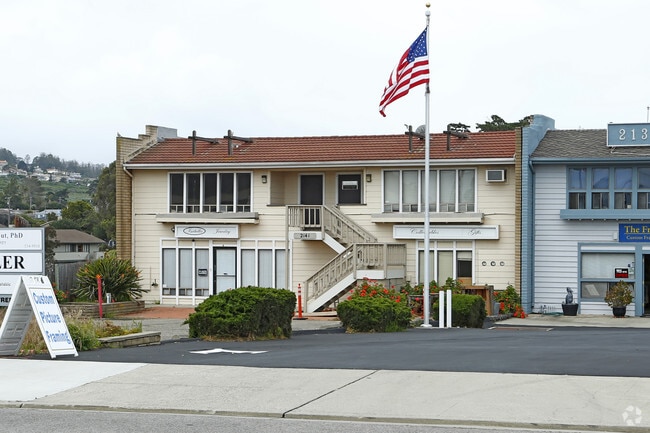


This Property Is For Sale
Property Detail
2141 10Th St
038-672-038
TN EL MORO BL 152 LTS 10 & 11
Storebuilding
San Luis Obispo
CR
California
B and X Area of moderate flood hazard, usually the area between the limits of the 100-year and 500-year floods.
10,11
2025
0.14 AC
2025
Coastal SLO
010703
San Luis Obispo/Paso Robles
2,500 SF
San Luis Obispo-Paso Robles, CA
NEARBY LISTINGS FOR SALE OR LEASE
DEMOGRAPHICS near 2141 10Th St
1 mile
3 mile
5 mile
2025 Total Population
8,963
13,621
19,773
2030 Population
8,800
13,375
19,557
Pop Growth 2025-2030
(1.82%)
(1.81%)
(1.09%)
Average Age
46
46
48
2025 Total Households
3,693
5,639
8,583
HH Growth 2025-2030
(2.11%)
(2.07%)
(1.22%)
Median Household Inc
$99,554
$103,992
$96,514
Avg Household Size
2.30
2.30
2.20
2025 Avg HH Vehicles
2.00
2.00
2.00
Median Home Value
$766,938
$795,520
$812,539
Median Year Built
1975
1975
1974
Nearby Places
Map Layers
Map Styles
 Street
 Aerial
Layers
 Traffic
 Biking
Places
Listings with unknown addresses are not visible on the map
- Restaurants
- Banks
- Shops
- Fitness
- Groceries
PUBLIC TRANSPORTATION
AIRPORT
San Luis County Regional
Drive
Walk
Distance
San Luis County Regional
27 min
13.1 mi
Nearby Properties
Address
Land Use
TOTAL SIZE
Lot Size
Zoning
Address
Land Use
TOTAL SIZE
Lot Size
Zoning
70,323 SF
5.38 AC
CR
Address
Land Use
TOTAL SIZE
Lot Size
Zoning
42,742 SF
4.47 AC
VSC
Address
Land Use
TOTAL SIZE
Lot Size
Zoning
48.18 AC
PF
Address
Land Use
TOTAL SIZE
Lot Size
Zoning
1.35 AC
CR
Address
Land Use
TOTAL SIZE
Lot Size
Zoning
18 AC
REC
Address
Land Use
TOTAL SIZE
Lot Size
Zoning
2.99 AC
20
Address
Land Use
TOTAL SIZE
Lot Size
Zoning
18,592 SF
2.15 AC
RMF
Address
Land Use
TOTAL SIZE
Lot Size
Zoning
2.06 AC
RMF
Address
Land Use
TOTAL SIZE
Lot Size
Zoning
38,728 SF
1.46 AC
60
Address
Land Use
TOTAL SIZE
Lot Size
Zoning
16,560 SF
0.86 AC
30
Address
Land Use
TOTAL SIZE
Lot Size
Zoning
1.38 AC
RMF
Address
Land Use
TOTAL SIZE
Lot Size
Zoning
1.51 AC
RMF
Address
Land Use
TOTAL SIZE
Lot Size
Zoning
6,382 SF
0.45 AC
CR
Address
Land Use
TOTAL SIZE
Lot Size
Zoning
1.50 AC
OP
Address
Land Use
TOTAL SIZE
Lot Size
Zoning
8 AC
RSF
Address
Land Use
TOTAL SIZE
Lot Size
Zoning
13,304 SF
0.38 AC
CR
Address
Land Use
TOTAL SIZE
Lot Size
Zoning
13,150 SF
0.90 AC
C-1
Address
Land Use
TOTAL SIZE
Lot Size
Zoning
7,257 SF
0.51 AC
CR
Address
Land Use
TOTAL SIZE
Lot Size
Zoning
16,758 SF
1.42 AC
RMF
Address
Land Use
TOTAL SIZE
Lot Size
Zoning
2.30 AC
CR
Address
Land Use
TOTAL SIZE
Lot Size
Zoning
1,324 SF
1 AC
RS
Address
Land Use
TOTAL SIZE
Lot Size
Zoning
1.15 AC
CR
Address
Land Use
TOTAL SIZE
Lot Size
Zoning
1,642 SF
0.46 AC
CR
Address
Land Use
TOTAL SIZE
Lot Size
Zoning
7,100 SF
0.93 AC
CR
Address
Land Use
TOTAL SIZE
Lot Size
Zoning
0.87 AC
CR
Address
Land Use
TOTAL SIZE
Lot Size
Zoning
0.69 AC
RS
Address
Land Use
TOTAL SIZE
Lot Size
Zoning
11.83 AC
AG
Address
Land Use
TOTAL SIZE
Lot Size
Zoning
3,289 SF
5.07 AC
RSF
Address
Land Use
TOTAL SIZE
Lot Size
Zoning
4.81 AC
RS
Address
Land Use
TOTAL SIZE
Lot Size
Zoning
4,050 SF
0.53 AC
CR
The World's #1 Commercial Real Estate Marketplace
Connect with us
© 2026 CoStar Group
The information above has been obtained from sources believed reliable. While we do not doubt its accuracy we have not verified it and make no guarantee, warranty or representation about it. It is your responsibility to independently confirm its accuracy and completeness. Any projections, opinions, assumptions, or estimates used are for example only and do not represent the current or future performance of the property. The value of this transaction to you depends on tax and other factors which should be evaluated by your tax, financial, and legal advisors. You and your advisors should conduct a careful, independent investigation of the property to determine to your satisfaction the suitability of the property for your needs.