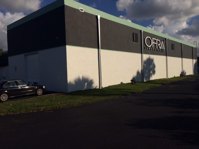
Property Record
2141 Blount Rd, Pompano Beach, FL 33069


Property Detail
2141 Blount Rd
48-42-28-09-0141
TURNPIKE INDUSTRIAL PARK 111-20 B PORTION OF LOTS 13 & 14 DESC AS, COMM SE COR OF LOT 13,NLY 89.52, WLY 440 TO POB,CONT WLY 231.32, NWLY 295.92,ELY 253.83,SLY ALG E/L OF LOTS 14 & 13 295 TO POB
Warehouse
Broward
I-1
Florida
AH Areas with a 1% annual chance of shallow flooding, usually in the form of a pond, withan average depth ranging from 1 to 3 feet. These areas have a 26% chance of flooding over the life of a 30-year mortgage.
13,14
2025
1.64 AC
2026
Pompano Beach
030601
South Florida
24,541 SF
Fort Lauderdale-Pompano Beach-Sunrise, FL
NEARBY LISTINGS FOR SALE OR LEASE
DEMOGRAPHICS near 2141 Blount Rd
1 mile
3 mile
5 mile
2025 Total Population
9,996
128,819
415,202
2030 Population
10,863
137,404
441,180
Pop Growth 2025-2030
+ 8.67%
+ 6.66%
+ 6.26%
Average Age
55
42
42
2025 Total Households
4,751
50,992
166,374
HH Growth 2025-2030
+ 9.53%
+ 6.55%
+ 6.31%
Median Household Inc
$58,641
$63,520
$68,323
Avg Household Size
1.80
2.40
2.40
2025 Avg HH Vehicles
1.00
1.00
2.00
Median Home Value
$216,579
$299,028
$366,677
Median Year Built
1982
1981
1978
Nearby Places
Map Layers
Map Styles
 Street
 Aerial
Layers
 Traffic
 Biking
Places
Listings with unknown addresses are not visible on the map
- Restaurants
- Banks
- Shops
- Fitness
- Groceries
PUBLIC TRANSPORTATION
COMMUTER RAIL
Pompano Beach (Tri-County Commuter - South Florida Regional Transportation Authority (Tri-Rail))
Drive
Walk
Distance
Pompano Beach (Tri-County Commuter - South Florida Regional Transportation Authority (Tri-Rail))
7 min
2.8 mi
Cypress Creek (Tri-County Commuter - South Florida Regional Transportation Authority (Tri-Rail))
Drive
Walk
Distance
Cypress Creek (Tri-County Commuter - South Florida Regional Transportation Authority (Tri-Rail))
11 min
5.0 mi
AIRPORT
Fort Lauderdale/Hollywood International
Drive
Walk
Distance
Fort Lauderdale/Hollywood International
26 min
17.9 mi
Palm Beach International
Drive
Walk
Distance
Palm Beach International
46 min
35.5 mi
Freight Ports
Port Everglades
Drive
Walk
Distance
Port Everglades
25 min
16.6 mi
Nearby Properties
Address
Land Use
TOTAL SIZE
Lot Size
Zoning
Address
Land Use
TOTAL SIZE
Lot Size
Zoning
1,724,503 SF
64.97 AC
LAC
Address
Land Use
TOTAL SIZE
Lot Size
Zoning
32,538 SF
331.51 AC
P
Address
Land Use
TOTAL SIZE
Lot Size
Zoning
425,379 SF
26.84 AC
RPUD
Address
Land Use
TOTAL SIZE
Lot Size
Zoning
467,722 SF
36.71 AC
I-1
Address
Land Use
TOTAL SIZE
Lot Size
Zoning
667,120 SF
12.75 AC
PCD
Address
Land Use
TOTAL SIZE
Lot Size
Zoning
365,849 SF
25.66 AC
RM-10
Address
Land Use
TOTAL SIZE
Lot Size
Zoning
356,704 SF
11.84 AC
PCD
Address
Land Use
TOTAL SIZE
Lot Size
Zoning
591,110 SF
62.54 AC
CF
Address
Land Use
TOTAL SIZE
Lot Size
Zoning
294,865 SF
14.49 AC
PUD
Address
Land Use
TOTAL SIZE
Lot Size
Zoning
380,866 SF
26.23 AC
O-IP/PCD
Address
Land Use
TOTAL SIZE
Lot Size
Zoning
500,974 SF
16.20 AC
CF-1
Address
Land Use
TOTAL SIZE
Lot Size
Zoning
276,412 SF
10.40 AC
TOC-G
Address
Land Use
TOTAL SIZE
Lot Size
Zoning
434,859 SF
38.72 AC
CF
Address
Land Use
TOTAL SIZE
Lot Size
Zoning
548,682 SF
21.63 AC
CF
Address
Land Use
TOTAL SIZE
Lot Size
Zoning
274,772 SF
22.37 AC
PUD
Address
Land Use
TOTAL SIZE
Lot Size
Zoning
295,883 SF
21.22 AC
PUD
Address
Land Use
TOTAL SIZE
Lot Size
Zoning
238,898 SF
13.84 AC
TOC-CC
Address
Land Use
TOTAL SIZE
Lot Size
Zoning
325,343 SF
21.10 AC
PUD
Address
Land Use
TOTAL SIZE
Lot Size
Zoning
384,131 SF
17.84 AC
PMDD
Address
Land Use
TOTAL SIZE
Lot Size
Zoning
216,533 SF
9.99 AC
RPUD
Address
Land Use
TOTAL SIZE
Lot Size
Zoning
291,908 SF
29.79 AC
B-3
Address
Land Use
TOTAL SIZE
Lot Size
Zoning
275,724 SF
26.67 AC
TOC-G
Address
Land Use
TOTAL SIZE
Lot Size
Zoning
10,315 SF
37.74 AC
PCD
Address
Land Use
TOTAL SIZE
Lot Size
Zoning
283,330 SF
27.02 AC
I-1/PCI
Address
Land Use
TOTAL SIZE
Lot Size
Zoning
269,508 SF
38.46 AC
A-1
Address
Land Use
TOTAL SIZE
Lot Size
Zoning
242,178 SF
25.40 AC
RM-10
Address
Land Use
TOTAL SIZE
Lot Size
Zoning
935,349 SF
20.20 AC
PMDD
Address
Land Use
TOTAL SIZE
Lot Size
Zoning
214,164 SF
11.31 AC
PUD
Address
Land Use
TOTAL SIZE
Lot Size
Zoning
224,769 SF
15.48 AC
I-1
Address
Land Use
TOTAL SIZE
Lot Size
Zoning
188,844 SF
77.09 AC
PU
The World's #1 Commercial Real Estate Marketplace
Connect with us
© 2026 CoStar Group
The information above has been obtained from sources believed reliable. While we do not doubt its accuracy we have not verified it and make no guarantee, warranty or representation about it. It is your responsibility to independently confirm its accuracy and completeness. Any projections, opinions, assumptions, or estimates used are for example only and do not represent the current or future performance of the property. The value of this transaction to you depends on tax and other factors which should be evaluated by your tax, financial, and legal advisors. You and your advisors should conduct a careful, independent investigation of the property to determine to your satisfaction the suitability of the property for your needs.